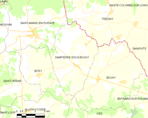
Bitry (Bitry)

- commune in Nièvre, France
- Country:

- Postal Code: 58310
- Coordinates: 47° 29' 25" N, 3° 4' 47" E


- GPS tracks (wikiloc): [Link]
- Area: 17.47 sq km
- Population: 311
- Wikipedia en: wiki(en)
- Wikipedia: wiki(fr)
- Wikidata storage: Wikidata: Q681910
- Wikipedia Commons Category: [Link]
- Freebase ID: [/m/03qfzz1]
- GeoNames ID: Alt: [6449972]
- SIREN number: [215800335]
- BnF ID: [152662980]
- INSEE municipality code: 58033
Shares border with regions:


Saint-Vérain
- commune in Nièvre, France
- Country:
- Postal Code: 58310
- Coordinates: 47° 28' 51" N, 3° 3' 22" E
- GPS tracks (wikiloc): [Link]
- Area: 24.69 sq km
- Population: 340


Saint-Amand-en-Puisaye
- commune in Nièvre, France
- Country:
- Postal Code: 58310
- Coordinates: 47° 31' 44" N, 3° 4' 28" E
- GPS tracks (wikiloc): [Link]
- Area: 41.51 sq km
- Population: 1297
- Web site: [Link]

Alligny-Cosne
- commune in Nièvre, France
- Country:
- Postal Code: 58200
- Coordinates: 47° 27' 15" N, 3° 3' 43" E
- GPS tracks (wikiloc): [Link]
- Area: 34.41 sq km
- Population: 878


Ciez
- commune in Nièvre, France
- Country:
- Postal Code: 58220
- Coordinates: 47° 26' 29" N, 3° 9' 44" E
- GPS tracks (wikiloc): [Link]
- Area: 28.34 sq km
- Population: 375

Dampierre-sous-Bouhy
- commune in Nièvre, France
- Country:
- Postal Code: 58310
- Coordinates: 47° 29' 57" N, 3° 8' 3" E
- GPS tracks (wikiloc): [Link]
- Area: 26.9 sq km
- Population: 462