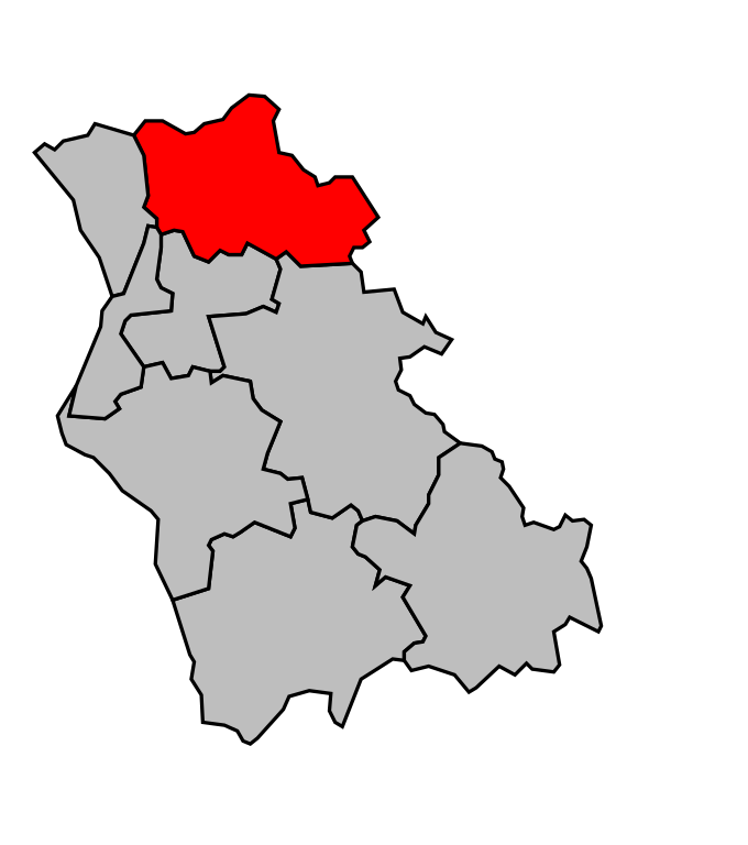
arrondissement of Cosne-Cours-sur-Loire (arrondissement de Cosne-Cours-sur-Loire)

- arrondissement of France
- Country:

- Capital: Cosne-Cours-sur-Loire
- Coordinates: 47° 20' 0" N, 3° 10' 0" E


- GPS tracks (wikiloc): [Link]
- Area: 1403.33 sq km
- Population: 44367
- Wikipedia en: wiki(en)
- Wikipedia: wiki(fr)
- Wikidata storage: Wikidata: Q701061
- Freebase ID: [/m/0955t2]
- GeoNames ID: Alt: [3023475]
- OSM relation ID: [1975324]
- INSEE arrondissement code: [584]
Includes regions:
canton of Saint-Amand-en-Puisaye
- canton of France (until March 2015)
- Country:
- Capital: Saint-Amand-en-Puisaye
- Coordinates: 47° 30' 16" N, 3° 5' 0" E
- GPS tracks (wikiloc): [Link]


canton of La Charité-sur-Loire
- canton of France
- Country:
- Capital: La Charité-sur-Loire
- Coordinates: 47° 11' 8" N, 3° 7' 18" E
- GPS tracks (wikiloc): [Link]
- Population: 14810

canton of Cosne-Cours-sur-Loire-Nord
- canton of France
- Country:
- Capital: Cosne-Cours-sur-Loire
- Coordinates: 47° 28' 41" N, 2° 55' 18" E
- GPS tracks (wikiloc): [Link]

canton of Cosne-Cours-sur-Loire-Sud
- canton of France
- Country:
- Capital: Cosne-Cours-sur-Loire
- Coordinates: 47° 25' 18" N, 2° 59' 28" E
- GPS tracks (wikiloc): [Link]


canton of Pouilly-sur-Loire
- canton of France
- Country:
- Capital: Pouilly-sur-Loire
- Coordinates: 47° 18' 6" N, 3° 0' 26" E
- GPS tracks (wikiloc): [Link]
- Population: 14872
Shares border with regions:


arrondissement of Nevers
- arrondissement of France
- Country:
- Capital: Nevers
- Coordinates: 46° 55' 0" N, 3° 20' 0" E
- GPS tracks (wikiloc): [Link]
- Area: 2020 sq km
- Population: 117173

arrondissement of Auxerre
- arrondissement of France
- Country:
- Capital: Auxerre
- Coordinates: 47° 45' 0" N, 3° 30' 0" E
- GPS tracks (wikiloc): [Link]
- Area: 3514.55 sq km
- Population: 166396


arrondissement of Bourges
- arrondissement of France
- Country:
- Capital: Bourges
- Coordinates: 47° 15' 0" N, 2° 25' 0" E
- GPS tracks (wikiloc): [Link]
- Area: 2798 sq km
- Population: 173577


arrondissement of Clamecy
- arrondissement of France
- Country:
- Capital: Clamecy
- Coordinates: 47° 20' 0" N, 3° 40' 0" E
- GPS tracks (wikiloc): [Link]
- Population: 21597