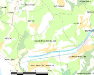
Blussangeaux (Blussangeaux)

- commune in Doubs, France
 Hiking in Blussangeaux
Blussangeaux is a relatively lesser-known hiking destination, so it might not have as much detailed information available compared to more popular hiking areas. However, if you find yourself in or around this region, you can expect beautiful landscapes, diverse flora and fauna, and a chance to enjoy the great outdoors. Here are some general tips and considerations for hiking in Blussangeaux:
Scenery and Terrain
- Natural Beauty: Blussangeaux is likely to offer scenic views, including forests, valleys, and possibly water features like rivers or lakes, depending on the area.
- Trail Varieties: Be prepared for different types of terrains. Some trails may be well-maintained, while others could be more rugged and less traveled.
Hiking Trails
- Trail Length and Difficulty: Research available trails in the area to find ones that match your skill level and time availability, whether you're looking for a short walk or a more challenging hike.
- Markings and Safety: Follow trail signage and maps carefully. Off-trail hiking can be risky, and it’s important to stay on marked paths to avoid getting lost.
Preparation
- Gear: Bring appropriate hiking gear, including sturdy shoes, a backpack, water, snacks, and possibly trekking poles, especially for steeper trails.
- Weather: Check the weather conditions prior to your hike, as conditions can change rapidly in mountainous or wooded areas.
Wildlife and Flora
- Wildlife Watching: Be aware of the local wildlife. Depending on the region, you may encounter various species—always observe animals from a distance.
- Respect Nature: Follow Leave No Trace principles to preserve the environment for future visitors.
Local Amenities
- Access Points: Determine the best access points for hiking in Blussangeaux, including parking options or public transportation availability.
- Guided Tours: If you prefer to have an expert guide, consider looking for local hiking clubs or guides that offer tours in the area.
Conclusion
Researching specific trails and their conditions will greatly enhance your hiking experience in Blussangeaux. Always prioritize safety, be prepared for changing conditions, and take the time to enjoy the natural beauty around you. Happy hiking!
- Country:

- Postal Code: 25250
- Coordinates: 47° 25' 47" N, 6° 36' 50" E


- GPS tracks (wikiloc): [Link]
- Area: 2.12 sq km
- Population: 84
- Wikipedia en: wiki(en)
- Wikipedia: wiki(fr)
- Wikidata storage: Wikidata: Q528773
- Wikipedia Commons Category: [Link]
- Freebase ID: [/m/03mgr82]
- Freebase ID: [/m/03mgr82]
- GeoNames ID: Alt: [6447844]
- GeoNames ID: Alt: [6447844]
- SIREN number: [212500664]
- SIREN number: [212500664]
- BnF ID: [15252292r]
- BnF ID: [15252292r]
- INSEE municipality code: 25066
- INSEE municipality code: 25066
Shares border with regions:


La Prétière
- commune in Doubs, France
Hiking in La Prétière
La Prétière is a beautiful area for outdoor enthusiasts and hikers. Located in the Vienne region of France, it offers a mix of scenic landscapes, lush green forests, and a variety of trails suitable for different skill levels. Here’s what you can expect when hiking in La Prétière:...
- Country:
- Postal Code: 25250
- Coordinates: 47° 26' 41" N, 6° 36' 34" E
- GPS tracks (wikiloc): [Link]
- Area: 2.71 sq km
- Population: 160

Longevelle-sur-Doubs
- commune in Doubs, France
Hiking in Longevelle-sur-Doubs
Longevelle-sur-Doubs is a charming commune located in the Doubs department of eastern France, bordered by beautiful natural scenery. It is an excellent base for hiking enthusiasts due to its proximity to the Doubs River and the surrounding landscapes that offer a variety of trails suitable for different skill levels....
- Country:
- Postal Code: 25260
- Coordinates: 47° 27' 9" N, 6° 39' 5" E
- GPS tracks (wikiloc): [Link]
- Area: 8.31 sq km
- Population: 697
- Web site: [Link]


Saint-Maurice-Colombier
- commune in Doubs, France
Hiking in Saint-Maurice-Colombier
Saint-Maurice-Colombier is located in the Doubs department in the Bourgogne-Franche-Comté region of France. It offers a picturesque backdrop for hikers, characterized by beautiful landscapes, dense forests, and rolling hills....
- Country:
- Postal Code: 25260
- Coordinates: 47° 26' 31" N, 6° 38' 41" E
- GPS tracks (wikiloc): [Link]
- AboveSeaLevel: 330 м m
- Area: 13.29 sq km
- Population: 907
- Web site: [Link]