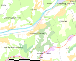
Saint-Maurice-Colombier (Saint-Maurice-Colombier)

- commune in Doubs, France
 Hiking in Saint-Maurice-Colombier
Saint-Maurice-Colombier is located in the Doubs department in the Bourgogne-Franche-Comté region of France. It offers a picturesque backdrop for hikers, characterized by beautiful landscapes, dense forests, and rolling hills.
Hiking Opportunities:
-
Trails: There are various marked trails catering to different skill levels, from easy walks suitable for families to more challenging routes for experienced hikers. Make sure to check local maps for specific trail information.
-
Hiking in Nature: The area is rich in biodiversity, allowing hikers to enjoy the sights and sounds of nature. Birdwatching and wildlife spotting can be particularly rewarding in this region.
-
Scenic Views: As you hike, look for vantage points that offer stunning vistas of the surrounding countryside. The tranquil atmosphere makes it an ideal location for photography and relaxation.
-
Historic Sites: Along your journey, you might encounter historic landmarks or small villages that provide insight into the local culture and history.
-
Best Time to Hike: The best time for hiking in Saint-Maurice-Colombier is typically late spring through early autumn when the weather is mild and the natural scenery is at its best.
Tips for Hikers:
- Always check the weather before heading out and dress appropriately.
- Stay hydrated and carry enough snacks for your hike.
- Make sure to inform someone about your plans and estimated return time.
- Respect nature by staying on marked trails and leaving no trace.
Whether you're a local or visiting, the hiking trails in Saint-Maurice-Colombier offer a delightful way to explore the natural beauty of the region. Enjoy your hike!
- Country:

- Postal Code: 25260
- Coordinates: 47° 26' 31" N, 6° 38' 41" E


- GPS tracks (wikiloc): [Link]
- AboveSeaLevel: 330 м m
- Area: 13.29 sq km
- Population: 907
- Web site: http://www.saint-maurice-colombier.fr/
- Wikipedia en: wiki(en)
- Wikipedia: wiki(fr)
- Wikidata storage: Wikidata: Q905831
- Wikipedia Commons Category: [Link]
- Freebase ID: [/m/03mgbkj]
- Freebase ID: [/m/03mgbkj]
- GeoNames ID: Alt: [6616237]
- GeoNames ID: Alt: [6616237]
- SIREN number: [212505242]
- SIREN number: [212505242]
- BnF ID: [152527506]
- BnF ID: [152527506]
- VIAF ID: Alt: [135498565]
- VIAF ID: Alt: [135498565]
- INSEE municipality code: 25524
- INSEE municipality code: 25524
Shares border with regions:


La Prétière
- commune in Doubs, France
Hiking in La Prétière
La Prétière is a beautiful area for outdoor enthusiasts and hikers. Located in the Vienne region of France, it offers a mix of scenic landscapes, lush green forests, and a variety of trails suitable for different skill levels. Here’s what you can expect when hiking in La Prétière:...
- Country:
- Postal Code: 25250
- Coordinates: 47° 26' 41" N, 6° 36' 34" E
- GPS tracks (wikiloc): [Link]
- Area: 2.71 sq km
- Population: 160


Blussangeaux
- commune in Doubs, France
Hiking in Blussangeaux
Blussangeaux is a relatively lesser-known hiking destination, so it might not have as much detailed information available compared to more popular hiking areas. However, if you find yourself in or around this region, you can expect beautiful landscapes, diverse flora and fauna, and a chance to enjoy the great outdoors. Here are some general tips and considerations for hiking in Blussangeaux:...
- Country:
- Postal Code: 25250
- Coordinates: 47° 25' 47" N, 6° 36' 50" E
- GPS tracks (wikiloc): [Link]
- Area: 2.12 sq km
- Population: 84


Sourans
- commune in Doubs, France
Hiking in Sourans
Sourans is a small village in the Hautes-Alpes region of France, known for its beautiful landscapes and proximity to the French Alps. While it may not be as well-known as larger hiking destinations, it offers a range of hiking opportunities for both beginners and experienced hikers....
- Country:
- Postal Code: 25250
- Coordinates: 47° 24' 29" N, 6° 37' 56" E
- GPS tracks (wikiloc): [Link]
- Area: 4.2 sq km
- Population: 122

Colombier-Fontaine
- commune in Doubs, France
Hiking in Colombier-Fontaine
Colombier-Fontaine is a commune located in the Bourgogne-Franche-Comté region of France. Although it might not be as famous as some other hiking destinations in the region, it offers a charming natural environment that can be appealing for hiking enthusiasts. Here are some key points about hiking in the area:...
- Country:
- Postal Code: 25260
- Coordinates: 47° 27' 9" N, 6° 41' 23" E
- GPS tracks (wikiloc): [Link]
- Area: 7.66 sq km
- Population: 1344


Blussans
- commune in Doubs, France
Hiking in Blussans
Blussans is a picturesque village located in the Jura region of France, known for its beautiful landscapes and outdoor activities, including hiking. Here are some key aspects of hiking in Blussans:...
- Country:
- Postal Code: 25250
- Coordinates: 47° 25' 39" N, 6° 36' 26" E
- GPS tracks (wikiloc): [Link]
- Area: 8.04 sq km
- Population: 196


Goux-lès-Dambelin
- commune in Doubs, France
Hiking in Goux-lès-Dambelin
Goux-lès-Dambelin is a charming village located in the Doubs department in the Bourgogne-Franche-Comté region of eastern France. The surrounding area offers a variety of hiking opportunities that allow you to experience the natural beauty and local culture....
- Country:
- Postal Code: 25150
- Coordinates: 47° 23' 48" N, 6° 40' 17" E
- GPS tracks (wikiloc): [Link]
- Area: 8.9 sq km
- Population: 279
- Web site: [Link]

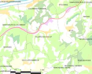
Villars-sous-Écot
- commune in Doubs, France
Hiking in Villars-sous-Écot
Villars-sous-Écot is a charming village located in the French region of Bourgogne-Franche-Comté, near the border with Switzerland. The area is known for its picturesque landscapes and diverse hiking opportunities, making it a great destination for outdoor enthusiasts....
- Country:
- Postal Code: 25150
- Coordinates: 47° 25' 18" N, 6° 41' 57" E
- GPS tracks (wikiloc): [Link]
- Area: 11.48 sq km
- Population: 356
- Web site: [Link]

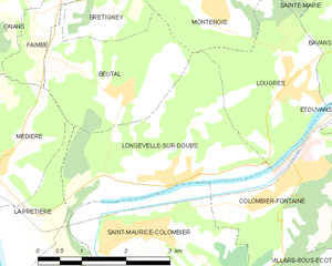
Longevelle-sur-Doubs
- commune in Doubs, France
Hiking in Longevelle-sur-Doubs
Longevelle-sur-Doubs is a charming commune located in the Doubs department of eastern France, bordered by beautiful natural scenery. It is an excellent base for hiking enthusiasts due to its proximity to the Doubs River and the surrounding landscapes that offer a variety of trails suitable for different skill levels....
- Country:
- Postal Code: 25260
- Coordinates: 47° 27' 9" N, 6° 39' 5" E
- GPS tracks (wikiloc): [Link]
- Area: 8.31 sq km
- Population: 697
- Web site: [Link]