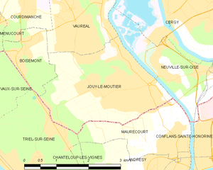
Boisemont (Boisemont)

- commune in Val-d'Oise, France
- Country:

- Postal Code: 95000
- Coordinates: 49° 1' 17" N, 2° 0' 6" E


- GPS tracks (wikiloc): [Link]
- Area: 2.77 sq km
- Population: 769
- Web site: http://www.ville-boisemont.fr
- Wikipedia en: wiki(en)
- Wikipedia: wiki(fr)
- Wikidata storage: Wikidata: Q243284
- Wikipedia Commons Category: [Link]
- Freebase ID: [/m/03qklnw]
- Freebase ID: [/m/03qklnw]
- GeoNames ID: Alt: [6613144]
- GeoNames ID: Alt: [6613144]
- SIREN number: [219500741]
- SIREN number: [219500741]
- BnF ID: [15280393h]
- BnF ID: [15280393h]
- PACTOLS thesaurus ID: [pcrtnB6ni0ypJR]
- PACTOLS thesaurus ID: [pcrtnB6ni0ypJR]
- INSEE municipality code: 95074
- INSEE municipality code: 95074
Shares border with regions:


Vauréal
- commune in Val-d'Oise, France
- Country:
- Postal Code: 95490
- Coordinates: 49° 1' 48" N, 2° 1' 17" E
- GPS tracks (wikiloc): [Link]
- Area: 3.46 sq km
- Population: 16221
- Web site: [Link]

Jouy-le-Moutier
- commune in Val-d'Oise, France
- Country:
- Postal Code: 95280
- Coordinates: 49° 0' 39" N, 2° 2' 19" E
- GPS tracks (wikiloc): [Link]
- Area: 6.89 sq km
- Population: 15971
- Web site: [Link]

Triel-sur-Seine
- commune in Yvelines, France
- Country:
- Postal Code: 78510
- Coordinates: 48° 58' 51" N, 2° 0' 22" E
- GPS tracks (wikiloc): [Link]
- Area: 13.58 sq km
- Population: 11922


Courdimanche
- commune in Val-d'Oise, France
- Country:
- Postal Code: 95800
- Coordinates: 49° 2' 4" N, 2° 0' 5" E
- GPS tracks (wikiloc): [Link]
- Area: 5.57 sq km
- Population: 6677
- Web site: [Link]


Vaux-sur-Seine
- commune in Yvelines, France
- Country:
- Postal Code: 78740
- Coordinates: 49° 0' 28" N, 1° 57' 47" E
- GPS tracks (wikiloc): [Link]
- Area: 8.45 sq km
- Population: 4788


Menucourt
- commune in Val-d'Oise, France
- Country:
- Postal Code: 95180
- Coordinates: 49° 1' 38" N, 1° 58' 53" E
- GPS tracks (wikiloc): [Link]
- Area: 3.68 sq km
- Population: 5518
- Web site: [Link]