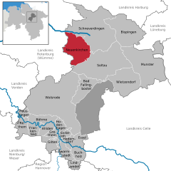
Bomlitz (Bomlitz)

- municipality of Germany
 Hiking in Bomlitz
Bomlitz is a small town located in Lower Saxony, Germany, known for its picturesque scenery and access to natural landscapes. While it may not be as well-known as larger hiking destinations, there are still plenty of opportunities for outdoor enthusiasts to explore the surrounding areas.
Hiking Opportunities in Bomlitz:
-
Lühe Nature Reserve: Located nearby, this area offers several trails that wind through lush forests and wetlands. The reserve is home to diverse flora and fauna, making it a great location for both hiking and wildlife spotting.
-
Dröge Heide: This heathland area is perfect for those looking to enjoy a quieter hiking experience. The trails here are less crowded and allow hikers to experience the beauty of heath landscapes and unique plant species.
-
Böhme Valley: A little further from Bomlitz, the Böhme Valley offers scenic hiking routes that follow the river. The trails here can be combined with longer hikes and provide beautiful views along the waterway.
-
Local Trails: Bomlitz and the surrounding area have several marked trails that cater to a range of difficulty levels. You can find shorter walks suitable for families or longer, more challenging hikes for experienced trekkers.
Tips for Hiking in Bomlitz:
- Check Weather Conditions: The weather can change quickly, especially in the spring and fall, so it’s essential to check forecasts before heading out.
- Wear Suitable Footwear: Good hiking boots are important as many trails can be uneven or muddy, particularly after rain.
- Bring Water and Snacks: Ensure you have enough hydration and energy snacks, especially for longer hikes.
- Respect Nature: Stay on marked trails and respect wildlife by not disturbing plants and animals.
Conclusion:
Hiking in and around Bomlitz offers a delightful experience for nature lovers and those who appreciate tranquil landscapes. Whether you’re looking for a leisurely stroll or a challenging hike, the region has something to offer everyone. Enjoy the fresh air and the beautiful scenery!
- Country:

- Postal Code: 29699
- Local Dialing Code: 05197; 05163; 05161; 04262
- Licence Plate Code: SFA
- Coordinates: 52° 53' 0" N, 9° 39' 0" E


- GPS tracks (wikiloc): [Link]
- AboveSeaLevel: 52 м m
- Area: 64 sq km
- Population: 6955
- Web site: http://www.bomlitz.de/
- Wikipedia en: wiki(en)
- Wikipedia: wiki(de)
- Wikidata storage: Wikidata: Q686853
- Wikipedia Commons Category: [Link]
- Freebase ID: [/m/05cg21]
- GeoNames ID: Alt: [2946524]
- VIAF ID: Alt: [145597333]
- OSM relation ID: [1808965]
- GND ID: Alt: [4211294-1]
- Library of Congress authority ID: Alt: [n98025692]
- MusicBrainz area ID: [d384e9b3-060b-4fcb-a597-9c4563d537fd]
- German municipality key: 03358004
Includes regions:
Jarlingen
- human settlement in Germany
Hiking in Jarlingen
Jarlingen is not a widely recognized destination for hiking as of my last update, so it may not have established hiking trails or specific information readily available. However, if Jarlingen is a local area or a lesser-known location within a larger region, it could potentially offer unique hiking opportunities, scenic views, and local flora and fauna....
- Country:
- Postal Code: 29699
- Coordinates: 52° 55' 38" N, 9° 37' 26" E
- GPS tracks (wikiloc): [Link]
Uetzingen
- human settlement in Germany
Hiking in Uetzingen
Uetzingen is a small area in Lower Saxony, Germany, and while it may not be as widely recognized as some larger hiking destinations, it offers several opportunities for outdoor enthusiasts. Here are some tips and insights for hiking in and around Uetzingen:...
- Country:
- Postal Code: 29699
- Coordinates: 52° 53' 0" N, 9° 39' 12" E
- GPS tracks (wikiloc): [Link]
Ahrsen
- human settlement in Germany
Hiking in Ahrsen
Ahrsen is a small locality in Germany that might not be widely known for hiking, but it is situated in the Lower Saxony region, which offers beautiful landscapes and natural areas suitable for outdoor activities, including hiking....
- Country:
- Postal Code: 29699
- Coordinates: 52° 56' 33" N, 9° 37' 47" E
- GPS tracks (wikiloc): [Link]

Benefeld
- human settlement in Germany
Hiking in Benefeld
Benefeld, located in Germany, is surrounded by lovely landscapes and offers a variety of hiking opportunities. The region is characterized by its rolling hills, forests, and serene countryside, making it perfect for outdoor enthusiasts....
- Country:
- Postal Code: 29699
- Coordinates: 52° 54' 16" N, 9° 37' 47" E
- GPS tracks (wikiloc): [Link]

Bommelsen
- human settlement in Germany
Hiking in Bommelsen
Bommelsen, while not as widely known as some major hiking destinations, is situated in Germany and offers opportunities for outdoor enthusiasts to explore natural landscapes. The area is characterized by picturesque scenery, including forests, fields, and possibly small hills or elevation changes that can make for enjoyable hikes....
- Country:
- Postal Code: 29699
- Coordinates: 52° 56' 45" N, 9° 41' 25" E
- GPS tracks (wikiloc): [Link]

Borg
- borough of Bomlitz
Hiking in Borg
Borg, also known as Bomlitz, is a small village located in the Lower Saxony region of Germany. While it may not be as famous as some larger hiking destinations, the area surrounding Borg offers beautiful landscapes, scenic trails, and opportunities for outdoor activities....
- Country:
- Postal Code: 29699
- Coordinates: 52° 53' 17" N, 9° 37' 16" E
- GPS tracks (wikiloc): [Link]
Kroge
- human settlement in Germany
Hiking in Kroge
Kroge, located near Bomlitz in Lower Saxony, Germany, is an area that offers a peaceful hiking experience surrounded by nature. While it may not be as well-known as some larger hiking destinations, it has its charm with lush forests, rolling hills, and serene landscapes. Here are some tips and information for hiking in the Kroge area:...
- Country:
- Postal Code: 29699
- Coordinates: 52° 55' 26" N, 9° 41' 39" E
- GPS tracks (wikiloc): [Link]
Shares border with regions:


Bad Fallingbostel
- municipality of Germany
Hiking in Bad Fallingbostel
Bad Fallingbostel, located in Lower Saxony, Germany, offers a variety of hiking opportunities that showcase the region's natural beauty and diverse landscapes. Here’s an overview of what you can expect when hiking in and around Bad Fallingbostel:...
- Country:
- Postal Code: 29683
- Local Dialing Code: 05163; 05162
- Licence Plate Code: HK
- Coordinates: 52° 52' 3" N, 9° 41' 48" E
- GPS tracks (wikiloc): [Link]
- AboveSeaLevel: 67 м m
- Area: 63.7 sq km
- Population: 11413
- Web site: [Link]

Neuenkirchen
- place in Lower Saxony, Germany
Hiking in Neuenkirchen
Neuenkirchen, located in the beautiful Lüneburg Heath (Lüneburger Heide) of northern Germany, offers a serene hiking experience amidst stunning natural landscapes. The area is characterized by its unique heathlands, dense forests, and charming villages, making it a great destination for outdoor enthusiasts....
- Country:
- Postal Code: 29643
- Local Dialing Code: 05195
- Licence Plate Code: HK
- Coordinates: 53° 2' 5" N, 9° 42' 29" E
- GPS tracks (wikiloc): [Link]
- AboveSeaLevel: 69 м m
- Area: 96.68 sq km
- Population: 5578
- Web site: [Link]


Soltau
- town in Heidekreis District, in Lower Saxony, Germany
Hiking in Soltau
Hiking in Soltau, a quaint town located in Lower Saxony, Germany, offers a blend of scenic landscapes, lush forests, and a range of trails suitable for all skill levels. The region is part of the Lüneburg Heath (Lüneburger Heide), known for its picturesque heathland, rolling hills, and charming villages....
- Country:
- Postal Code: 29614
- Local Dialing Code: 05191
- Licence Plate Code: HK
- Coordinates: 52° 59' 0" N, 9° 50' 0" E
- GPS tracks (wikiloc): [Link]
- AboveSeaLevel: 57 м m
- Area: 203.25 sq km
- Population: 21324
- Web site: [Link]