Bonneuil-en-Valois (Bonneuil-en-Valois)

- commune in Oise, France
- Country:

- Postal Code: 60123
- Coordinates: 49° 17' 5" N, 2° 59' 37" E


- GPS tracks (wikiloc): [Link]
- Area: 12.81 sq km
- Population: 1037
- Wikipedia en: wiki(en)
- Wikipedia: wiki(fr)
- Wikidata storage: Wikidata: Q587904
- Wikipedia Commons Category: [Link]
- Freebase ID: [/m/03qfvpl]
- GeoNames ID: Alt: [6450149]
- SIREN number: [216000836]
- BnF ID: [152673228]
- VIAF ID: Alt: [248319954]
- GND ID: Alt: [7651172-8]
- PACTOLS thesaurus ID: [pcrtftKEkHqYmS]
- INSEE municipality code: 60083
Shares border with regions:

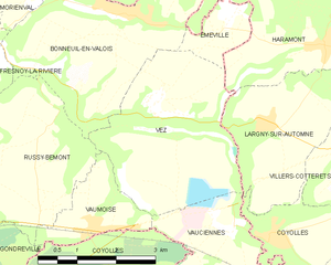
Vez
- commune in Oise, France
- Country:
- Postal Code: 60117
- Coordinates: 49° 15' 50" N, 3° 0' 9" E
- GPS tracks (wikiloc): [Link]
- Area: 10.88 sq km
- Population: 301
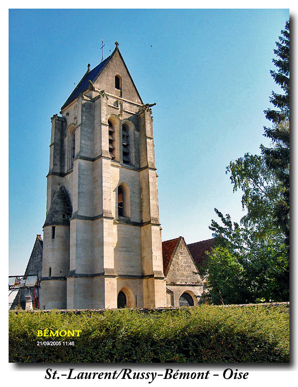

Russy-Bémont
- commune in Oise, France
- Country:
- Postal Code: 60117
- Coordinates: 49° 14' 36" N, 2° 57' 54" E
- GPS tracks (wikiloc): [Link]
- Area: 9.75 sq km
- Population: 207


Fresnoy-la-Rivière
- commune in Oise, France
- Country:
- Postal Code: 60127
- Coordinates: 49° 17' 4" N, 2° 54' 58" E
- GPS tracks (wikiloc): [Link]
- Area: 6.81 sq km
- Population: 641

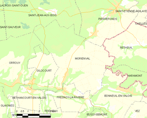
Morienval
- commune in Oise, France
- Country:
- Postal Code: 60127
- Coordinates: 49° 17' 53" N, 2° 55' 12" E
- GPS tracks (wikiloc): [Link]
- Area: 25.74 sq km
- Population: 1063
- Web site: [Link]

Haramont
- commune in Aisne, France
- Country:
- Postal Code: 02600
- Coordinates: 49° 16' 41" N, 3° 3' 42" E
- GPS tracks (wikiloc): [Link]
- Area: 12.24 sq km
- Population: 583
- Web site: [Link]

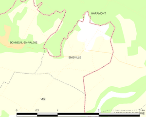
Éméville
- commune in Oise, France
- Country:
- Postal Code: 60123
- Coordinates: 49° 17' 3" N, 3° 1' 40" E
- GPS tracks (wikiloc): [Link]
- Area: 1.84 sq km
- Population: 291