Bonnieux (Bonnieux)
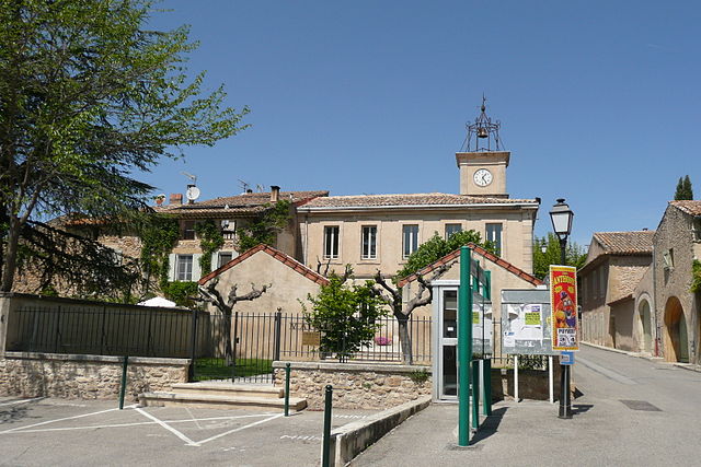
- commune in Vaucluse, France
Bonnieux, a charming village located in the Vaucluse region of the Provence-Alpes-Côte d'Azur, offers beautiful hiking opportunities amid stunning landscapes, vineyards, and ancient ruins. The surrounding Luberon National Park is particularly rich in trails that cater to various skill levels, from easy walks to more challenging hikes.
Popular Hiking Trails in Bonnieux
-
Sentier des Ocres: A relatively easy trail that showcases the ochre cliffs and beautiful scenery of the Roussillon area. This hike allows you to explore the unique ochre formations and vibrant colors characteristic of the region.
-
Chemin de la Lavande: A moderately challenging route that takes you through lavender fields (best visited in late June to early August), offering spectacular views of the Luberon valley and the surrounding countryside.
-
Luberon Circuit: For a more extensive hike, consider tackling a section of the larger Luberon circuit that connects various villages, including Bonnieux, Ménerbes, and Lacoste. This trail encompasses a mix of terrains, including vineyards, olive groves, and forested areas.
-
Bonnieux to Lacoste: A shorter, scenic hike that connects Bonnieux to the nearby village of Lacoste. This trail offers picturesque views and a chance to explore both villages.
Tips for Hiking in Bonnieux
-
Best Time to Hike: Spring (April to June) and fall (September to October) provide mild temperatures and beautiful landscapes, making these seasons ideal for hiking.
-
Facilities: Make sure to carry water and snacks, as some trails may not have immediate access to facilities. Bonnieux itself has shops and restaurants for supplies before heading out.
-
Footwear: Wear comfortable and sturdy hiking shoes, as some trails can be rocky and uneven.
-
Navigation: While many trails are well-marked, it’s always a good idea to have a map or a hiking app for navigation.
-
Local Wildlife: Be respectful of local wildlife and vegetation. Keep noise levels down and do not disturb any animals you may encounter.
Hiking in Bonnieux allows you to immerse yourself in the natural beauty and rich history of Provence, making it a rewarding experience for nature lovers and adventure seekers alike. Enjoy your hike!
- Country:

- Postal Code: 84480
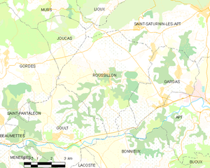
- Coordinates: 43° 49' 23" N, 5° 18' 25" E


- GPS tracks (wikiloc): [Link]
- Area: 51.12 sq km
- Population: 1362
- Web site: http://www.bonnieux.com
- Wikipedia en: wiki(en)
- Wikipedia: wiki(fr)
- Wikidata storage: Wikidata: Q247260
- Wikipedia Commons Category: [Link]
- Freebase ID: [/m/0c3b79]
- GeoNames ID: Alt: [3031665]
- SIREN number: [218400208]
- BnF ID: [15278000k]
- VIAF ID: Alt: [133823026]
- OSM relation ID: [107749]
- GND ID: Alt: [4236774-8]
- archINFORM location ID: [44104]
- Library of Congress authority ID: Alt: [n90671090]
- INSEE municipality code: 84020
Shares border with regions:


Goult
- commune in Vaucluse, France
Goult, located in the Luberon region of Provence, France, is a charming and picturesque village surrounded by stunning landscapes, making it a great destination for hiking enthusiasts. Here are some key points about hiking in and around Goult:...
- Country:

- Postal Code: 84220
- Coordinates: 43° 51' 48" N, 5° 14' 37" E


- GPS tracks (wikiloc): [Link]
- Area: 23.77 sq km
- Population: 1126
- Web site: [Link]

Gargas
- commune in Vaucluse, France
Gargas, located in the Vaucluse department of the Provence-Alpes-Côte d'Azur region in southeastern France, is a charming area known for its picturesque landscapes, historical sites, and unique geological features. Hiking in and around Gargas offers a wonderful opportunity to explore the natural beauty of the region, including the iconic ochre cliffs that the area is famous for....
- Country:

- Postal Code: 84400
- Coordinates: 43° 54' 7" N, 5° 21' 31" E


- GPS tracks (wikiloc): [Link]
- Area: 14.9 sq km
- Population: 2976
- Web site: [Link]


Apt
- commune in Vaucluse, France
Apt, located in the Vaucluse department of France, is an excellent destination for hiking enthusiasts. Nestled in the heart of the Luberon Regional Park, Apt offers a diverse range of landscapes, from lush hillsides and vineyards to rocky cliffs and scenic viewpoints. Here are some highlights of hiking in and around Apt:...
- Country:

- Postal Code: 84400
- Coordinates: 43° 52' 34" N, 5° 23' 47" E


- GPS tracks (wikiloc): [Link]
- AboveSeaLevel: 567 м m
- Area: 44.57 sq km
- Population: 11846
- Web site: [Link]


Roussillon
- commune in Vaucluse, France
Roussillon, located in the Vaucluse department of the Provence-Alpes-Côte d'Azur region in southeastern France, is renowned for its stunning landscapes, rich ochre deposits, and charming village atmosphere. Hiking in this area offers a unique blend of natural beauty and cultural heritage. Here are some key aspects to consider:...
- Country:

- Postal Code: 84220
- Coordinates: 43° 54' 8" N, 5° 17' 34" E


- GPS tracks (wikiloc): [Link]
- Area: 29.77 sq km
- Population: 1328
- Web site: [Link]


Buoux
- commune in Vaucluse, France
Buoux, located in the Provence region of France, is a fantastic destination for hiking enthusiasts. Nestled in the Luberon National Park, this area is renowned for its stunning landscapes, rich history, and well-marked trails that offer a range of hiking opportunities for all skill levels....
- Country:

- Postal Code: 84480
- Coordinates: 43° 49' 52" N, 5° 22' 40" E


- GPS tracks (wikiloc): [Link]
- Area: 17.54 sq km
- Population: 73
- Web site: [Link]


Lourmarin
- commune in Vaucluse, France
Lourmarin, located in the Luberon region of Provence in southern France, is surrounded by beautiful landscapes, offering a variety of hiking opportunities. The region is characterized by its picturesque villages, rolling hills, vineyards, and rugged mountains, making it an ideal spot for both novice and experienced hikers....
- Country:

- Postal Code: 84160
- Coordinates: 43° 45' 50" N, 5° 21' 45" E


- GPS tracks (wikiloc): [Link]
- AboveSeaLevel: 200 м m
- Area: 20.18 sq km
- Population: 1142


Puyvert
- commune in Vaucluse, France
Puyvert, located in the Vaucluse region of Provence, France, is known for its picturesque landscapes and charming rural atmosphere. Although it's a small village, the surrounding area offers a variety of hiking opportunities that can cater to different skill levels....
- Country:

- Postal Code: 84160
- Coordinates: 43° 45' 33" N, 5° 20' 35" E


- GPS tracks (wikiloc): [Link]
- Area: 9.78 sq km
- Population: 819


Lauris
- commune in Vaucluse, France
Lauris is a picturesque village located in the Provence-Alpes-Côte d'Azur region of France, known for its stunning landscapes, charming architecture, and rich history. It sits at the foot of the Luberon mountains, making it an excellent base for hikers looking to explore the natural beauty of the area. Here are some key points to consider when hiking in Lauris:...
- Country:

- Postal Code: 84360
- Coordinates: 43° 44' 49" N, 5° 18' 48" E


- GPS tracks (wikiloc): [Link]
- Area: 21.81 sq km
- Population: 3789
- Web site: [Link]


Lacoste
- commune in Vaucluse, France
Lacoste, located in the Vaucluse region of France, is a charming village in the Luberon area, known for its picturesque landscapes, historic buildings, and stunning views of the surrounding countryside. Hiking in and around Lacoste offers a wonderful opportunity to explore the natural beauty of Provence while immersing yourself in its rich history....
- Country:

- Postal Code: 84480
- Coordinates: 43° 49' 56" N, 5° 16' 24" E


- GPS tracks (wikiloc): [Link]
- Area: 10.66 sq km
- Population: 409

