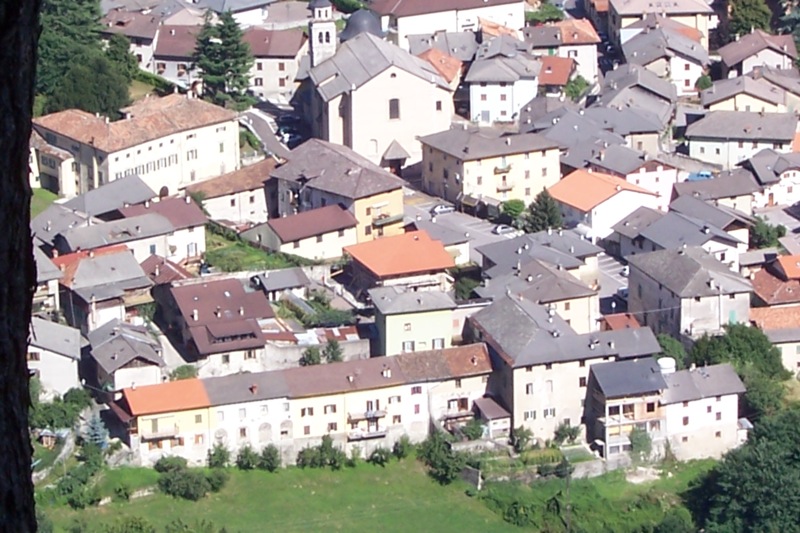
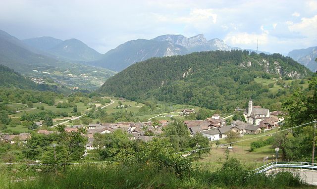
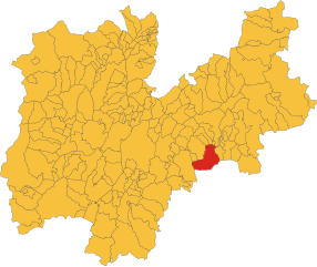
Borgo Valsugana (Borgo Valsugana)
- Italian comune
Borgo Valsugana, located in the Trentino region of northern Italy, is a picturesque area known for its stunning landscapes, rich history, and outdoor activities, making it a fantastic destination for hiking enthusiasts. The region features a mix of valleys, rivers, and mountains, providing a diverse range of trails suitable for all levels of hikers.
Hiking Highlights in Borgo Valsugana:
-
Val Sugana Trail: A scenic path that winds its way through the valley, offering beautiful views of the surrounding mountains, traditional villages, and the Brenta River. This trail is great for leisurely walks and photography.
-
Monte Raut: For those looking for a bit of a challenge, hiking to Monte Raut provides breathtaking panoramic views of the Valsugana valley and beyond. The trek is a bit steeper, making it suitable for experienced hikers.
-
The Lakes of Levico and Caldonazzo: These beautiful lakes are great starting points for various hiking trails. You can enjoy paths that take you around the lakes, or venture into the surrounding hills for more challenging hikes.
-
The Sentiero degli Dei: This is an attractive trail that offers stunning overlooks and connects several points of interest in the area. Be sure to check the trail conditions and signage before heading out.
-
Cultural Stops: Along the hiking trails, you can discover local history and culture, with opportunities to visit charming towns, ancient castles, and local farms that epitomize the region's heritage.
Tips for Hiking in Borgo Valsugana:
-
Season Considerations: The best time for hiking is typically spring through fall (April to October), depending on the weather and snow conditions in higher elevations.
-
Equipment: Ensure you have proper hiking gear, including sturdy shoes, weather-appropriate clothing, a hat, sunscreen, and plenty of water.
-
Local Guides: For those unfamiliar with the area, consider hiring a local guide who can provide valuable insights into the trails, natural history, and safety tips.
-
Trail Maps and Signage: It’s a good idea to obtain trail maps from local visitor centers or online resources. Trails are usually well-marked, but having a map can be very helpful.
-
Safety: Always let someone know your hiking plan, check weather forecasts, and be aware of your limits. Carry a basic first-aid kit and know how to handle emergencies.
Conclusion
Borgo Valsugana offers a beautiful combination of natural beauty and outdoor adventure, making it a wonderful destination for hikers of all levels. Whether you're looking for a gentle stroll or a more challenging trek, the region has plenty to offer for an unforgettable hiking experience!
- Country:

- Postal Code: 38051
- Local Dialing Code: 0461
- Licence Plate Code: TN
- Coordinates: 46° 3' 0" N, 11° 27' 0" E


- GPS tracks (wikiloc): [Link]
- AboveSeaLevel: 386 м m
- Area: 52.37 sq km
- Population: 6949
- Web site: http://borgovalsugana.webprofessional.it/default.php
- Wikipedia en: wiki(en)
- Wikipedia: wiki(it)
- Wikidata storage: Wikidata: Q246524
- Wikipedia Commons Category: [Link]
- Freebase ID: [/m/0g9xxp]
- GeoNames ID: Alt: [6536031]
- VIAF ID: Alt: [243860212]
- OSM relation ID: [46701]
- GND ID: Alt: [4561657-7]
- archINFORM location ID: [14853]
- UN/LOCODE: [ITBVU]
- Digital Atlas of the Roman Empire ID: [17153]
- ISTAT ID: 022022
- Italian cadastre code: B006
Shares border with regions:


Castelnuovo
- Italian comune
Castelnuovo, located in the Trentino region of northern Italy, offers a variety of beautiful hiking opportunities amidst stunning landscapes. The area is known for its picturesque mountains, serene forests, and scenic lakes, making it an excellent destination for both novice and experienced hikers....
- Country:

- Postal Code: 38050
- Local Dialing Code: 0461
- Licence Plate Code: TN
- Coordinates: 46° 3' 0" N, 11° 29' 0" E


- GPS tracks (wikiloc): [Link]
- AboveSeaLevel: 348 м m
- Area: 13.15 sq km
- Population: 1035
- Web site: [Link]


Levico Terme
- Italian comune
Levico Terme is a picturesque town located in the Trentino region of northern Italy, known for its thermal springs and stunning natural landscapes. It's an excellent base for hiking enthusiasts who wish to explore the surrounding mountains, forests, and lakes. Here are some highlights about hiking in and around Levico Terme:...
- Country:

- Postal Code: 38056
- Local Dialing Code: 0461
- Licence Plate Code: TN
- Coordinates: 46° 1' 0" N, 11° 18' 0" E


- GPS tracks (wikiloc): [Link]
- AboveSeaLevel: 520 м m
- Area: 62.83 sq km
- Population: 8000
- Web site: [Link]


Novaledo
- Italian comune
Novaledo is a charming municipality located in the Trentino region of northern Italy. The area is known for its beautiful natural landscapes, making it a great destination for hiking enthusiasts. Here are some key points to consider for hiking in Novaledo:...
- Country:

- Postal Code: 38050
- Local Dialing Code: 0461
- Licence Plate Code: TN
- Coordinates: 46° 1' 0" N, 11° 22' 0" E


- GPS tracks (wikiloc): [Link]
- AboveSeaLevel: 475 м m
- Area: 7.97 sq km
- Population: 1081
- Web site: [Link]


Roncegno Terme
- Italian comune
Roncegno Terme, located in the Trentino region of northern Italy, is a beautiful destination for hiking enthusiasts. Nestled in the scenic Valsugana valley, the area boasts stunning landscapes, rich biodiversity, and a mild climate, making it an appealing spot for outdoor activities year-round....
- Country:

- Postal Code: 38050
- Local Dialing Code: 0461
- Licence Plate Code: TN
- Coordinates: 46° 3' 3" N, 11° 24' 36" E


- GPS tracks (wikiloc): [Link]
- AboveSeaLevel: 535 м m
- Area: 38.08 sq km
- Population: 2906
- Web site: [Link]
Ronchi Valsugana
- Italian comune
Ronchi Valsugana, located in the Trentino region of northern Italy, is a beautiful area that offers a variety of hiking trails amidst stunning natural landscapes. The region is characterized by its picturesque valleys, rolling hills, and the backdrop of the Dolomite mountains. Here’s what you need to know for hiking in Ronchi Valsugana:...
- Country:

- Postal Code: 38051
- Local Dialing Code: 0461
- Licence Plate Code: TN
- Coordinates: 46° 4' 0" N, 11° 26' 0" E


- GPS tracks (wikiloc): [Link]
- AboveSeaLevel: 776 м m
- Area: 10 sq km
- Population: 434
- Web site: [Link]


Telve
- Italian comune
Telve, located in the Trentino region of northern Italy, offers some beautiful hiking opportunities amid the stunning alpine scenery. Nestled near the foothills of the Alps, this area is known for its picturesque landscapes, diverse wildlife, and charming local culture....
- Country:

- Postal Code: 38050
- Local Dialing Code: 0461
- Licence Plate Code: TN
- Coordinates: 46° 4' 0" N, 11° 29' 0" E


- GPS tracks (wikiloc): [Link]
- AboveSeaLevel: 548 м m
- Area: 64.75 sq km
- Population: 2008
- Web site: [Link]
Telve di Sopra
- Italian comune
Telve di Sopra is a charming village located in the Trentino region of northern Italy, surrounded by the picturesque landscape of the Italian Alps. Hiking in this area offers stunning views, diverse trails, and opportunities to explore the natural beauty and local culture....
- Country:

- Postal Code: 38050
- Local Dialing Code: 0461
- Licence Plate Code: TN
- Coordinates: 46° 4' 0" N, 11° 28' 0" E


- GPS tracks (wikiloc): [Link]
- AboveSeaLevel: 650 м m
- Area: 17.72 sq km
- Population: 595
- Web site: [Link]


Torcegno
- Italian comune
Torcegno is a charming village located in the Trentino region of northern Italy, nestled in the heart of the Italian Alps. The region is known for its stunning natural landscapes, lush forests, and scenic mountain trails that are perfect for hiking enthusiasts....
- Country:

- Postal Code: 38050
- Local Dialing Code: 0461
- Licence Plate Code: TN
- Coordinates: 46° 4' 0" N, 11° 27' 0" E


- GPS tracks (wikiloc): [Link]
- AboveSeaLevel: 769 м m
- Area: 15.19 sq km
- Population: 691
- Web site: [Link]


Asiago
- Italian comune
Asiago is a beautiful town located in the Veneto region of Italy, known for its stunning landscapes, rich history, and delicious cheese. The surrounding area offers numerous hiking opportunities, making it a popular destination for outdoor enthusiasts....
- Country:

- Postal Code: 36012
- Local Dialing Code: 0424
- Licence Plate Code: VI
- Coordinates: 45° 52' 0" N, 11° 31' 0" E


- GPS tracks (wikiloc): [Link]
- AboveSeaLevel: 1001 м m
- Area: 162.95 sq km
- Population: 6441
- Web site: [Link]

