
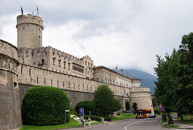
Trentino-South Tyrol (Trentino-Alto Adige)


- autonomous region in Northern Italy
 Hiking in Trentino-South Tyrol
Trentino-Alto Adige/Südtirol is a stunning region in northern Italy, known for its breathtaking landscapes, rich culture, and a diverse array of hiking opportunities. Here's an overview of what to expect when hiking in this beautiful area:
1.
- The region features dramatic mountains, lush valleys, picturesque lakes, and charming villages. The Dolomites, a UNESCO World Heritage site, are particularly famous for their unique rock formations and striking views.
2.
- Difficulty Levels: Hiking trails range from easy walks suitable for families to challenging climbs ideal for experienced hikers.
- Types of Trails: You can find everything from well-marked paths and leisurely lakeside strolls to rugged mountain routes and long-distance treks like the Alta Via routes.
3.
- Dolomites: Iconic peaks such as the Tre Cime di Lavaredo and Sassolungo offer numerous trails with varying difficulty levels.
- Val di Fassa: Known for its vibrant mountain landscapes and rich Ladin culture, it offers both easy walks and more demanding routes.
- Lake Como: Offers beautiful trails with scenic views of the lake and surrounding mountains.
- Adige Valley: Features vineyards and gentler slopes, ideal for more relaxed hiking experiences.
4.
- Spring and Summer: The most popular seasons for hiking, with blooming wildflowers and accessible trails. Summer temperatures can be warm, but higher elevations provide cooler options.
- Autumn: A magnificent time to visit, as the foliage turns vibrant colors. The weather can still be pleasant, but trails at higher altitudes may start to see snow.
- Winter: While popular for skiing and snow sports, the region also offers winter hiking and snowshoeing opportunities.
5.
- The region is a blend of Italian and Austrian cultures, reflected in its cuisine, architecture, and traditions. Many trails lead you through quaint towns where you can sample local foods and wines or experience regional festivities.
6.
- There are numerous mountain huts (rifugi) along popular trails, offering food and overnight accommodations. These huts provide an excellent opportunity to rest and enjoy local cuisine.
7.
- Always check weather conditions before heading out, pack necessary gear (like maps, first-aid kits, and sufficient water), and inform someone of your hiking plans.
- Familiarize yourself with the trail difficulties and your own fitness level to ensure a safe and enjoyable outing.
In summary, hiking in Trentino-Alto Adige/Südtirol offers an unforgettable experience, with its dramatic landscapes, rich culture, and diverse trails catering to all levels of hikers. Whether you’re looking for a scenic day hike or an extended trek through the mountains, you're sure to find something that suits your adventurous spirit!
- Country:

- Capital: Trento
- Coordinates: 46° 23' 0" N, 11° 25' 0" E


- GPS tracks (wikiloc): [Link]
- AboveSeaLevel: 749 м m
- Area: 13606.87 sq km
- Population: 1068264
- Web site: http://www.regione.taa.it/
- Wikipedia en: wiki(en)
- Wikipedia: wiki(it)
- Wikidata storage: Wikidata: Q1237
- Wikipedia Commons Gallery: [Link]
- Wikipedia Commons Category: [Link]
- Wikipedia Commons Maps Category: [Link]
- Freebase ID: [/m/01kpyw]
- GeoNames ID: Alt: [3165244]
- BnF ID: [12036478j]
- VIAF ID: Alt: [134852476]
- OSM relation ID: [45757]
- GND ID: Alt: [4060814-1]
- archINFORM location ID: [4730]
- Library of Congress authority ID: Alt: [n79032952]
- MusicBrainz area ID: [19a7a4c5-d897-4ab0-9657-632b1878c91c]
- TGN ID: [7003124]
- SUDOC authorities ID: [104482664]
- Encyclopædia Britannica Online ID: [place/Trentino-Alto-Adige-Sudtirol]
- Gran Enciclopèdia Catalana ID: [0067342]
- Encyclopædia Universalis ID: [trentin-haut-adige]
- ISNI: Alt: [0000 0001 2289 8331]
- DMOZ ID: Alt: [Regional/Europe/Italy/Regions/Trentino-Alto_Adige/]
- National Library of Israel ID: [000974888]
- NUTS code: [IT31]
- Ringgold ID: [57044]
- ISTAT ID: 04
- ISO 3166-2 code: IT-32
- FIPS 10-4 (countries and regions): IT17
- GACS ID: 21670
Includes regions:


South Tyrol
- autonomous province of Italy
Hiking in South Tyrol
South Tyrol, located in northern Italy, is a paradise for hikers and outdoor enthusiasts. This stunning region is characterized by its dramatic landscapes, which include the towering peaks of the Dolomites, lush valleys, and picturesque alpine meadows. Here are some key points about hiking in South Tyrol:...
- Country:
- Capital: Bolzano
- Postal Code: 39010–39059; 39100
- Local Dialing Code: 0471; 0463; 0474; 0473; 0472
- Licence Plate Code: BZ
- Coordinates: 46° 30' 0" N, 11° 20' 0" E
- GPS tracks (wikiloc): [Link]
- Area: 7400.43 sq km
- Population: 550432
- Web site: [Link]
Trentino
- autonomous province of Italy
Hiking in Trentino
Hiking in Trentino, a region in northern Italy, offers a stunning array of landscapes, from the majestic Dolomites to picturesque valleys, dense forests, and serene lakes. Here are some highlights and essentials for hiking in this beautiful region:...
- Country:
- Capital: Trento
- Postal Code: 38010-38023-38089; 38121–38123
- Local Dialing Code: 0465; 0464; 0463; 0462; 0461; 0439
- Licence Plate Code: TN
- Coordinates: 46° 26' 44" N, 11° 10' 23" E
- GPS tracks (wikiloc): [Link]
- Area: 6207 sq km
- Population: 447359
- Web site: [Link]
Shares border with regions:
Graubünden
- canton of Switzerland
Hiking in Graubünden
The Canton of Grisons, or Graubünden, is a breathtaking region in Switzerland known for its stunning landscapes, diverse hiking trails, and rich cultural heritage. Here are some highlights of hiking in this beautiful area:...
- Country:

- Capital: Chur
- Licence Plate Code: GR
- Coordinates: 46° 45' 0" N, 9° 30' 0" E
- GPS tracks (wikiloc): [Link]
- AboveSeaLevel: 585 м m
- Area: 7105.39 sq km
- Web site: [Link]

Lombardy
- administrative region in Northern Italy
Hiking in Lombardy
Lombardy, a region in northern Italy, is known for its stunning landscapes, ranging from the Alps in the north to picturesque lakes, rolling hills, and charming towns. Hiking in Lombardy offers a variety of trails suitable for all levels, whether you're a beginner looking for an easy stroll or an experienced hiker seeking challenging mountain routes....
- Country:
- Capital: Milan
- Coordinates: 45° 39' 0" N, 9° 57' 0" E
- GPS tracks (wikiloc): [Link]
- Area: 23863.65 sq km
- Population: 10023876
- Web site: [Link]
Veneto
- region in Italy
Hiking in Veneto
Hiking in the Veneto region of Italy offers a diverse range of landscapes and experiences, from the idyllic foothills of the Alps to the scenic paths along the Adriatic coast. Here are some highlights and notable trails to consider:...
- Country:
- Capital: Venice
- Coordinates: 45° 44' 0" N, 11° 51' 0" E
- GPS tracks (wikiloc): [Link]
- AboveSeaLevel: 180 м m
- Area: 18339 sq km
- Population: 4925737
- Web site: [Link]


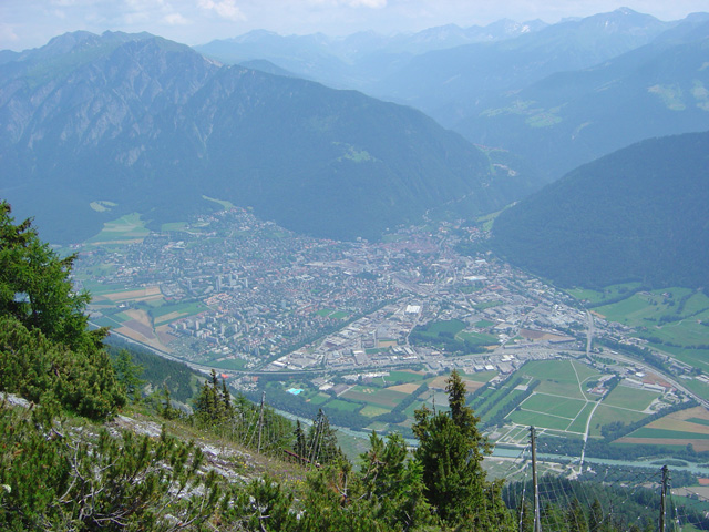
Tyrol
- federal state in western Austria
Hiking in Tyrol
Tyrol, located in the Austrian Alps, is a paradise for hiking enthusiasts, offering a diverse array of trails that cater to all skill levels. The landscape is characterized by stunning mountain vistas, lush valleys, sparkling lakes, and charming alpine villages, making it a perfect setting for outdoor activities....
- Country:

- Capital: Innsbruck
- Coordinates: 47° 16' 0" N, 11° 24' 0" E
- GPS tracks (wikiloc): [Link]
- AboveSeaLevel: 605 м m
- Area: 12647.71 sq km
- Population: 739002
- Web site: [Link]


Salzburg
- state of Austria
Hiking in Salzburg
Salzburg, located in Austria, is renowned for its stunning alpine landscapes and rich cultural heritage, making it a fantastic destination for hiking enthusiasts. Here are some highlights and tips for hiking in the state of Salzburg:...
- Country:
- Capital: Salzburg
- Coordinates: 47° 46' 1" N, 13° 21' 51" E
- GPS tracks (wikiloc): [Link]
- AboveSeaLevel: 827 м m
- Area: 7156.03 sq km
- Population: 545742
- Web site: [Link]