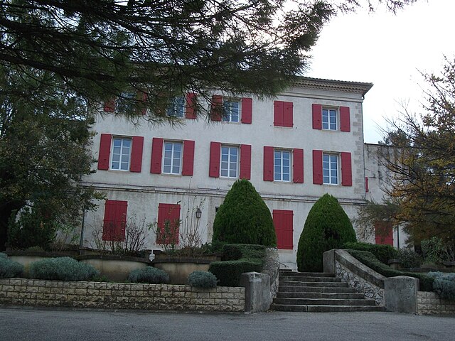
Bouc-Bel-Air (Bouc-Bel-Air)

- commune in Bouches-du-Rhône, France
 Hiking in Bouc-Bel-Air
Bouc-Bel-Air is a charming commune located in the Provence-Alpes-Côte d'Azur region of southern France, near Marseille. With its scenic landscapes and proximity to natural parks, it's a great locale for hiking enthusiasts. Here are some highlights of hiking in Bouc-Bel-Air:
Trails and Nature
-
Natural Areas: The region is characterized by rolling hills, olive groves, and Mediterranean vegetation. The nearby École Naturelle and the Calanques National Park offer stunning views and a variety of hiking opportunities.
-
Varied Difficulty: Whether you're a beginner or an experienced hiker, there are trails of varying difficulty levels. Many paths are well-marked, making it easy to navigate.
-
Scenic Views: Hikers can enjoy panoramic views of the surrounding countryside, as well as the nearby Sainte-Victoire Mountain, which is a favorite among both locals and visitors.
Hiking Tips
- Best Time to Hike: Spring (April to June) and fall (September to October) are ideal times for hiking, as the weather is mild and the scenery is particularly beautiful.
- Prepare for the Terrain: The trails can be rocky and uneven in places, so sturdy hiking boots are recommended.
- Stay Hydrated: Carry enough water, especially on hotter days, as some trails may not have accessible water sources.
Local Insights
- Guided Tours: If you're unfamiliar with the area, consider joining a guided hiking group. They can enhance your experience with local knowledge and ensure you find the best trails.
- Combine with Sightseeing: After a hike, you can explore the charming village of Bouc-Bel-Air and enjoy its cafés and local markets.
Safety Considerations
- Always let someone know your plans before heading out.
- Check the weather forecast and trail conditions beforehand.
- Be mindful of wildlife and respect the local flora and fauna.
With its picturesque landscapes and diverse hiking options, Bouc-Bel-Air is a wonderful destination for anyone looking to immerse themselves in nature. Enjoy your hike!
- Country:

- Postal Code: 13320
- Coordinates: 43° 27' 16" N, 5° 24' 52" E


- GPS tracks (wikiloc): [Link]
- Area: 21.75 sq km
- Population: 14351
- Web site: http://www.boucbelair.fr
- Wikipedia en: wiki(en)
- Wikipedia: wiki(fr)
- Wikidata storage: Wikidata: Q117438
- Wikipedia Commons Category: [Link]
- Freebase ID: [/m/099__3]
- GeoNames ID: Alt: [3031387]
- SIREN number: [211300157]
- BnF ID: [15247297g]
- VIAF ID: Alt: [149827176]
- GND ID: Alt: [1156947081]
- Library of Congress authority ID: Alt: [no2017020003]
- Quora topic ID: [Bouc-Bel-Air]
- SUDOC authorities ID: [030182131]
- Gran Enciclopèdia Catalana ID: [0264019]
- Trismegistos Geo ID: [20758]
- INSEE municipality code: 13015
Shares border with regions:


Les Pennes-Mirabeau
- commune in Bouches-du-Rhône, France
Hiking in Les Pennes-Mirabeau
Les Pennes-Mirabeau, located in the Provence-Alpes-Côte d'Azur region in southeastern France, is a charming area that offers a variety of hiking opportunities. Nestled near Marseille, it provides a blend of picturesque landscapes, natural parks, and cultural experiences....
- Country:
- Postal Code: 13170
- Coordinates: 43° 24' 36" N, 5° 18' 34" E
- GPS tracks (wikiloc): [Link]
- Area: 33.66 sq km
- Population: 21387
- Web site: [Link]


Gardanne
- commune in Bouches-du-Rhône, France
Hiking in Gardanne
Gardanne, located in the Provence-Alpes-Côte d'Azur region of France, offers various hiking opportunities that showcase the beautiful landscapes and rich natural heritage of the area. Here are some details about hiking in Gardanne:...
- Country:
- Postal Code: 13120
- Coordinates: 43° 27' 16" N, 5° 28' 34" E
- GPS tracks (wikiloc): [Link]
- Area: 27.02 sq km
- Population: 19749
- Web site: [Link]


Cabriès
- commune in Bouches-du-Rhône, France
Hiking in Cabriès
Cabriès is a charming village located in the Provence-Alpes-Côte d'Azur region of France, near Marseille and Aix-en-Provence. It's surrounded by picturesque countryside and offers several opportunities for hiking enthusiasts. Here are some highlights about hiking in and around Cabriès:...
- Country:
- Postal Code: 13480
- Coordinates: 43° 26' 28" N, 5° 22' 47" E
- GPS tracks (wikiloc): [Link]
- Area: 36.55 sq km
- Population: 9627
- Web site: [Link]


Aix-en-Provence
- commune in Bouches-du-Rhône, France
Hiking in Aix-en-Provence
Aix-en-Provence, located in the Provence region of southern France, is surrounded by beautiful landscapes that offer excellent hiking opportunities. Here's what you can expect when hiking in and around Aix-en-Provence:...
- Country:
- Postal Code: 13540; 13290; 13100; 13090; 13080
- Coordinates: 43° 31' 40" N, 5° 26' 44" E
- GPS tracks (wikiloc): [Link]
- AboveSeaLevel: 173 м m
- Area: 186.08 sq km
- Population: 142668
- Web site: [Link]

Simiane-Collongue
- commune in Bouches-du-Rhône, France
Hiking in Simiane-Collongue
Simiane-Collongue is a charming commune located in the Bouches-du-Rhône department in the Provence-Alpes-Côte d'Azur region of southern France. It is surrounded by beautiful landscapes, making it a delightful destination for hiking enthusiasts....
- Country:
- Postal Code: 13109
- Coordinates: 43° 25' 52" N, 5° 25' 57" E
- GPS tracks (wikiloc): [Link]
- Area: 29.84 sq km
- Population: 5584


Septèmes-les-Vallons
- commune in Bouches-du-Rhône, France
Hiking in Septèmes-les-Vallons
Septèmes-les-Vallons is a charming commune located in the Bouches-du-Rhône department in the Provence-Alpes-Côte d'Azur region of France. It's situated near Marseille and offers various hiking opportunities that showcase the beautiful landscapes of southern France....
- Country:
- Postal Code: 13240
- Coordinates: 43° 23' 54" N, 5° 21' 57" E
- GPS tracks (wikiloc): [Link]
- Area: 17.84 sq km
- Population: 10721
- Web site: [Link]