
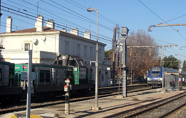
Aix-en-Provence (Aix-en-Provence)


- commune in Bouches-du-Rhône, France
 Hiking in Aix-en-Provence
Aix-en-Provence, located in the Provence region of southern France, is surrounded by beautiful landscapes that offer excellent hiking opportunities. Here's what you can expect when hiking in and around Aix-en-Provence:
Scenic Trails
-
Montagne Sainte-Victoire: One of the most iconic hiking destinations near Aix, Montagne Sainte-Victoire has various trails ranging from easy walks to challenging climbs. The views from the summit are spectacular, with panoramic vistas of the surrounding countryside. The trail is about 6 km (3.7 miles) to the summit, and you can expect a moderate climb.
-
Puy Sainte-Réparade: Located slightly north of Aix, this area offers a number of trails through vineyards and olive groves, with the backdrop of the Montagne Sainte-Victoire.
-
The Calanques: While a bit further from Aix-en-Provence, the Calanques National Park is worth the trip. It offers stunning coastal hikes, rugged cliffs, and beautiful beaches. The Calanques between Cassis and Marseille feature several trails that can be combined into day hikes.
Nature and Flora
The region around Aix-en-Provence is known for its diverse flora, including Mediterranean plants such as lavender, rosemary, and wild herbs. Depending on the season, you might also encounter beautiful wildflowers, particularly in spring.
Wildlife
Hikers can spot various birds and wildlife indigenous to the Provence region. Keep your eyes open for birds like hawks and owls, as well as small mammals.
Best Time to Hike
- Spring (April to June): Ideal weather with blooming flowers and moderate temperatures.
- Autumn (September to November): Cooler temperatures and beautiful fall colors.
- Summer (July to August): Can be quite hot, so early morning hikes are recommended.
- Winter (December to February): Mild temperatures but can be rainy; still pleasant for hiking if you're prepared.
Preparation Tips
- Wear proper footwear: A good pair of hiking shoes is essential, especially for rocky or uneven terrain.
- Bring water and snacks: Stay hydrated and have some fuel for your hike.
- Check the weather: Conditions can change rapidly, so make sure you're prepared for the weather.
- Trail maps: While many trails are well-marked, having a map or GPS can help, especially in more remote areas.
Local Hiking Groups
Consider joining local hiking groups or guided tours if you're unfamiliar with the area. This can also be a great way to meet fellow hiking enthusiasts.
Overall, hiking in Aix-en-Provence combines stunning natural beauty with the rich culture and history of the region, making it a wonderful experience for outdoor lovers.
- Country:

- Postal Code: 13540; 13290; 13100; 13090; 13080
- Coordinates: 43° 31' 40" N, 5° 26' 44" E


- GPS tracks (wikiloc): [Link]
- AboveSeaLevel: 173 м m
- Area: 186.08 sq km
- Population: 142668
- Web site: http://www.mairie-aixenprovence.fr
- Wikipedia en: wiki(en)
- Wikipedia: wiki(fr)
- Wikidata storage: Wikidata: Q47465
- Wikipedia Commons Gallery: [Link]
- Wikipedia Commons Category: [Link]
- Wikipedia Commons Maps Category: [Link]
- Freebase ID: [/m/0knfs]
- Freebase ID: [/m/0knfs]
- Freebase ID: [/m/0knfs]
- GeoNames ID: Alt: [6452134]
- GeoNames ID: Alt: [6452134]
- GeoNames ID: Alt: [6452134]
- SIREN number: [211300017]
- SIREN number: [211300017]
- SIREN number: [211300017]
- BnF ID: [15247283s]
- BnF ID: [15247283s]
- BnF ID: [15247283s]
- VIAF ID: Alt: [312740180]
- VIAF ID: Alt: [312740180]
- VIAF ID: Alt: [312740180]
- OSM relation ID: [70279]
- OSM relation ID: [70279]
- OSM relation ID: [70279]
- GND ID: Alt: [4000860-5]
- GND ID: Alt: [4000860-5]
- GND ID: Alt: [4000860-5]
- archINFORM location ID: [576]
- archINFORM location ID: [576]
- archINFORM location ID: [576]
- Library of Congress authority ID: Alt: [n79091185]
- Library of Congress authority ID: Alt: [n79091185]
- Library of Congress authority ID: Alt: [n79091185]
- PACTOLS thesaurus ID: [pcrtbE3vzlaX0O]
- PACTOLS thesaurus ID: [pcrtbE3vzlaX0O]
- PACTOLS thesaurus ID: [pcrtbE3vzlaX0O]
- MusicBrainz area ID: [37bc32de-19c2-474b-86ed-c73919891f06]
- MusicBrainz area ID: [37bc32de-19c2-474b-86ed-c73919891f06]
- MusicBrainz area ID: [37bc32de-19c2-474b-86ed-c73919891f06]
- WOEID: [12654994]
- WOEID: [12654994]
- WOEID: [12654994]
- Quora topic ID: [Aix-en-Provence-France]
- Quora topic ID: [Aix-en-Provence-France]
- Quora topic ID: [Aix-en-Provence-France]
- TGN ID: [7010786]
- TGN ID: [7010786]
- TGN ID: [7010786]
- UN/LOCODE: [FRQXB]
- UN/LOCODE: [FRQXB]
- UN/LOCODE: [FRQXB]
- SUDOC authorities ID: [026358506]
- SUDOC authorities ID: [026358506]
- SUDOC authorities ID: [026358506]
- Encyclopædia Britannica Online ID: [place/Aix-en-Provence]
- Encyclopædia Britannica Online ID: [place/Aix-en-Provence]
- Encyclopædia Britannica Online ID: [place/Aix-en-Provence]
- Gran Enciclopèdia Catalana ID: [0001399]
- Gran Enciclopèdia Catalana ID: [0001399]
- Gran Enciclopèdia Catalana ID: [0001399]
- Encyclopædia Universalis ID: [aix-en-provence]
- Encyclopædia Universalis ID: [aix-en-provence]
- Encyclopædia Universalis ID: [aix-en-provence]
- EMLO location ID: [104df272-c38c-4db8-91f4-7b6493d986ad]
- EMLO location ID: [104df272-c38c-4db8-91f4-7b6493d986ad]
- EMLO location ID: [104df272-c38c-4db8-91f4-7b6493d986ad]
- Facebook Places ID: [101896829852427]
- Facebook Places ID: [101896829852427]
- Facebook Places ID: [101896829852427]
- Great Russian Encyclopedia Online ID: [4927398]
- Great Russian Encyclopedia Online ID: [4927398]
- Great Russian Encyclopedia Online ID: [4927398]
- ISNI: Alt: [0000 0001 2348 4317]
- ISNI: Alt: [0000 0001 2348 4317]
- ISNI: Alt: [0000 0001 2348 4317]
- data.gouv.fr org ID: [ville-d-aix-en-provence]
- data.gouv.fr org ID: [ville-d-aix-en-provence]
- data.gouv.fr org ID: [ville-d-aix-en-provence]
- OpenPlaques subject ID: [6158]
- OpenPlaques subject ID: [6158]
- OpenPlaques subject ID: [6158]
- INSEE municipality code: 13001
- INSEE municipality code: 13001
- INSEE municipality code: 13001
Shares border with regions:


Bouc-Bel-Air
- commune in Bouches-du-Rhône, France
Hiking in Bouc-Bel-Air
Bouc-Bel-Air is a charming commune located in the Provence-Alpes-Côte d'Azur region of southern France, near Marseille. With its scenic landscapes and proximity to natural parks, it's a great locale for hiking enthusiasts. Here are some highlights of hiking in Bouc-Bel-Air:...
- Country:
- Postal Code: 13320
- Coordinates: 43° 27' 16" N, 5° 24' 52" E
- GPS tracks (wikiloc): [Link]
- Area: 21.75 sq km
- Population: 14351
- Web site: [Link]


Vitrolles
- commune in Bouches-du-Rhône, France
- Country:
- Postal Code: 13127
- Coordinates: 43° 26' 53" N, 5° 14' 59" E
- GPS tracks (wikiloc): [Link]
- Area: 36.58 sq km
- Population: 34089
- Web site: [Link]


Éguilles
- commune in Bouches-du-Rhône, France
Hiking in Éguilles
Éguilles is a charming village located in the Provence-Alpes-Côte d'Azur region of southern France, close to the city of Aix-en-Provence. The area surrounding Éguilles offers a variety of hiking opportunities that allow you to explore the stunning landscapes, diverse flora and fauna, and the cultural heritage of the region....
- Country:
- Postal Code: 13510
- Coordinates: 43° 34' 7" N, 5° 21' 15" E
- GPS tracks (wikiloc): [Link]
- Area: 34.07 sq km
- Population: 7672
- Web site: [Link]


Gardanne
- commune in Bouches-du-Rhône, France
Hiking in Gardanne
Gardanne, located in the Provence-Alpes-Côte d'Azur region of France, offers various hiking opportunities that showcase the beautiful landscapes and rich natural heritage of the area. Here are some details about hiking in Gardanne:...
- Country:
- Postal Code: 13120
- Coordinates: 43° 27' 16" N, 5° 28' 34" E
- GPS tracks (wikiloc): [Link]
- Area: 27.02 sq km
- Population: 19749
- Web site: [Link]


Cabriès
- commune in Bouches-du-Rhône, France
Hiking in Cabriès
Cabriès is a charming village located in the Provence-Alpes-Côte d'Azur region of France, near Marseille and Aix-en-Provence. It's surrounded by picturesque countryside and offers several opportunities for hiking enthusiasts. Here are some highlights about hiking in and around Cabriès:...
- Country:
- Postal Code: 13480
- Coordinates: 43° 26' 28" N, 5° 22' 47" E
- GPS tracks (wikiloc): [Link]
- Area: 36.55 sq km
- Population: 9627
- Web site: [Link]


Rognes
- commune in Bouches-du-Rhône, France
Hiking in Rognes
Rognes, located in the Bouches-du-Rhône department in the south of France, is a charming village surrounded by the beautiful landscapes of Provence. Hiking in and around Rognes offers a fantastic experience for outdoor enthusiasts, thanks to its scenic trails and natural beauty....
- Country:
- Postal Code: 13840
- Coordinates: 43° 39' 52" N, 5° 20' 50" E
- GPS tracks (wikiloc): [Link]
- Area: 58.32 sq km
- Population: 4795


Saint-Cannat
- commune in Bouches-du-Rhône, France
Hiking in Saint-Cannat
Saint-Cannat is a charming commune located in the Bouches-du-Rhône department in the Provence-Alpes-Côte d'Azur region of France. It offers a variety of hiking opportunities that allow visitors to experience the natural beauty and cultural heritage of the area....
- Country:
- Postal Code: 13760
- Coordinates: 43° 37' 17" N, 5° 17' 53" E
- GPS tracks (wikiloc): [Link]
- Area: 36.54 sq km
- Population: 5550
- Web site: [Link]


Venelles
- commune in Bouches-du-Rhône, France
Hiking in Venelles
Venelles, located in the Provence-Alpes-Côte d'Azur region of France, offers a variety of beautiful landscapes perfect for hiking enthusiasts. Here's a general overview of what you can expect while hiking in and around Venelles:...
- Country:
- Postal Code: 13770
- Coordinates: 43° 35' 54" N, 5° 28' 57" E
- GPS tracks (wikiloc): [Link]
- Area: 20.54 sq km
- Population: 8352
- Web site: [Link]


Meyreuil
- commune in Bouches-du-Rhône, France
Hiking in Meyreuil
Meyreuil is a charming commune located near Aix-en-Provence in the Provence-Alpes-Côte d'Azur region of France. It's an excellent starting point for hiking enthusiasts because of its beautiful natural landscapes and proximity to the Sainte-Victoire mountain....
- Country:
- Postal Code: 13590
- Coordinates: 43° 29' 10" N, 5° 29' 44" E
- GPS tracks (wikiloc): [Link]
- Area: 20.13 sq km
- Population: 5417
- Web site: [Link]

Rognac
- commune in Bouches-du-Rhône, France
- Country:
- Postal Code: 13340
- Coordinates: 43° 29' 16" N, 5° 13' 56" E
- GPS tracks (wikiloc): [Link]
- Area: 17.46 sq km
- Population: 11870
- Web site: [Link]

Le Puy-Sainte-Réparade
- commune in Bouches-du-Rhône, France
Hiking in Le Puy-Sainte-Réparade
Le Puy-Sainte-Réparade is a charming commune located in the Provence-Alpes-Côte d'Azur region of southeastern France. While it may not be as widely known for hiking as some other areas in Provence, it offers beautiful landscapes and nearby trails perfect for outdoor enthusiasts. Here are some aspects of hiking in and around Le Puy-Sainte-Réparade:...
- Country:
- Postal Code: 13610
- Coordinates: 43° 39' 48" N, 5° 26' 14" E
- GPS tracks (wikiloc): [Link]
- Area: 46.29 sq km
- Population: 5557

Velaux
- commune in Bouches-du-Rhône, France
Hiking in Velaux
Velaux is a charming village located in the Provence-Alpes-Côte d'Azur region of France, near Marseille and Aix-en-Provence. It offers a variety of hiking opportunities, allowing you to explore beautiful landscapes, vineyards, and local flora and fauna. Here are some highlights for hiking in and around Velaux:...
- Country:
- Postal Code: 13880
- Coordinates: 43° 31' 21" N, 5° 15' 14" E
- GPS tracks (wikiloc): [Link]
- Area: 25.23 sq km
- Population: 8876
- Web site: [Link]


Le Tholonet
- commune in Bouches-du-Rhône, France
Hiking in Le Tholonet
Le Tholonet is a picturesque village located near Aix-en-Provence in the southeastern part of France. It offers some beautiful hiking opportunities, with trails that showcase stunning views of the surrounding landscape, including the iconic Mont Sainte-Victoire, which has been a muse for many artists, including Cézanne....
- Country:
- Postal Code: 13100
- Coordinates: 43° 31' 18" N, 5° 30' 40" E
- GPS tracks (wikiloc): [Link]
- Area: 10.82 sq km
- Population: 2376


Saint-Marc-Jaumegarde
- commune in Bouches-du-Rhône, France
Hiking in Saint-Marc-Jaumegarde
Saint-Marc-Jaumegarde is a charming commune located near Aix-en-Provence in the Provence-Alpes-Côte d'Azur region of France. It offers beautiful landscapes that are perfect for hiking enthusiasts. Here's what you should know about hiking in this area:...
- Country:
- Postal Code: 13100
- Coordinates: 43° 32' 51" N, 5° 31' 27" E
- GPS tracks (wikiloc): [Link]
- Area: 22.56 sq km
- Population: 1228
- Web site: [Link]


Ventabren
- commune in Bouches-du-Rhône, France
Hiking in Ventabren
Ventabren is a picturesque village located in the Provence-Alpes-Côte d'Azur region of southern France, near Marseille. It offers stunning landscapes, charming architecture, and a variety of hiking opportunities that cater to different skill levels. Here are some highlights about hiking in and around Ventabren:...
- Country:
- Postal Code: 13122
- Coordinates: 43° 32' 20" N, 5° 17' 35" E
- GPS tracks (wikiloc): [Link]
- Area: 26.32 sq km
- Population: 5278
- Web site: [Link]