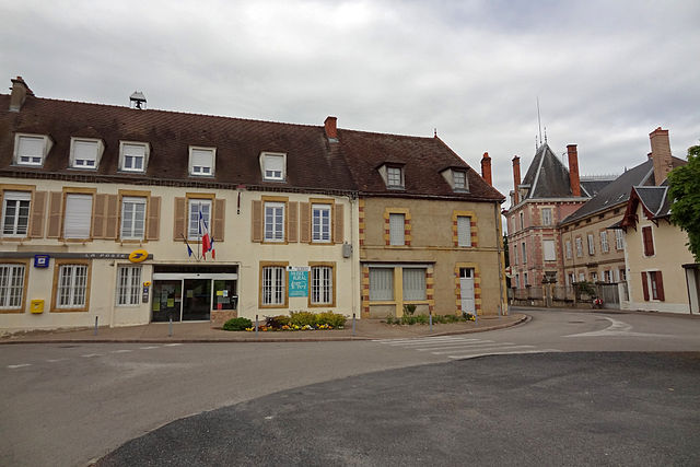
Bourbon-Lancy (Bourbon-Lancy)
- commune in Saône-et-Loire, France
- Country:

- Postal Code: 71140
- Coordinates: 46° 37' 10" N, 3° 46' 24" E


- GPS tracks (wikiloc): [Link]
- Area: 55.73 sq km
- Population: 5054
- Web site: http://www.bourbon-lancy.com
- Wikipedia en: wiki(en)
- Wikipedia: wiki(fr)
- Wikidata storage: Wikidata: Q829308
- Wikipedia Commons Category: [Link]
- Wikipedia Commons Maps Category: [Link]
- Freebase ID: [/m/08w217]
- Freebase ID: [/m/08w217]
- GeoNames ID: Alt: [3031090]
- GeoNames ID: Alt: [3031090]
- SIREN number: [217100478]
- SIREN number: [217100478]
- BnF ID: [15273021b]
- BnF ID: [15273021b]
- VIAF ID: Alt: [122429152]
- VIAF ID: Alt: [122429152]
- GND ID: Alt: [4253499-9]
- GND ID: Alt: [4253499-9]
- Library of Congress authority ID: Alt: [nr92023991]
- Library of Congress authority ID: Alt: [nr92023991]
- PACTOLS thesaurus ID: [pcrtTPQuZRLvYo]
- PACTOLS thesaurus ID: [pcrtTPQuZRLvYo]
- WOEID: [581146]
- WOEID: [581146]
- EMLO location ID: [88c40666-31f8-42e3-afb8-dbffb7a70c6a]
- EMLO location ID: [88c40666-31f8-42e3-afb8-dbffb7a70c6a]
- Digital Atlas of the Roman Empire ID: [7830]
- Digital Atlas of the Roman Empire ID: [7830]
- INSEE municipality code: 71047
- INSEE municipality code: 71047
Shares border with regions:


Gilly-sur-Loire
- commune in Saône-et-Loire, France
- Country:

- Postal Code: 71160
- Coordinates: 46° 32' 17" N, 3° 46' 44" E


- GPS tracks (wikiloc): [Link]
- Area: 22.63 sq km
- Population: 504


Mont
- commune in Saône-et-Loire, France
- Country:

- Postal Code: 71140
- Coordinates: 46° 37' 34" N, 3° 49' 48" E


- GPS tracks (wikiloc): [Link]
- Area: 16.18 sq km
- Population: 211


Lesme
- commune in Saône-et-Loire, France
- Country:

- Postal Code: 71140
- Coordinates: 46° 39' 5" N, 3° 42' 57" E


- GPS tracks (wikiloc): [Link]
- Area: 5.08 sq km
- Population: 192


Vitry-sur-Loire
- commune in Saône-et-Loire, France
- Country:

- Postal Code: 71140
- Coordinates: 46° 40' 53" N, 3° 42' 28" E


- GPS tracks (wikiloc): [Link]
- Area: 27.38 sq km
- Population: 438


Maltat
- commune in Saône-et-Loire, France
- Country:

- Postal Code: 71140
- Coordinates: 46° 40' 55" N, 3° 49' 2" E


- GPS tracks (wikiloc): [Link]
- Area: 31.35 sq km
- Population: 290

Beaulon
- commune in Allier, France
- Country:

- Postal Code: 03230
- Coordinates: 46° 36' 6" N, 3° 40' 23" E


- GPS tracks (wikiloc): [Link]
- Area: 63.98 sq km
- Population: 1680
- Web site: [Link]

Garnat-sur-Engièvre
- commune in Allier, France
- Country:

- Postal Code: 03230
- Coordinates: 46° 38' 1" N, 3° 39' 47" E


- GPS tracks (wikiloc): [Link]
- Area: 18.74 sq km
- Population: 693


Chalmoux
- commune in Saône-et-Loire, France
- Country:

- Postal Code: 71140
- Coordinates: 46° 35' 54" N, 3° 50' 53" E


- GPS tracks (wikiloc): [Link]
- Area: 38.47 sq km
- Population: 656
- Web site: [Link]


Saint-Aubin-sur-Loire
- commune in Saône-et-Loire, France
- Country:

- Postal Code: 71140
- Coordinates: 46° 34' 9" N, 3° 44' 40" E


- GPS tracks (wikiloc): [Link]
- Area: 10.86 sq km
- Population: 306
