Brénod (Brénod)
- commune in Ain, France
 Hiking in Brénod
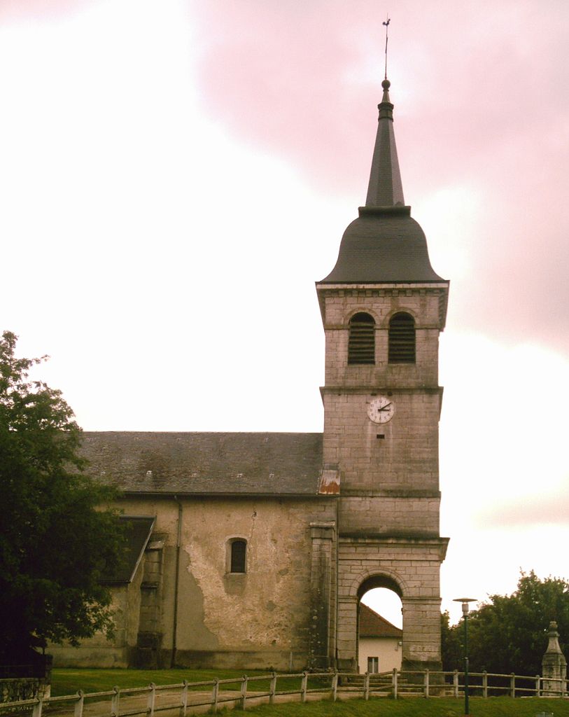
Brénod is a charming commune located in the Ain department in the Auvergne-Rhône-Alpes region of France. It is situated at the foothills of the Jura mountains, making it a great starting point for various hiking adventures.
Hiking Highlights in Brénod:
-
Scenic Trails: The area around Brénod offers a variety of hiking trails suitable for different skill levels. You will find well-marked paths that lead through stunning landscapes, including forests, rolling hills, and meandering streams.
-
Natural Parks: Brénod is close to the Haut-Jura Regional Nature Park, which contains numerous trails that showcase the rich biodiversity and stunning natural beauty of the region. This park is known for its impressive wildlife and flora.
-
Local Sights: As you hike, don't miss the chance to explore local attractions such as the historical sites, traditional farms, and panoramic viewpoints. Some trails may take you to viewpoints where you can see vast panoramas of the surrounding region, including the Alps on clearer days.
-
Cultural Experience: Hiking in this area allows you to immerse yourself in the local culture. You may encounter traditional architecture and might even come across local markets or events, depending on the time of year.
-
Wildlife Watching: The Jura mountains are home to a variety of wildlife, so keep an eye out for deer, foxes, and a diverse range of bird species while on your hikes.
-
Hiking Seasons: The best time for hiking in Brénod is typically from late spring through early fall (May to September), when the weather is warmer and trails are more accessible. However, winter hikes can also be spectacular, especially for those interested in snowshoeing or winter trekking.
Preparation Tips:
- Gear Up: Depending on the season, ensure you wear appropriate footwear, and pack plenty of water, snacks, and a first-aid kit.
- Maps and Guidance: Consider picking up a map of local trails or downloading hiking apps for navigation.
- Check Weather Conditions: Always check the weather forecast before setting out, as conditions can change quickly in mountainous areas.
Local Resources:
- Local tourist offices can provide trail maps, guided tour options, and information about the best hiking routes in Brénod.
Whether you’re looking for a leisurely stroll or an adventurous hike, Brénod and its surrounding regions have something to offer every outdoor enthusiast. Enjoy your hike!
- Country:

- Postal Code: 01110
- Coordinates: 46° 3' 39" N, 5° 36' 22" E


- GPS tracks (wikiloc): [Link]
- Area: 23.79 sq km
- Population: 536
- Web site: http://www.brenod.com
- Wikipedia en: wiki(en)
- Wikipedia: wiki(fr)
- Wikidata storage: Wikidata: Q207453
- Wikipedia Commons Category: [Link]
- Wikipedia Commons Maps Category: [Link]
- Freebase ID: [/m/07ttll]
- Freebase ID: [/m/07ttll]
- Freebase ID: [/m/07ttll]
- GeoNames ID: Alt: [3030343]
- GeoNames ID: Alt: [3030343]
- GeoNames ID: Alt: [3030343]
- SIREN number: [210100608]
- SIREN number: [210100608]
- SIREN number: [210100608]
- BnF ID: [12155913p]
- BnF ID: [12155913p]
- BnF ID: [12155913p]
- VIAF ID: Alt: [243081662]
- VIAF ID: Alt: [243081662]
- VIAF ID: Alt: [243081662]
- INSEE municipality code: 01060
- INSEE municipality code: 01060
- INSEE municipality code: 01060
Shares border with regions:
Champdor
- former commune in Ain, France
Hiking in Champdor
Champdor, located in the Auvergne-Rhône-Alpes region of France, is a picturesque destination for hikers, offering a range of trails that showcase the natural beauty of the area. Surrounded by mountains, forests, and rivers, the scenery is both diverse and breathtaking, making it an excellent spot for outdoor enthusiasts....
- Country:
- Postal Code: 01110
- Coordinates: 46° 1' 2" N, 5° 35' 50" E
- GPS tracks (wikiloc): [Link]
- Area: 17.37 sq km
- Population: 455
Champdor-Corcelles
- commune in Ain, France
Hiking in Champdor-Corcelles
Champdor-Corcelles is a small village located in the Ain department in the Auvergne-Rhône-Alpes region of France. It offers beautiful landscapes, making it an excellent destination for hiking enthusiasts. Here are some key points to consider when hiking in this area:...
- Country:
- Postal Code: 01080
- Coordinates: 46° 1' 5" N, 5° 35' 52" E
- GPS tracks (wikiloc): [Link]
- Area: 31.53 sq km
- Web site: [Link]

Le Petit-Abergement
- former commune in Ain, France
Hiking in Le Petit-Abergement
Le Petit-Abergement is a charming village located in the Auvergne-Rhône-Alpes region of France, nestled in the stunning landscapes of the Jura Mountains. This area offers a variety of hiking opportunities for all skill levels, whether you're an experienced hiker or a beginner looking for a scenic day out....
- Country:
- Postal Code: 01260
- Coordinates: 46° 1' 57" N, 5° 39' 49" E
- GPS tracks (wikiloc): [Link]
- Area: 26.95 sq km
- Population: 133

Vieu-d'Izenave
- commune in Ain, France
Hiking in Vieu-d'Izenave
Vieu-d'Izenave is a charming alpine village nestled in the Ain department of the Auvergne-Rhône-Alpes region in France. It offers numerous hiking opportunities thanks to its picturesque landscapes and proximity to the Jura Mountains....
- Country:
- Postal Code: 01430
- Coordinates: 46° 4' 51" N, 5° 31' 45" E
- GPS tracks (wikiloc): [Link]
- Area: 23.73 sq km
- Population: 691
- Web site: [Link]

Les Neyrolles
- commune in Ain, France
Hiking in Les Neyrolles
Les Neyrolles, located in the Jura Mountains of France, offers a fantastic setting for hiking enthusiasts. This region is known for its lush greenery, rolling hills, and panoramic views. Here are some highlights and tips for hiking in Les Neyrolles:...
- Country:
- Postal Code: 01130
- Coordinates: 46° 8' 30" N, 5° 38' 1" E
- GPS tracks (wikiloc): [Link]
- Area: 9.5 sq km
- Population: 635

Saint-Martin-du-Frêne
- commune in Ain, France
Hiking in Saint-Martin-du-Frêne
Saint-Martin-du-Frêne, located in the Ain department of the Auvergne-Rhône-Alpes region in France, offers a variety of beautiful hiking opportunities set against the backdrop of the stunning Jura Mountains. The area is recognized for its picturesque landscapes, lush forests, and diverse wildlife, making it an excellent destination for outdoor enthusiasts....
- Country:
- Postal Code: 01430
- Coordinates: 46° 8' 20" N, 5° 33' 9" E
- GPS tracks (wikiloc): [Link]
- Area: 19.14 sq km
- Population: 1076
- Web site: [Link]

Corcelles
- former commune in Ain, France
Hiking in Corcelles
Corcelles, located in the Ain department of France, offers beautiful landscapes and various hiking opportunities. The region is characterized by rolling hills, woodlands, vineyards, and picturesque countryside that is typical of the Auvergne-Rhône-Alpes region....
- Country:
- Postal Code: 01110
- Coordinates: 46° 2' 8" N, 5° 34' 28" E
- GPS tracks (wikiloc): [Link]
- Area: 14.16 sq km
- Population: 208
- Web site: [Link]

Chevillard
- commune in Ain, France
Hiking in Chevillard
Chevillard is a small commune located in the Ain department in the Auvergne-Rhône-Alpes region of southeastern France. Known for its picturesque landscapes, Chevillard offers a variety of hiking opportunities that cater to different skill levels. Here are some key points to consider when hiking in and around Chevillard:...
- Country:
- Postal Code: 01430
- Coordinates: 46° 6' 34" N, 5° 34' 55" E
- GPS tracks (wikiloc): [Link]
- Area: 6.67 sq km
- Population: 156