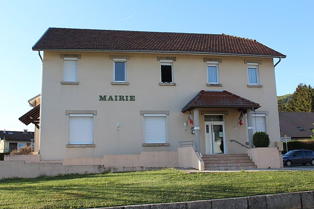
Champdor-Corcelles (Champdor-Corcelles)
- commune in Ain, France
 Hiking in Champdor-Corcelles
Champdor-Corcelles is a small village located in the Ain department in the Auvergne-Rhône-Alpes region of France. It offers beautiful landscapes, making it an excellent destination for hiking enthusiasts. Here are some key points to consider when hiking in this area:
Scenic Trails
-
Diverse Landscapes: The region features a mix of rolling hills, forests, and picturesque valleys. Hikers can enjoy changing scenery and various ecosystems.
-
Local Trails: Look for local hiking trails that offer well-marked paths. The terrain can range from easy to moderate, making it suitable for hikers of all skill levels.
-
Nature Exploration: The area is often rich with flora and fauna, including wildflowers and possibly sightings of local wildlife. Take your time to enjoy the natural environment.
Key Hiking Locations
-
Surrounding Forests: The forests around Champdor-Corcelles provide shaded areas and cooler temperatures, ideal for summer hikes.
-
Rivers and Streams: Many hiking routes may lead to small rivers or streams, offering a great spot for a picnic or to rest and enjoy the sound of flowing water.
Tips for Hiking in Champdor-Corcelles
-
Season: Spring and early autumn are often the best times for hiking, as the weather is usually mild and the landscapes are vibrant.
-
Local Maps: Make sure to have a local hiking map or utilize mobile applications to help navigate. Some trails may not be well-signposted.
-
Equipment: Wear sturdy hiking boots and dress in layers, as the weather can change. Carry sufficient water and snacks, especially on longer hikes.
-
Respect Nature: Follow Leave No Trace principles. Stay on marked trails to protect local wildlife and vegetation.
-
Local Knowledge: If you're not familiar with the area, consider reaching out to local hiking groups or tourism offices for advice on the best trails and safety tips.
Additional Activities
Besides hiking, the region might offer opportunities for picnicking, cycling, or even visiting local attractions, such as historical sites or charming villages.
Overall, Champdor-Corcelles can provide a rewarding hiking experience for nature lovers looking for tranquility off the beaten path. Enjoy your adventure!
- Country:

- Postal Code: 01080
- Coordinates: 46° 1' 5" N, 5° 35' 52" E


- GPS tracks (wikiloc): [Link]
- Area: 31.53 sq km
- Web site: http://champdor-corcelles.jimdo.com
- Wikipedia en: wiki(en)
- Wikipedia: wiki(fr)
- Wikidata storage: Wikidata: Q21979656
- Wikipedia Commons Category: [Link]
- Wikipedia Commons Maps Category: [Link]
- SIREN number: [200056695]
- OpenCorporates ID: [fr/200056695]
- INSEE municipality code: 01080
Shares border with regions:


Aranc
- commune in Ain, France
Hiking in Aranc
Aranc is a captivating destination for those who love the great outdoors, particularly hiking. Nestled in the stunning Jura Mountains in France, it offers a variety of trails that cater to different skill levels, from easy walks suitable for families to more challenging hikes for seasoned adventurers....
- Country:
- Postal Code: 01110
- Coordinates: 46° 0' 16" N, 5° 30' 33" E
- GPS tracks (wikiloc): [Link]
- Area: 21.65 sq km
- Population: 327
- Web site: [Link]

Brénod
- commune in Ain, France
Hiking in Brénod
Brénod is a charming commune located in the Ain department in the Auvergne-Rhône-Alpes region of France. It is situated at the foothills of the Jura mountains, making it a great starting point for various hiking adventures....
- Country:
- Postal Code: 01110
- Coordinates: 46° 3' 39" N, 5° 36' 22" E
- GPS tracks (wikiloc): [Link]
- Area: 23.79 sq km
- Population: 536
- Web site: [Link]
Haut-Valromey
- commune in Ain, France
Hiking in Haut-Valromey
Haut-Valromey is a beautiful region located in the French Alps, known for its stunning landscapes and outdoor activities, particularly hiking. Here are some key points to consider if you plan to hike in Haut-Valromey:...
- Country:
- Postal Code: 01260
- Coordinates: 45° 59' 51" N, 5° 41' 42" E
- GPS tracks (wikiloc): [Link]
- Area: 107.85 sq km
- Web site: [Link]

Outriaz
- commune in Ain, France
Hiking in Outriaz
Outriaz is a small commune located in the Auvergne-Rhône-Alpes region of France, nestled in the beautiful French Alps. While it may not be as well-known as some other hiking destinations, it offers access to stunning landscapes, charming villages, and a variety of outdoor activities....
- Country:
- Postal Code: 01430
- Coordinates: 46° 4' 2" N, 5° 32' 49" E
- GPS tracks (wikiloc): [Link]
- Area: 5.91 sq km
- Population: 265

Hauteville-Lompnes
- commune in Ain, France
Hiking in Hauteville-Lompnes
Hauteville-Lompnes, located in the Ain department of the Auvergne-Rhône-Alpes region in France, is a stunning destination for hiking enthusiasts. Nestled in the foothills of the Alps, it offers a variety of trails ranging from easy walks to more challenging hikes, making it suitable for hikers of all experience levels....
- Country:
- Postal Code: 01110
- Coordinates: 45° 58' 44" N, 5° 35' 58" E
- GPS tracks (wikiloc): [Link]
- Area: 50.34 sq km
- Population: 3739
- Web site: [Link]

Le Petit-Abergement
- former commune in Ain, France
Hiking in Le Petit-Abergement
Le Petit-Abergement is a charming village located in the Auvergne-Rhône-Alpes region of France, nestled in the stunning landscapes of the Jura Mountains. This area offers a variety of hiking opportunities for all skill levels, whether you're an experienced hiker or a beginner looking for a scenic day out....
- Country:
- Postal Code: 01260
- Coordinates: 46° 1' 57" N, 5° 39' 49" E
- GPS tracks (wikiloc): [Link]
- Area: 26.95 sq km
- Population: 133

Vieu-d'Izenave
- commune in Ain, France
Hiking in Vieu-d'Izenave
Vieu-d'Izenave is a charming alpine village nestled in the Ain department of the Auvergne-Rhône-Alpes region in France. It offers numerous hiking opportunities thanks to its picturesque landscapes and proximity to the Jura Mountains....
- Country:
- Postal Code: 01430
- Coordinates: 46° 4' 51" N, 5° 31' 45" E
- GPS tracks (wikiloc): [Link]
- Area: 23.73 sq km
- Population: 691
- Web site: [Link]

Lantenay
- commune in Ain, France
Hiking in Lantenay
Lantenay, located in the Ain department in the Auvergne-Rhône-Alpes region of France, offers a tranquil setting for hiking enthusiasts. The area features picturesque landscapes, including rolling hills, forests, and meadows, making it a perfect spot for both casual walkers and more experienced hikers....
- Country:
- Postal Code: 01430
- Coordinates: 46° 3' 27" N, 5° 32' 30" E
- GPS tracks (wikiloc): [Link]
- AboveSeaLevel: 730 м m
- Area: 6.59 sq km
- Population: 267
- Web site: [Link]

Corcelles
- former commune in Ain, France
Hiking in Corcelles
Corcelles, located in the Ain department of France, offers beautiful landscapes and various hiking opportunities. The region is characterized by rolling hills, woodlands, vineyards, and picturesque countryside that is typical of the Auvergne-Rhône-Alpes region....
- Country:
- Postal Code: 01110
- Coordinates: 46° 2' 8" N, 5° 34' 28" E
- GPS tracks (wikiloc): [Link]
- Area: 14.16 sq km
- Population: 208
- Web site: [Link]

Ruffieu
- commune in Ain, France
Hiking in Ruffieu
Ruffieu is a charming village located in the Ain department of the Auvergne-Rhône-Alpes region in France. It’s nestled in the picturesque landscapes of the Jura mountains, offering a variety of hiking opportunities that cater to different levels of experience....
- Country:
- Postal Code: 01260
- Coordinates: 45° 59' 39" N, 5° 39' 48" E
- GPS tracks (wikiloc): [Link]
- Area: 14.03 sq km
- Population: 182
- Web site: [Link]

Izenave
- commune in Ain, France
Hiking in Izenave
Izenave is a charming commune located in the Ain department in the Auvergne-Rhône-Alpes region of southeastern France. It’s nestled in the natural beauty of the Jura Mountains, making it an excellent destination for hiking enthusiasts....
- Country:
- Postal Code: 01430
- Coordinates: 46° 2' 17" N, 5° 31' 30" E
- GPS tracks (wikiloc): [Link]
- Area: 13.04 sq km
- Population: 168