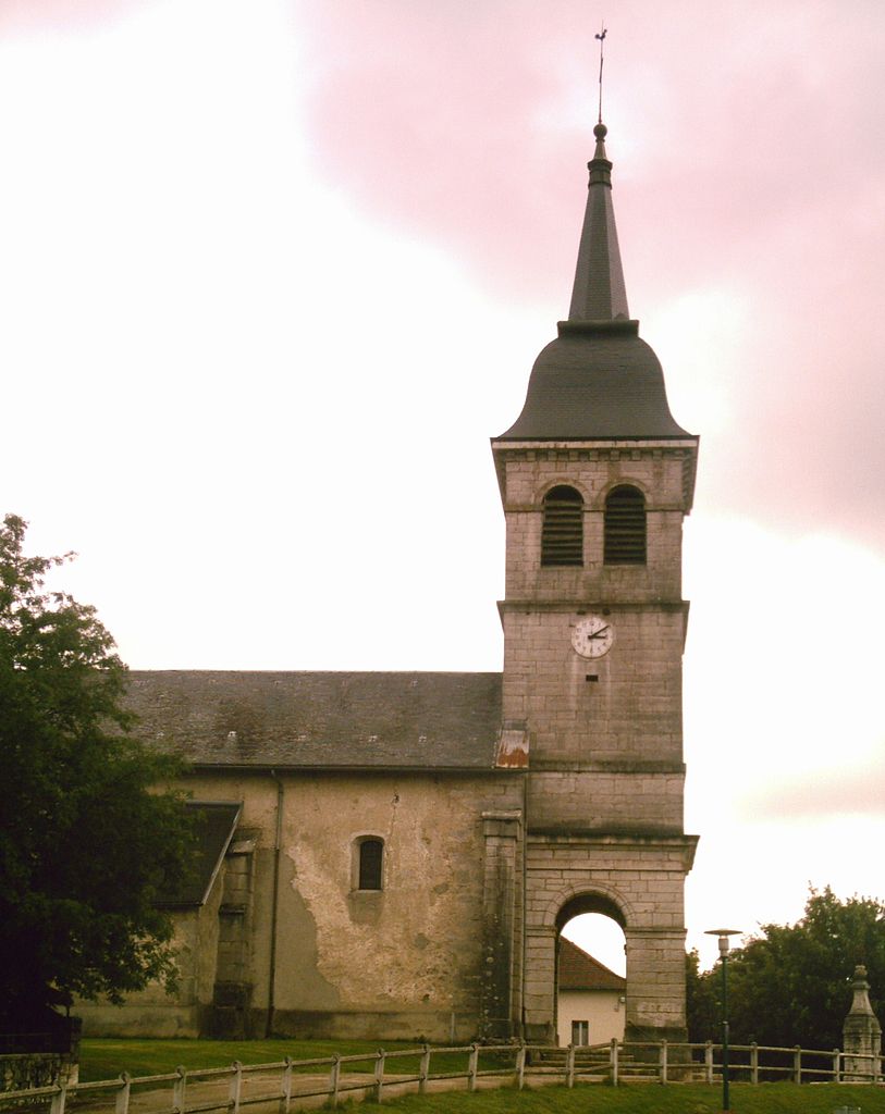
Corcelles (Corcelles)
- former commune in Ain, France
 Hiking in Corcelles
Corcelles, located in the Ain department of France, offers beautiful landscapes and various hiking opportunities. The region is characterized by rolling hills, woodlands, vineyards, and picturesque countryside that is typical of the Auvergne-Rhône-Alpes region.
Hiking Trails
-
Local Trails: There are several marked trails around Corcelles that vary in difficulty. The trails may take you through charming villages, vineyards, and forests. It's advisable to check local maps or hiking apps for specific routes.
-
Monts d'Or: While not directly in Corcelles, the nearby Monts d'Or region offers more challenging hikes with stunning views of the surrounding areas. These trails typically feature more elevation change and require good physical fitness.
-
Pilgrim Routes: You may also find parts of historical pilgrimage routes that provide a unique hiking experience, blending nature with cultural awareness.
Best Time to Hike
- Spring (March - May): Ideal temperatures and blooming flora make spring a great time for hiking.
- Fall (September - November): The fall foliage adds beauty to the surroundings and the temperatures are usually mild.
Safety and Preparations
- Footwear: Wear sturdy hiking shoes or boots to handle uneven terrain.
- Gear: Bring a map, sufficient water, snacks, and weather-appropriate clothing.
- Wildlife: Keep an eye out for local wildlife, especially if hiking in less populated areas.
- Local Regulations: Be aware of any local regulations or guidelines for hiking in the area.
Nearby Attractions
- Cultural Sites: Consider exploring local historical and cultural landmarks along your hike.
- Vineyards: The Ain region is known for its wines; some trails may take you through vineyards where you can enjoy local tastings.
In summary, hiking in Corcelles offers a delightful mix of nature and culture. By ensuring proper preparation and choosing the right trails, you can have a fantastic experience exploring this beautiful region.
- Country:

- Postal Code: 01110
- Coordinates: 46° 2' 8" N, 5° 34' 28" E


- GPS tracks (wikiloc): [Link]
- Area: 14.16 sq km
- Population: 208
- Web site: http://www.corcelles.org
- Wikipedia en: wiki(en)
- Wikipedia: wiki(fr)
- Wikidata storage: Wikidata: Q275356
- Wikipedia Commons Category: [Link]
- Wikipedia Commons Maps Category: [Link]
- Freebase ID: [/m/03cz18q]
- Freebase ID: [/m/03cz18q]
- Freebase ID: [/m/03cz18q]
- GeoNames ID: Alt: [6453499]
- GeoNames ID: Alt: [6453499]
- GeoNames ID: Alt: [6453499]
- VIAF ID: Alt: [239650784]
- VIAF ID: Alt: [239650784]
- VIAF ID: Alt: [239650784]
- INSEE municipality code: 01119
- INSEE municipality code: 01119
- INSEE municipality code: 01119
Shares border with regions:


Aranc
- commune in Ain, France
Hiking in Aranc
Aranc is a captivating destination for those who love the great outdoors, particularly hiking. Nestled in the stunning Jura Mountains in France, it offers a variety of trails that cater to different skill levels, from easy walks suitable for families to more challenging hikes for seasoned adventurers....
- Country:
- Postal Code: 01110
- Coordinates: 46° 0' 16" N, 5° 30' 33" E
- GPS tracks (wikiloc): [Link]
- Area: 21.65 sq km
- Population: 327
- Web site: [Link]

Brénod
- commune in Ain, France
Hiking in Brénod
Brénod is a charming commune located in the Ain department in the Auvergne-Rhône-Alpes region of France. It is situated at the foothills of the Jura mountains, making it a great starting point for various hiking adventures....
- Country:
- Postal Code: 01110
- Coordinates: 46° 3' 39" N, 5° 36' 22" E
- GPS tracks (wikiloc): [Link]
- Area: 23.79 sq km
- Population: 536
- Web site: [Link]
Champdor
- former commune in Ain, France
Hiking in Champdor
Champdor, located in the Auvergne-Rhône-Alpes region of France, is a picturesque destination for hikers, offering a range of trails that showcase the natural beauty of the area. Surrounded by mountains, forests, and rivers, the scenery is both diverse and breathtaking, making it an excellent spot for outdoor enthusiasts....
- Country:
- Postal Code: 01110
- Coordinates: 46° 1' 2" N, 5° 35' 50" E
- GPS tracks (wikiloc): [Link]
- Area: 17.37 sq km
- Population: 455
Champdor-Corcelles
- commune in Ain, France
Hiking in Champdor-Corcelles
Champdor-Corcelles is a small village located in the Ain department in the Auvergne-Rhône-Alpes region of France. It offers beautiful landscapes, making it an excellent destination for hiking enthusiasts. Here are some key points to consider when hiking in this area:...
- Country:
- Postal Code: 01080
- Coordinates: 46° 1' 5" N, 5° 35' 52" E
- GPS tracks (wikiloc): [Link]
- Area: 31.53 sq km
- Web site: [Link]

Outriaz
- commune in Ain, France
Hiking in Outriaz
Outriaz is a small commune located in the Auvergne-Rhône-Alpes region of France, nestled in the beautiful French Alps. While it may not be as well-known as some other hiking destinations, it offers access to stunning landscapes, charming villages, and a variety of outdoor activities....
- Country:
- Postal Code: 01430
- Coordinates: 46° 4' 2" N, 5° 32' 49" E
- GPS tracks (wikiloc): [Link]
- Area: 5.91 sq km
- Population: 265

Vieu-d'Izenave
- commune in Ain, France
Hiking in Vieu-d'Izenave
Vieu-d'Izenave is a charming alpine village nestled in the Ain department of the Auvergne-Rhône-Alpes region in France. It offers numerous hiking opportunities thanks to its picturesque landscapes and proximity to the Jura Mountains....
- Country:
- Postal Code: 01430
- Coordinates: 46° 4' 51" N, 5° 31' 45" E
- GPS tracks (wikiloc): [Link]
- Area: 23.73 sq km
- Population: 691
- Web site: [Link]

Lantenay
- commune in Ain, France
Hiking in Lantenay
Lantenay, located in the Ain department in the Auvergne-Rhône-Alpes region of France, offers a tranquil setting for hiking enthusiasts. The area features picturesque landscapes, including rolling hills, forests, and meadows, making it a perfect spot for both casual walkers and more experienced hikers....
- Country:
- Postal Code: 01430
- Coordinates: 46° 3' 27" N, 5° 32' 30" E
- GPS tracks (wikiloc): [Link]
- AboveSeaLevel: 730 м m
- Area: 6.59 sq km
- Population: 267
- Web site: [Link]

Izenave
- commune in Ain, France
Hiking in Izenave
Izenave is a charming commune located in the Ain department in the Auvergne-Rhône-Alpes region of southeastern France. It’s nestled in the natural beauty of the Jura Mountains, making it an excellent destination for hiking enthusiasts....
- Country:
- Postal Code: 01430
- Coordinates: 46° 2' 17" N, 5° 31' 30" E
- GPS tracks (wikiloc): [Link]
- Area: 13.04 sq km
- Population: 168