Braslou (Braslou)

- commune in Indre-et-Loire, France
- Country:

- Postal Code: 37120
- Coordinates: 47° 0' 0" N, 0° 23' 32" E


- GPS tracks (wikiloc): [Link]
- Area: 15.79 sq km
- Population: 308
- Web site: http://www.braslou.fr/
- Wikipedia en: wiki(en)
- Wikipedia: wiki(fr)
- Wikidata storage: Wikidata: Q660987
- Wikipedia Commons Category: [Link]
- Freebase ID: [/m/03nvd2j]
- GeoNames ID: Alt: [6448654]
- SIREN number: [213700347]
- BnF ID: [15257585h]
- PACTOLS thesaurus ID: [pcrtijXByYRTrO]
- INSEE municipality code: 37034
Shares border with regions:


Chaveignes
- commune in Indre-et-Loire, France
- Country:
- Postal Code: 37120
- Coordinates: 47° 2' 16" N, 0° 20' 59" E
- GPS tracks (wikiloc): [Link]
- Area: 21.34 sq km
- Population: 554
- Web site: [Link]


Courcoué
- commune in Indre-et-Loire, France
- Country:
- Postal Code: 37120
- Coordinates: 47° 2' 2" N, 0° 23' 45" E
- GPS tracks (wikiloc): [Link]
- Area: 15.66 sq km
- Population: 266


Braye-sous-Faye
- commune in Indre-et-Loire, France
- Country:
- Postal Code: 37120
- Coordinates: 46° 59' 29" N, 0° 20' 48" E
- GPS tracks (wikiloc): [Link]
- Area: 15.67 sq km
- Population: 339

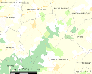
Luzé
- commune in Indre-et-Loire, France
- Country:
- Postal Code: 37120
- Coordinates: 47° 1' 24" N, 0° 27' 9" E
- GPS tracks (wikiloc): [Link]
- Area: 20.3 sq km
- Population: 261


Jaulnay
- commune in Indre-et-Loire, France
- Country:
- Postal Code: 37120
- Coordinates: 46° 56' 54" N, 0° 24' 51" E
- GPS tracks (wikiloc): [Link]
- Area: 14.76 sq km
- Population: 257


Razines
- commune in Indre-et-Loire, France
- Country:
- Postal Code: 37120
- Coordinates: 46° 58' 32" N, 0° 22' 40" E
- GPS tracks (wikiloc): [Link]
- Area: 14.73 sq km
- Population: 239