Bruck-Mürzzuschlag District (Bezirk Bruck-Mürzzuschlag)
.svg)
- district in Austria
 Hiking in Bruck-Mürzzuschlag District
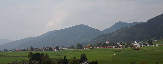
Bruck-Mürzzuschlag District, located in the state of Styria, Austria, offers a wealth of hiking opportunities surrounded by stunning natural beauty. The region is characterized by its picturesque mountains, lush forests, and vibrant valleys, making it an ideal destination for both novice and experienced hikers. Here are some highlights and tips for hiking in this area:
Popular Hiking Areas
-
Semmering: This mountain pass is not only a UNESCO World Heritage Site due to its railway but also a popular hiking destination. Several trails, such as the Semmering Panorama Trail, offer breathtaking views and diverse landscapes.
-
Mürzzuschlag: The region around Mürzzuschlag features beautiful trails that vary in difficulty. The nearby Veitsch Mountains offer challenging hikes with rewards like panoramic views and unique geological formations.
-
Hochschwab Massif: Located on the western edge of the district, this mountain range provides more rugged terrain for adventurous hikers. The trails here, such as the Hochschwab Circular Trail, are well-marked and take you through alpine meadows and rocky paths.
-
Totes Gebirge: Slightly further afield but still accessible for day hikes, the Totes Gebirge offers spectacular scenery, with alpine lakes and dramatic rock formations. The trails here can be more demanding, suitable for experienced hikers.
Hiking Tips
-
Trail Markings: Trails in Austria are well-marked; look for color-coded signs that indicate the level of difficulty and destination.
-
Weather Preparedness: The weather can change rapidly in the mountains. It’s essential to check forecasts before heading out and to dress in layers to adjust to temperature changes.
-
Wildlife and Flora: Keep an eye out for local wildlife, including deer and various bird species. Also, take time to appreciate the diverse plant life, especially in blooming seasons.
-
Equipment: Good hiking boots, a daypack with enough water and snacks, and a map or GPS device are crucial for safe hiking.
-
Local Regulations: Be mindful of local regulations, especially regarding protected areas and respecting nature.
Safety First
Always inform someone about your hiking plans and expected return time. If you’re hiking in remote areas, consider carrying a first aid kit and knowing basic first aid procedures.
Whether you’re looking for a leisurely walk or a challenging mountain trek, the Bruck-Mürzzuschlag District has something to offer every outdoor enthusiast! Enjoy your adventure!
- Country:

- Capital: Bruck an der Mur
- Licence Plate Code: BM
- Coordinates: 47° 25' 0" N, 15° 16' 0" E


- GPS tracks (wikiloc): [Link]
- Area: 2155 sq km
- Web site: http://www.bh-bruck-muerzzuschlag.steiermark.at/
- Wikipedia en: wiki(en)
- Wikipedia: wiki(de)
- Wikidata storage: Wikidata: Q853690
- Wikipedia Commons Category: [Link]
- Wikipedia Commons Maps Category: [Link]
- VIAF ID: Alt: [311727044]
- archINFORM location ID: [14698]
Includes regions:

Pernegg an der Mur
- municipality in Austria
Hiking in Pernegg an der Mur
Pernegg an der Mur is a charming town in Styria, Austria, situated in a picturesque valley along the Mur River. The area offers a variety of hiking opportunities that cater to different skill levels, set against beautiful natural backdrops with lush forests, rolling hills, and streams....
- Country:
- Postal Code: 8132
- Local Dialing Code: 03867
- Licence Plate Code: BM
- Coordinates: 47° 22' 0" N, 15° 21' 0" E
- GPS tracks (wikiloc): [Link]
- AboveSeaLevel: 458 м m
- Area: 86.05 sq km
- Population: 2356
- Web site: [Link]
Spital am Semmering
- municipality in Austria
Hiking in Spital am Semmering
Spital am Semmering is a picturesque village located in the Styrian region of Austria, surrounded by stunning mountain scenery, making it an excellent destination for hiking enthusiasts. Here are some highlights and tips for hiking in this beautiful area:...
- Country:
- Postal Code: 8684
- Local Dialing Code: 03853
- Licence Plate Code: MZ
- Coordinates: 47° 36' 58" N, 15° 45' 14" E
- GPS tracks (wikiloc): [Link]
- AboveSeaLevel: 800 м m
- Area: 72.59 sq km
- Population: 1595
- Web site: [Link]
Aflenz
- municipality in Austria
Hiking in Aflenz
Aflenz is a beautiful region located in the Styrian Alps of Austria, known for its stunning landscapes and a variety of hiking opportunities. If you're planning to hike in this area, here are some things you should know:...
- Country:
- Postal Code: 8621, 8623, 8624
- Local Dialing Code: 03861
- Licence Plate Code: BM
- Coordinates: 47° 34' 26" N, 15° 13' 34" E
- GPS tracks (wikiloc): [Link]
- AboveSeaLevel: 1586 м m
- Area: 55.06 sq km
- Population: 2417
- Web site: [Link]
Sankt Barbara im Mürztal
- municipality in Austria
Hiking in Sankt Barbara im Mürztal
Sankt Barbara im Mürztal, located in Austria, offers a range of hiking opportunities set against a beautiful backdrop of the Styrian Alps. Here are some highlights and tips for hiking in this area:...
- Country:
- Postal Code: 8661, 8662, 8663, 8664
- Licence Plate Code: BM
- Coordinates: 47° 34' 46" N, 15° 29' 34" E
- GPS tracks (wikiloc): [Link]
- AboveSeaLevel: 587 м m
- Area: 112.48 sq km
- Population: 6583
- Web site: [Link]
Tragöß-Sankt Katharein
- municipality in Austria
Hiking in Tragöß-Sankt Katharein
Tragöß-Sankt Katharein, located in the Styria region of Austria, is a beautiful area for hiking enthusiasts. The region is characterized by lush forests, scenic mountain views, and clear lakes, making it an excellent destination for outdoor activities. Here are some aspects of hiking in the area:...
- Country:
- Postal Code: 8611, 8612
- Local Dialing Code: 03861
- Licence Plate Code: BM
- Coordinates: 47° 30' 0" N, 15° 4' 0" E
- GPS tracks (wikiloc): [Link]
- AboveSeaLevel: 651 м m
- Area: 153.89 sq km
- Population: 1893
- Web site: [Link]

Bruck an der Mur
- city in Styria
Hiking in Bruck an der Mur
Bruck an der Mur, located in Styria, Austria, is surrounded by stunning natural landscapes that are excellent for hiking. The region offers a variety of trails suitable for all skill levels, from leisurely walks to challenging hikes. Here are some highlights and recommendations for hiking in and around Bruck an der Mur:...
- Country:
- Postal Code: 8600
- Local Dialing Code: 03862
- Licence Plate Code: BM
- Coordinates: 47° 24' 38" N, 15° 16' 7" E
- GPS tracks (wikiloc): [Link]
- AboveSeaLevel: 491 м m
- Area: 38.4 sq km
- Population: 15885
- Web site: [Link]

Mariazell
- municipality in Austria
Hiking in Mariazell
Mariazell, located in the Styrian region of Austria, is known for its stunning landscapes, rich cultural heritage, and numerous hiking opportunities. It lies in the foothills of the Alps and is surrounded by beautiful mountain ranges, making it an ideal spot for hikers of all skill levels....
- Country:
- Local Dialing Code: 03882
- Licence Plate Code: BM
- Coordinates: 47° 46' 23" N, 15° 18' 59" E
- GPS tracks (wikiloc): [Link]
- AboveSeaLevel: 868 м m
- Area: 6.44 sq km
- Population: 3813
- Web site: [Link]


Aflenz Kurort
- former municipality in Austria
Hiking in Aflenz Kurort
Aflenz Kurort, located in the Styrian region of Austria, is a charming hiking destination known for its beautiful landscapes and well-maintained trails. Nestled within the foothills of the Alps, Aflenz offers a mix of easy, moderate, and challenging hikes that cater to various skill levels....
- Country:
- Local Dialing Code: 03861
- Licence Plate Code: BM
- Coordinates: 47° 32' 37" N, 15° 14' 20" E
- GPS tracks (wikiloc): [Link]
- AboveSeaLevel: 763 м m
- Area: 16.1 sq km


Aflenz Land
- former municipality in Austria
Hiking in Aflenz Land
Aflenz Land, located in Austria's Styria region, is a beautiful destination for hiking enthusiasts. It offers a diverse landscape that includes rolling hills, dense forests, and stunning alpine scenery. Here are some of the highlights and tips for hiking in Aflenz Land:...
- Country:
- Local Dialing Code: 03861
- Licence Plate Code: BM
- Coordinates: 47° 32' 59" N, 15° 16' 23" E
- GPS tracks (wikiloc): [Link]
- AboveSeaLevel: 1045 м m
- Area: 39 sq km
Stanz im Mürztal
- municipality in Austria
Hiking in Stanz im Mürztal
Stanz im Mürztal, located in the beautiful Steiermark (Styria) region of Austria, offers an array of stunning hiking opportunities set amidst picturesque landscapes. The area is known for its lush forests, rolling hills, and the Mürz river, providing a scenic backdrop for outdoor enthusiasts....
- Country:
- Postal Code: 8653
- Local Dialing Code: 03865
- Licence Plate Code: MZ
- Coordinates: 47° 27' 59" N, 15° 30' 1" E
- GPS tracks (wikiloc): [Link]
- AboveSeaLevel: 669 м m
- Area: 76.93 sq km
- Population: 1827
- Web site: [Link]

Altenberg an der Rax
- former municipality in Austria
Hiking in Altenberg an der Rax
Altenberg an der Rax is a charming village located in the Rax mountains of Austria, known for its stunning natural landscapes and excellent hiking opportunities. The area offers a variety of trails that cater to different fitness levels and preferences, making it a great destination for hiking enthusiasts....
- Country:
- Local Dialing Code: 3857
- Licence Plate Code: MZ
- Coordinates: 47° 40' 39" N, 15° 38' 39" E
- GPS tracks (wikiloc): [Link]
- AboveSeaLevel: 782 м m
- Population: 266


Mürzzuschlag
- municipality in Austria
Hiking in Mürzzuschlag
Mürzzuschlag, located in the heart of Styria, Austria, is a wonderful destination for hiking enthusiasts. Surrounded by the stunning landscape of the Alps, the region offers a variety of trails catering to all skill levels, from leisurely walks to challenging mountain hikes....
- Country:
- Postal Code: 8680
- Local Dialing Code: 03852
- Licence Plate Code: MZ
- Coordinates: 47° 36' 27" N, 15° 40' 23" E
- GPS tracks (wikiloc): [Link]
- AboveSeaLevel: 670 м m
- Area: 12.26 sq km
- Population: 8681
- Web site: [Link]

Kapfenberg
- city in Styria, Austria
Hiking in Kapfenberg
Kapfenberg, located in Styria, Austria, is surrounded by beautiful landscapes, making it an excellent destination for hiking enthusiasts. The area features a variety of trails suitable for different skill levels, from easy walks to more challenging hikes....
- Country:
- Postal Code: 8600, 8605, 8641, 8642
- Local Dialing Code: 03862
- Licence Plate Code: BM
- Coordinates: 47° 26' 22" N, 15° 17' 22" E
- GPS tracks (wikiloc): [Link]
- AboveSeaLevel: 502 м m
- Area: 82.99 sq km
- Population: 22798
- Web site: [Link]
Parschlug
- former municipality in Austria
Hiking in Parschlug
Parschlug is a less well-known yet beautiful hiking area in Austria, offering stunning views and various trails suitable for different skill levels. The region is characterized by its lush forests, rugged terrain, and picturesque landscapes, making it a great destination for nature lovers and hiking enthusiasts....
- Country:
- Local Dialing Code: 03862
- Licence Plate Code: BM
- Coordinates: 47° 29' 0" N, 15° 17' 0" E
- GPS tracks (wikiloc): [Link]
- AboveSeaLevel: 702 м m
- Area: 21 sq km
- Population: 1735
Krieglach
- municipality in Austria
Hiking in Krieglach
Krieglach is a charming village located in Styria, Austria, known for its scenic landscapes and outdoor recreational opportunities, including hiking. The region is characterized by rolling hills, lush forests, and picturesque meadows, making it an ideal setting for hikers of all skill levels....
- Country:
- Postal Code: 8670
- Local Dialing Code: 0 38 55
- Licence Plate Code: MZ
- Coordinates: 47° 32' 44" N, 15° 33' 34" E
- GPS tracks (wikiloc): [Link]
- AboveSeaLevel: 612 м m
- Area: 93.77 sq km
- Population: 5305
- Web site: [Link]


Halltal
- former municipality in Austria
Hiking in Halltal
Hiking in Halltal, located in Austria's Tyrol region near the town of Hall in Tirol, offers a range of stunning views and diverse trails suitable for various skill levels. The Halltal Valley is known for its beautiful landscapes, steep mountains, and rich natural heritage....
- Country:
- Postal Code: 8630
- Local Dialing Code: 03882
- Licence Plate Code: BM
- Coordinates: 47° 45' 38" N, 15° 22' 24" E
- GPS tracks (wikiloc): [Link]
- AboveSeaLevel: 810 м m
- Area: 74.48 sq km
- Population: 321

Sankt Lorenzen im Mürztal
- municipality in Austria
Hiking in Sankt Lorenzen im Mürztal
Sankt Lorenzen im Mürztal, located in the Austrian region of Styria, is a fantastic destination for hikers of all levels. The area offers a variety of trails that showcase the stunning landscapes, lush forests, and breathtaking mountain views characteristic of the region....
- Country:
- Postal Code: 8642
- Local Dialing Code: 0 38 64
- Licence Plate Code: BM
- Coordinates: 47° 28' 48" N, 15° 22' 15" E
- GPS tracks (wikiloc): [Link]
- AboveSeaLevel: 560 м m
- Area: 38.01 sq km
- Population: 3626
- Web site: [Link]

Sankt Katharein an der Laming
- former municipality in Austria
Hiking in Sankt Katharein an der Laming
Sankt Katharein an der Laming is a picturesque village in Styria, Austria, known for its beautiful landscapes, lush forests, and serene atmosphere. The surrounding area offers a variety of hiking opportunities suitable for different skill levels, making it an excellent destination for both casual walkers and experienced hikers....
- Country:
- Postal Code: 8611
- Local Dialing Code: 0 38 69
- Licence Plate Code: BM
- Coordinates: 47° 28' 0" N, 15° 9' 0" E
- GPS tracks (wikiloc): [Link]
- AboveSeaLevel: 651 м m
- Area: 43.88 sq km
- Population: 971
Sankt Ilgen
- former municipality in Austria
Hiking in Sankt Ilgen
Sankt Ilgen is a charming village located in the Baden-Württemberg region of Germany, near Heidelberg. It's a delightful destination for hikers, offering a mix of scenic trails, beautiful landscapes, and cultural experiences....
- Country:
- Local Dialing Code: 03861
- Licence Plate Code: BM
- Coordinates: 47° 32' 41" N, 15° 9' 59" E
- GPS tracks (wikiloc): [Link]
- AboveSeaLevel: 736 м m
- Area: 73.44 sq km
- Population: 275

Wartberg im Mürztal
- former municipality in Austria
Hiking in Wartberg im Mürztal
Wartberg im Mürztal is a picturesque village located in the Steiermark (Styria) region of Austria, surrounded by beautiful landscapes, dense forests, and rolling hills, making it an excellent spot for hiking enthusiasts. Here are some highlights and tips for hiking in this area:...
- Country:
- Postal Code: 8661
- Local Dialing Code: 03858
- Licence Plate Code: MZ
- Coordinates: 47° 31' 32" N, 15° 29' 32" E
- GPS tracks (wikiloc): [Link]
- AboveSeaLevel: 584 м m
- Area: 23.68 sq km
- Population: 2051
Ganz
- former municipality in Austria
Hiking in Ganz
Hiking in Ganz, located in Styria, Austria, offers a variety of scenic trails amidst stunning natural landscapes. Though Ganz itself is a smaller community, it serves as a good base for exploring the surrounding areas rich in hiking opportunities....
- Country:
- Postal Code: 8680
- Local Dialing Code: 03852
- Licence Plate Code: MZ
- Coordinates: 47° 34' 54" N, 15° 40' 41" E
- GPS tracks (wikiloc): [Link]
- AboveSeaLevel: 750 м m
Mürzhofen
- former municipality in Austria
Hiking in Mürzhofen
Mürzhofen is situated in the beautiful region of Styria, Austria, and offers a variety of hiking opportunities for all skill levels. The area is known for its stunning natural landscapes, dense forests, and scenic views of the surrounding mountains....
- Country:
- Local Dialing Code: 03864
- Licence Plate Code: MZ
- Coordinates: 47° 29' 8" N, 15° 23' 44" E
- GPS tracks (wikiloc): [Link]
- AboveSeaLevel: 561 м m
- Area: 1.92 sq km
- Population: 959
Sankt Sebastian
- former municipality in Austria
Hiking in Sankt Sebastian
Sankt Sebastian in Styria, Austria, is a great destination for hiking enthusiasts. Nestled in the picturesque Alps, the region offers stunning landscapes, diverse trails, and a wealth of natural beauty....
- Country:
- Postal Code: 8630
- Local Dialing Code: 03882
- Licence Plate Code: BM
- Coordinates: 47° 47' 6" N, 15° 18' 30" E
- GPS tracks (wikiloc): [Link]
- AboveSeaLevel: 851 м m
- Area: 47.4 sq km
- Population: 1015


Thörl
- municipality in Austria
Hiking in Thörl
Thörl, situated in Austria, is a beautiful destination for hiking enthusiasts. Located in the Ennstal Alps, Thörl offers a variety of trails that cater to different skill levels, from leisurely walks to challenging mountain hikes....
- Country:
- Postal Code: 8621, 8622, 8623, 8624
- Local Dialing Code: 03861
- Licence Plate Code: BM
- Coordinates: 47° 31' 1" N, 15° 13' 9" E
- GPS tracks (wikiloc): [Link]
- AboveSeaLevel: 638 м m
- Area: 65.29 sq km
- Population: 2295
- Web site: [Link]

Veitsch
- former municipality in Austria
Hiking in Veitsch
Veitsch, located in Austria's Styria region, is a lesser-known hiking destination that offers stunning natural beauty and a variety of trails suitable for different experience levels. The area is characterized by its picturesque landscapes, including forests, meadows, and mountains, making it a great option for outdoor enthusiasts....
- Country:
- Local Dialing Code: 03848
- Licence Plate Code: MZ
- Coordinates: 47° 34' 46" N, 15° 29' 34" E
- GPS tracks (wikiloc): [Link]
- AboveSeaLevel: 669 м m
- Area: 77.71 sq km
- Population: 2050
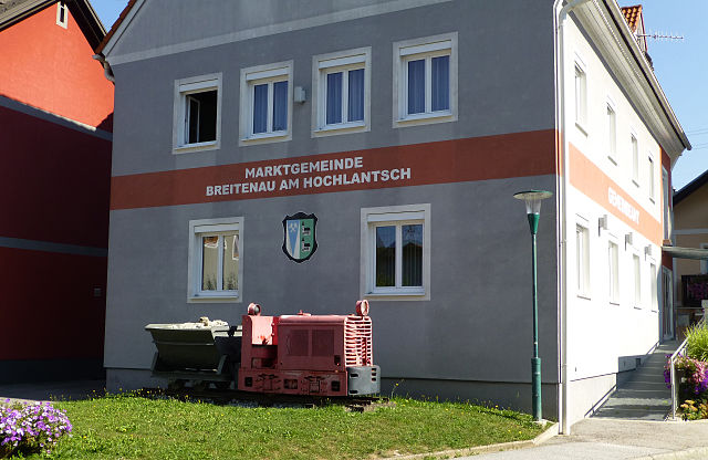

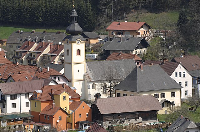
Breitenau am Hochlantsch
- municipality in Austria
Hiking in Breitenau am Hochlantsch
Breitenau am Hochlantsch is a beautiful area in Austria, ideal for hiking enthusiasts. Nestled in the Styria region, it offers a variety of trails that cater to different skill levels, from leisurely walks to more challenging hikes....
- Country:
- Postal Code: 8614
- Local Dialing Code: 0 38 66
- Licence Plate Code: BM
- Coordinates: 47° 23' 29" N, 15° 25' 46" E
- GPS tracks (wikiloc): [Link]
- AboveSeaLevel: 607 м m
- Area: 62.48 sq km
- Population: 1706
- Web site: [Link]

Gußwerk
- former municipality in Austria
Hiking in Gußwerk
Gußwerk, located in Austria, is a great destination for hiking enthusiasts. Nestled in the Austrian Alps, it offers a range of trails that cater to different skill levels, from easy walks for beginners to challenging hikes for seasoned adventurers....
- Country:
- Postal Code: 8632
- Local Dialing Code: 03882
- Licence Plate Code: BM
- Coordinates: 47° 44' 24" N, 15° 18' 13" E
- GPS tracks (wikiloc): [Link]
- AboveSeaLevel: 747 м m
- Area: 285.36 sq km
- Population: 1227

Frauenberg
- former municipality in Austria
Hiking in Frauenberg
Frauenberg, located in Styria, Austria, offers a beautiful landscape perfect for hiking enthusiasts. The region is known for its rolling hills, lush forests, and picturesque views, making it ideal for both casual and experienced hikers....
- Country:
- Postal Code: 8600
- Local Dialing Code: 03862
- Licence Plate Code: BM
- Coordinates: 47° 26' 0" N, 15° 21' 0" E
- GPS tracks (wikiloc): [Link]
- AboveSeaLevel: 939 м m
- Area: 20.62 sq km
- Population: 153
Etmißl
- former municipality in Austria
Hiking in Etmißl
Etmißl is a charming area in Austria, known for its beautiful landscapes and hiking opportunities. Nestled in the vicinity of the Styrian region, it is surrounded by rolling hills, dense forests, and picturesque villages, making it an ideal destination for hikers of all skill levels....
- Country:
- Local Dialing Code: 03861
- Licence Plate Code: BM
- Coordinates: 47° 30' 57" N, 15° 10' 22" E
- GPS tracks (wikiloc): [Link]
- AboveSeaLevel: 709 м m
- Area: 32.0 sq km
- Population: 479

Tragöß
- former municipality in Austria
Hiking in Tragöß
Tragöß, located in the Styria region of Austria, is known for its stunning natural beauty and diverse hiking options. Nestled near the Grebenzen Natural Park and the edge of the Hochschwab mountain range, it offers a range of trails suitable for hikers of all levels, from beginners to more experienced trekkers....
- Country:
- Postal Code: 8612
- Local Dialing Code: 03868
- Licence Plate Code: BM
- Coordinates: 47° 30' 0" N, 15° 4' 0" E
- GPS tracks (wikiloc): [Link]
- AboveSeaLevel: 793 м m
- Area: 110.52 sq km
- Population: 995
Turnau
- municipality in Austria
Hiking in Turnau
Turnau, located in the Styrian region of Austria, offers a beautiful setting for hiking enthusiasts. Nestled in the eastern part of the Alps, the area is characterized by stunning landscapes, rich flora and fauna, and a variety of trails catering to different skill levels....
- Country:
- Postal Code: 8625
- Local Dialing Code: 0 38 63
- Coordinates: 47° 33' 29" N, 15° 20' 15" E
- GPS tracks (wikiloc): [Link]
- AboveSeaLevel: 755 м m
- Area: 134.13 sq km
- Population: 1561
- Web site: [Link]
Mürzsteg
- former municipality in Austria
Hiking in Mürzsteg
Mürzsteg is a charming village in the Austrian Alps, located in the Styria region, and serves as a fantastic base for outdoor enthusiasts and hikers. The area is rich in natural beauty, featuring lush forests, scenic hills, and picturesque landscapes....
- Country:
- Local Dialing Code: 0 38 59
- Licence Plate Code: MZ
- Coordinates: 47° 40' 30" N, 15° 29' 32" E
- GPS tracks (wikiloc): [Link]
- AboveSeaLevel: 782 м m
- Area: 108.58 sq km
- Population: 235

Kindberg
- municipality in Austria
Hiking in Kindberg
Kindberg, located in Styria, Austria, is a charming town with a rich natural landscape that offers various hiking opportunities. The surrounding area is characterized by rolling hills, dense forests, and beautiful meadows, making it an excellent destination for outdoor enthusiasts....
- Country:
- Local Dialing Code: 03865
- Licence Plate Code: MZ
- Coordinates: 47° 30' 16" N, 15° 26' 56" E
- GPS tracks (wikiloc): [Link]
- AboveSeaLevel: 565 м m
- Area: 41.54 sq km
- Population: 8047
- Web site: [Link]

Neuberg an der Mürz
- municipality in Austria
Hiking in Neuberg an der Mürz
Neuberg an der Mürz is a charming town located in Styria, Austria, surrounded by beautiful mountainous landscapes, making it an excellent destination for hiking enthusiasts. Here are some highlights and considerations for hiking in this area:...
- Country:
- Local Dialing Code: 03857
- Licence Plate Code: MZ
- Coordinates: 47° 40' 1" N, 15° 34' 30" E
- GPS tracks (wikiloc): [Link]
- AboveSeaLevel: 732 м m
- Area: 63.98 sq km
- Population: 2494
- Web site: [Link]
Langenwang
- municipality in Austria
Hiking in Langenwang
Langenwang is a picturesque town in Austria, located in the state of Styria, which offers several hiking opportunities amidst beautiful natural scenery. The region is known for its stunning landscapes, including rolling hills, forests, and the nearby mountains, making it ideal for outdoor enthusiasts....
- Country:
- Postal Code: 8665
- Local Dialing Code: 0 38 54
- Licence Plate Code: MZ
- Coordinates: 47° 34' 3" N, 15° 37' 9" E
- GPS tracks (wikiloc): [Link]
- AboveSeaLevel: 637 м m
- Area: 76.07 sq km
- Population: 3868
- Web site: [Link]
Allerheiligen im Mürztal
- former municipality in Austria
Hiking in Allerheiligen im Mürztal
Allerheiligen im Mürztal is a scenic area located in the Austrian state of Styria, known for its beautiful landscapes and diverse hiking opportunities. The region is characterized by lush forests, rolling hills, and impressive mountain views, making it an appealing destination for both novice and experienced hikers....
- Country:
- Postal Code: 8643
- Local Dialing Code: 03864
- Licence Plate Code: MZ
- Coordinates: 47° 28' 53" N, 15° 24' 20" E
- GPS tracks (wikiloc): [Link]
- AboveSeaLevel: 551 м m
- Area: 47.17 sq km
- Population: 1972
- Web site: [Link]
Mitterdorf im Mürztal
- former municipality in Austria
Hiking in Mitterdorf im Mürztal
Mitterdorf im Mürztal, located in the picturesque region of Styria, Austria, offers numerous hiking opportunities that cater to various skill levels and preferences. The landscape is characterized by lush forests, rolling hills, and scenic views of the surrounding mountains, making it an ideal spot for both leisurely walks and more challenging hikes....
- Country:
- Local Dialing Code: 03858
- Licence Plate Code: MZ
- Coordinates: 47° 32' 8" N, 15° 30' 42" E
- GPS tracks (wikiloc): [Link]
- AboveSeaLevel: 587 м m
- Area: 11.12 sq km
- Population: 2380
Oberaich
- former municipality in Austria
Hiking in Oberaich
Oberaich, located in Austria, is a fantastic destination for hiking enthusiasts. Set in a picturesque region, Oberaich offers a variety of hiking trails that cater to different skill levels, from leisurely walks to more challenging treks....
- Country:
- Postal Code: 8600
- Local Dialing Code: 03862
- Licence Plate Code: BM
- Coordinates: 47° 24' 0" N, 15° 13' 0" E
- GPS tracks (wikiloc): [Link]
- AboveSeaLevel: 510 м m
- Area: 47 sq km
- Population: 3243

Kapellen
- former municipality in Austria
Hiking in Kapellen
Kapellen, located in Styria, Austria, is a wonderful destination for hiking enthusiasts. This picturesque area features beautiful landscapes, rolling hills, and scenic trails that cater to various skill levels. Here are some highlights and tips for hiking in Kapellen:...
- Country:
- Postal Code: 8691
- Local Dialing Code: 03857
- Licence Plate Code: MZ
- Coordinates: 47° 38' 50" N, 15° 37' 47" E
- GPS tracks (wikiloc): [Link]
- AboveSeaLevel: 703 м m
- Area: 44.59 sq km
- Population: 429

Sankt Marein im Mürztal
- municipality in Austria
Hiking in Sankt Marein im Mürztal
Sankt Marein im Mürztal, located in the Austrian state of Styria, offers a beautiful hiking experience surrounded by lush landscapes, rolling hills, and scenic views. It is an excellent destination for outdoor enthusiasts looking to explore nature while enjoying the tranquility of the Styrian countryside. Here are some highlights and tips for hiking in this area:...
- Country:
- Local Dialing Code: 03864
- Licence Plate Code: BM
- Coordinates: 47° 28' 28" N, 15° 22' 16" E
- GPS tracks (wikiloc): [Link]
- AboveSeaLevel: 537 м m
- Area: 8.87 sq km
- Population: 2713
- Web site: [Link]
Shares border with regions:


Graz-Umgebung District
- district in Austria
Hiking in Graz-Umgebung District
Graz-Umgebung District, located around the city of Graz in Austria, offers a wide range of hiking opportunities, featuring scenic landscapes, lush forests, and picturesque hilltops. Here are some highlights and recommendations for hiking in this area:...
- Country:
- Capital: Graz
- Licence Plate Code: GU
- Coordinates: 47° 3' 43" N, 15° 24' 54" E
- GPS tracks (wikiloc): [Link]
- AboveSeaLevel: 522 м m
- Area: 1100.7 sq km
- Population: 148830
- Web site: [Link]