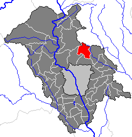
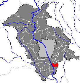
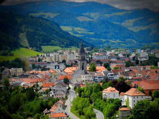
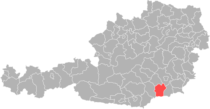
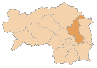
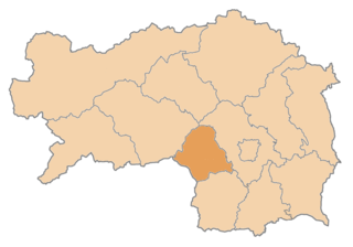
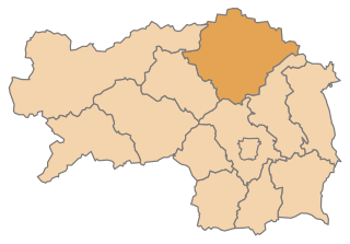
Graz-Umgebung District (Bezirk Graz-Umgebung)

- district in Austria
 Hiking in Graz-Umgebung District
Graz-Umgebung District, located around the city of Graz in Austria, offers a wide range of hiking opportunities, featuring scenic landscapes, lush forests, and picturesque hilltops. Here are some highlights and recommendations for hiking in this area:
1.
- Varied Terrain: The district features a diverse landscape with rolling hills, forests, and valleys. The Styrian hills provide beautiful panoramic views.
- Forest Trails: Many trails wind through dense forests, making it perfect for nature enthusiasts who enjoy shaded paths and the sounds of wildlife.
2.
- Schöckl Mountain: This is a well-known local mountain offering numerous trails that vary in difficulty. The summit provides breathtaking views of Graz and the surrounding countryside.
- Rosenberg: Another lovely hiking destination with trails that cater to different skill levels. The area is great for those looking for a more relaxed hike.
- Krautberg and surrounding hills: These areas are also great for hiking, with lovely routes that are less crowded but equally stunning.
3.
- Graz–Rannach Trail: This easy to moderate trail leads from Graz into the surrounding hills, offering beautiful views and an accessible path for most hikers.
- The Styrian Wine Path (Steirischer Weinweg): For those interested in a scenic and relaxed hike, this route takes you through vineyards and picturesque villages, showcasing the local wine culture.
4.
- Best Time to Hike: The best seasons for hiking in Graz-Umgebung are late spring through early autumn (from May to October). You can enjoy lush green landscapes and pleasant weather.
- Winter Hiking: Some trails are also accessible in winter; however, snow and ice may require appropriate gear.
5.
- Getting There: Graz is well-connected by public transport, making it easy to access many hiking trails in the Umgebungs district by bus or train.
- Amenities: Look for hiking maps and guides in local tourism offices. Many trails have signposts, but it's always good to have a map just in case.
6.
- Gear: Wear comfortable hiking shoes and dress in layers. Depending on the trail and season, weather can change quickly.
- Hydration and Snacks: Always bring enough water and snacks, especially on longer hikes.
- Navigation: If you're unfamiliar with the area, consider downloading GPS-based maps or using a hiking app to help you stay on track.
Graz-Umgebung offers a charming combination of nature and culture, making it a fantastic destination for hiking enthusiasts of all skill levels. Whether you're looking for a leisurely stroll or a challenging hike, you're sure to find routes that suit your preferences!
- Country:

- Capital: Graz
- Licence Plate Code: GU
- Coordinates: 47° 3' 43" N, 15° 24' 54" E


- GPS tracks (wikiloc): [Link]
- AboveSeaLevel: 522 м m
- Area: 1100.7 sq km
- Population: 148830
- Web site: http://www.bh-grazumgebung.steiermark.at/
- Wikipedia en: wiki(en)
- Wikipedia: wiki(de)
- Wikidata storage: Wikidata: Q672475
- Wikipedia Commons Category: [Link]
- Wikipedia Commons Maps Category: [Link]
- Freebase ID: [/m/0dzv99]
- GeoNames ID: Alt: [2778057]
- VIAF ID: Alt: [123257326]
- archINFORM location ID: [14690]
- Library of Congress authority ID: Alt: [n88080960]
- NKCR AUT ID: [ge278582]
- NUTS code: [AT221]
Includes regions:
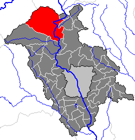
Dobl-Zwaring
- municipality in Austria
Hiking in Dobl-Zwaring
Dobl-Zwaring is a picturesque municipality located in Styria, Austria. It offers a variety of hiking opportunities for outdoor enthusiasts, with beautiful landscapes characterized by rolling hills, forests, and scenic views....
- Country:
- Postal Code: 8141, 8142, 8143, 8410, 8411, 8503, 8504
- Local Dialing Code: 03136
- Licence Plate Code: GU
- Coordinates: 46° 56' 48" N, 15° 22' 35" E
- GPS tracks (wikiloc): [Link]
- AboveSeaLevel: 349 м m
- Area: 37.92 sq km
- Population: 3537
- Web site: [Link]
Fernitz-Mellach
- municipality in Austria
Hiking in Fernitz-Mellach
Fernitz-Mellach is a charming community located in the Styria region of Austria, surrounded by beautiful natural landscapes, making it an attractive destination for hikers. While it may not be as widely known as some other hiking hotspots in Austria, it offers various trails that cater to different skill levels....
- Country:
- Postal Code: 8072, 8410
- Local Dialing Code: 03135
- Licence Plate Code: GU
- Coordinates: 46° 58' 27" N, 15° 29' 54" E
- GPS tracks (wikiloc): [Link]
- AboveSeaLevel: 320 м m
- Area: 20.51 sq km
- Population: 4804
- Web site: [Link]
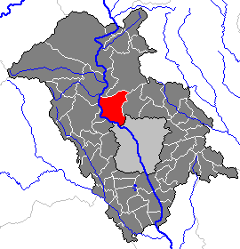
Gratwein-Straßengel
- municipality in Austria
Hiking in Gratwein-Straßengel
Gratwein-Straßengel, a municipality located in the Graz-Umgebung district of Styria, Austria, offers a range of beautiful hiking opportunities amidst stunning natural landscapes. The region is characterized by its hills, forests, and scenic views, making it a great destination for outdoor enthusiasts....
- Country:
- Postal Code: 8103, 8111, 8112, 8113, 8114, 8153
- Licence Plate Code: GU
- Coordinates: 47° 6' 46" N, 15° 20' 4" E
- GPS tracks (wikiloc): [Link]
- AboveSeaLevel: 380 м m
- Area: 86.62 sq km
- Population: 13002
- Web site: [Link]
Raaba-Grambach
- municipality in Austria
Hiking in Raaba-Grambach
Raaba-Grambach, located in the Styria region of Austria, offers beautiful scenery and a variety of trails for hiking enthusiasts. This area is characterized by lush green landscapes, rolling hills, and the nearby urban environment of Graz, making it a wonderful escape into nature without straying too far from city amenities....
- Country:
- Postal Code: 8071, 8074, 8302
- Licence Plate Code: GU
- Coordinates: 47° 1' 40" N, 15° 29' 48" E
- GPS tracks (wikiloc): [Link]
- AboveSeaLevel: 350 м m
- Area: 14.65 sq km
- Population: 4420
- Web site: [Link]
Seiersberg-Pirka
- municipality in Austria
Hiking in Seiersberg-Pirka
Seiersberg-Pirka, located near Graz in Austria, offers a variety of hiking opportunities amidst its picturesque landscape. The region is characterized by rolling hills, lush forests, and charming vineyards, making it an ideal spot for outdoor enthusiasts....
- Country:
- Postal Code: 8054, 8055, 8073
- Local Dialing Code: 0316
- Licence Plate Code: GU
- Coordinates: 47° 0' 36" N, 15° 23' 56" E
- GPS tracks (wikiloc): [Link]
- AboveSeaLevel: 350 м m
- Area: 17.36 sq km
- Population: 11187
- Web site: [Link]
Premstätten
- municipality in Austria
Hiking in Premstätten
Premstätten is a municipality located in Styria, Austria, near the city of Graz. The area is known for its beautiful landscapes, rolling hills, and access to nature, making it a great spot for hiking enthusiasts. Here are some things to consider when hiking in and around Premstätten:...
- Country:
- Postal Code: 8054, 8141, 8143, 8144, 8401
- Licence Plate Code: GU
- Coordinates: 46° 57' 53" N, 15° 24' 15" E
- GPS tracks (wikiloc): [Link]
- AboveSeaLevel: 351 м m
- Area: 29.27 sq km
- Population: 6068
- Web site: [Link]
Zettling
- former municipality in Austria
Hiking in Zettling
Zettling, located in Styria, Austria, offers scenic landscapes and a variety of hiking opportunities for outdoor enthusiasts. The region is characterized by its lush greenery, rolling hills, and charming rural scenery. Here are some key points to consider when hiking in Zettling:...
- Country:
- Postal Code: 8141, 8142
- Local Dialing Code: 03135
- Licence Plate Code: GU
- Coordinates: 46° 57' 7" N, 15° 26' 4" E
- GPS tracks (wikiloc): [Link]
- AboveSeaLevel: 325 м m
- Area: 11.29 sq km
- Population: 1570

Sankt Radegund bei Graz
- municipality in Austria
Hiking in Sankt Radegund bei Graz
Sankt Radegund bei Graz is a picturesque municipality located just a short drive from Graz, Austria. It offers a wealth of outdoor activities, including excellent hiking opportunities. The area is known for its beautiful landscapes, dense forests, and stunning views of the surrounding region, making it a great choice for both casual walkers and more experienced hikers....
- Country:
- Postal Code: 8061
- Local Dialing Code: 03132
- Licence Plate Code: GU
- Coordinates: 47° 10' 52" N, 15° 29' 22" E
- GPS tracks (wikiloc): [Link]
- AboveSeaLevel: 717 м m
- Area: 21.60 sq km
- Population: 2165
- Web site: [Link]
Zwaring-Pöls
- former municipality in Austria
Hiking in Zwaring-Pöls
Zwaring-Pöls is a picturesque municipality located in Styria, Austria, known for its stunning landscapes and outdoor activities, including hiking. The region features a mix of rolling hills, forests, and river valleys, offering a variety of hiking trails suitable for all experience levels....
- Country:
- Local Dialing Code: 03136
- Licence Plate Code: GU
- Coordinates: 46° 54' 37" N, 15° 24' 46" E
- GPS tracks (wikiloc): [Link]
- AboveSeaLevel: 312 м m
- Area: 23.98 sq km
- Population: 1587
Sankt Oswald bei Plankenwarth
- municipality in Austria
Hiking in Sankt Oswald bei Plankenwarth
Sankt Oswald bei Plankenwarth is a scenic area in Austria, nestled within the beautiful landscapes of Styria. This region offers a variety of hiking trails that cater to different skill levels, making it an excellent destination for both beginner and experienced hikers....
- Country:
- Postal Code: 8113
- Local Dialing Code: 03123
- Licence Plate Code: GU
- Coordinates: 47° 5' 13" N, 15° 16' 45" E
- GPS tracks (wikiloc): [Link]
- AboveSeaLevel: 557 м m
- Area: 11.75 sq km
- Population: 1244
- Web site: [Link]
Übelbach
- municipality in Austria
Hiking in Übelbach
Übelbach, located in the Styria region of Austria, offers a variety of hiking opportunities surrounded by stunning natural landscapes. The area is characterized by its rolling hills, lush forests, and picturesque Alpine views, making it a great destination for both novice and experienced hikers....
- Country:
- Postal Code: 8124
- Local Dialing Code: 03125
- Licence Plate Code: GU
- Coordinates: 47° 13' 35" N, 15° 14' 5" E
- GPS tracks (wikiloc): [Link]
- AboveSeaLevel: 580 м m
- Area: 94.55 sq km
- Population: 2036
- Web site: [Link]
Peggau
- municipality in Austria
Hiking in Peggau
Peggau, located in Austria, offers a picturesque setting for hiking enthusiasts. It’s situated near the scenic foothills of the Alps, providing a range of trails that cater to different skill levels, from leisurely walks to more challenging hikes....
- Country:
- Postal Code: 8120
- Local Dialing Code: 03127
- Licence Plate Code: GU
- Coordinates: 47° 12' 23" N, 15° 20' 39" E
- GPS tracks (wikiloc): [Link]
- AboveSeaLevel: 410 м m
- Area: 11.21 sq km
- Population: 2199
- Web site: [Link]
Lieboch
- municipality in Austria
Hiking in Lieboch
Lieboch is a small municipality in Styria, Austria, known for its picturesque landscapes and a variety of outdoor activities, including hiking. While it may not be as famous as some larger hiking destinations, it offers beautiful trails that cater to different skill levels, making it a great spot for both novice and experienced hikers....
- Country:
- Postal Code: 8501
- Local Dialing Code: 03136
- Licence Plate Code: GU
- Coordinates: 46° 58' 27" N, 15° 20' 15" E
- GPS tracks (wikiloc): [Link]
- AboveSeaLevel: 334 м m
- Area: 11.76 sq km
- Population: 5096
- Web site: [Link]

Deutschfeistritz
- municipality in Austria
Hiking in Deutschfeistritz
Deutschfeistritz, located near Graz in Styria, Austria, is surrounded by beautiful landscapes perfect for hiking enthusiasts. The area offers a variety of trails suitable for different skill levels, from leisurely walks to more strenuous hikes....
- Country:
- Postal Code: 8121
- Local Dialing Code: 03127
- Licence Plate Code: GU
- Coordinates: 47° 11' 55" N, 15° 20' 10" E
- GPS tracks (wikiloc): [Link]
- AboveSeaLevel: 414 м m
- Area: 39.19 sq km
- Population: 4311
- Web site: [Link]
Rohrbach-Steinberg
- former municipality in Austria
Hiking in Rohrbach-Steinberg
Rohrbach-Steinberg, located in the state of Bavaria, Germany, is a scenic area that offers a variety of hiking opportunities. The region is characterized by its beautiful landscapes, including rolling hills, forests, and charming villages. Here are some key points to consider for hiking in Rohrbach-Steinberg:...
- Country:
- Postal Code: 8151
- Local Dialing Code: 03123
- Licence Plate Code: GU
- Coordinates: 47° 3' 44" N, 15° 17' 44" E
- GPS tracks (wikiloc): [Link]
- AboveSeaLevel: 405 м m
- Area: 8.41 sq km
- Population: 1429

Gratkorn
- municipality in Austria
Hiking in Gratkorn
Gratkorn, located near Graz in Austria, offers a range of hiking opportunities for both beginners and more experienced hikers. The area is characterized by its diverse landscapes, including lush forests, rolling hills, and stunning views of the surrounding region....
- Country:
- Postal Code: 8101
- Licence Plate Code: GU
- Coordinates: 47° 8' 8" N, 15° 20' 21" E
- GPS tracks (wikiloc): [Link]
- AboveSeaLevel: 380 м m
- Area: 34.56 sq km
- Population: 7892
- Web site: [Link]

Thal
- village in Styria, Austria
Hiking in Thal
Thal, located in Styria, Austria, is a beautiful area known for its picturesque landscapes, lush forests, and well-marked hiking trails. Here are some key points to consider if you're planning to hike in this region:...
- Country:
- Local Dialing Code: 0316
- Licence Plate Code: GU
- Coordinates: 47° 4' 42" N, 15° 21' 15" E
- GPS tracks (wikiloc): [Link]
- AboveSeaLevel: 440 м m
- Area: 18.57 sq km
- Population: 2261
- Web site: [Link]
Hart-Purgstall
- former municipality in Austria
Hiking in Hart-Purgstall
Hart-Purgstall is a picturesque area that offers various hiking opportunities in a beautiful natural setting. Located in Austria, it's renowned for its stunning landscapes, including rolling hills, forests, and picturesque views of the surrounding countryside....
- Country:
- Postal Code: 8063
- Local Dialing Code: 0 31 17
- Coordinates: 47° 7' 57" N, 15° 34' 29" E
- GPS tracks (wikiloc): [Link]
- AboveSeaLevel: 426 м m
- Area: 15.84 sq km
- Population: 1599
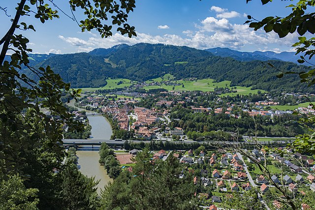
Frohnleiten
- municipality in Austria
Hiking in Frohnleiten
Frohnleiten is a charming town located in Styria, Austria, surrounded by beautiful landscapes that make it a great location for hiking and outdoor activities. Here are some highlights and tips for hiking in this region:...
- Country:
- Licence Plate Code: GU
- Coordinates: 47° 16' 13" N, 15° 19' 28" E
- GPS tracks (wikiloc): [Link]
- AboveSeaLevel: 438 м m
- Area: 127.62 sq km
- Population: 6655
- Web site: [Link]
Wundschuh
- municipality in Austria
Hiking in Wundschuh
Wundschuh, located in Austria, is an excellent destination for hiking enthusiasts. Nestled near the city of Graz, it offers a range of scenic trails suitable for various skill levels, from leisurely walks to more challenging hikes....
- Country:
- Postal Code: 8142
- Local Dialing Code: 03135
- Licence Plate Code: GU
- Coordinates: 46° 55' 35" N, 15° 27' 4" E
- GPS tracks (wikiloc): [Link]
- AboveSeaLevel: 322 м m
- Area: 12.75 sq km
- Population: 1599
- Web site: [Link]
Sankt Marein bei Graz
- municipality in Austria
Hiking in Sankt Marein bei Graz
Sankt Marein bei Graz is a picturesque area located near Graz, Austria, known for its scenic landscapes and access to various hiking trails. Here are some key points about hiking in this region:...
- Country:
- Postal Code: 8323
- Local Dialing Code: 03119
- Licence Plate Code: GU
- Coordinates: 47° 1' 8" N, 15° 41' 46" E
- GPS tracks (wikiloc): [Link]
- AboveSeaLevel: 407 м m
- Area: 10.25 sq km
- Population: 3675
- Web site: [Link]
Feldkirchen bei Graz
- municipality in Austria
Hiking in Feldkirchen bei Graz
Feldkirchen bei Graz, located near the city of Graz in Styria, Austria, offers a variety of hiking opportunities for outdoor enthusiasts. The area is characterized by beautiful landscapes, rolling hills, and scenic views of the surrounding countryside and the nearby Graz area. Here are some highlights and tips for hiking in Feldkirchen bei Graz:...
- Country:
- Licence Plate Code: GU
- Coordinates: 47° 0' 45" N, 15° 26' 33" E
- GPS tracks (wikiloc): [Link]
- AboveSeaLevel: 342 м m
- Area: 11.54 sq km
- Population: 6308
- Web site: [Link]

Fernitz
- former municipality in Austria
Hiking in Fernitz
Fernitz is a picturesque area located in Austria, near the Styrian capital of Graz. While it's not known as a major hiking destination, it offers a range of trails that cater to different skill levels and provide beautiful views of the surrounding countryside....
- Country:
- Local Dialing Code: 03135
- Licence Plate Code: GU
- Coordinates: 46° 58' 27" N, 15° 29' 54" E
- GPS tracks (wikiloc): [Link]
- AboveSeaLevel: 320 м m
- Area: 10.58 sq km
Attendorf
- former municipality in Austria
Hiking in Attendorf
Attendorf, a picturesque village located in the heart of nature, offers a variety of hiking opportunities for both beginners and experienced hikers. Surrounded by lush landscapes, rolling hills, and scenic views, it's an ideal destination for outdoor enthusiasts....
- Country:
- Local Dialing Code: 03137
- Licence Plate Code: GU
- Coordinates: 47° 0' 20" N, 15° 19' 34" E
- GPS tracks (wikiloc): [Link]
- AboveSeaLevel: 354 м m
- Area: 15.66 sq km
- Population: 1823
Werndorf
- municipality in Austria
Hiking in Werndorf
Werndorf is a charming village located in Austria, close to the border with Slovenia. It is surrounded by beautiful landscapes, making it a lovely destination for hiking enthusiasts. When exploring hiking options in and around Werndorf, here are several highlights to consider:...
- Country:
- Postal Code: 8402
- Local Dialing Code: 03135
- Licence Plate Code: GU
- Coordinates: 46° 55' 16" N, 15° 28' 52" E
- GPS tracks (wikiloc): [Link]
- AboveSeaLevel: 309 м m
- Area: 6.23 sq km
- Population: 2365
- Web site: [Link]
Schrems bei Frohnleiten
- former municipality in Austria
Hiking in Schrems bei Frohnleiten
Schrems bei Frohnleiten is a charming area in Austria known for its picturesque landscapes and hiking opportunities. It’s situated in the Styria region, characterized by rolling hills, forested areas, and the scenic Mur River nearby....
- Country:
- Postal Code: 8130
- Local Dialing Code: 03126
- Licence Plate Code: GU
- Coordinates: 47° 16' 46" N, 15° 21' 51" E
- GPS tracks (wikiloc): [Link]
- AboveSeaLevel: 493 м m
- Area: 19.25 sq km
- Population: 586
Tyrnau
- former municipality in Austria
Hiking in Tyrnau
Tyrnau, also known as Trnava, is a city in Slovakia that offers a rich history and beautiful scenery, making it a great spot for hiking enthusiasts. While the city itself is relatively flat, there are several hiking opportunities in the surrounding areas, particularly in the nearby Small Carpathians (Malé Karpaty) mountain range....
- Country:
- Postal Code: 8130
- Local Dialing Code: 03179
- Licence Plate Code: GU
- Coordinates: 47° 18' 43" N, 15° 24' 54" E
- GPS tracks (wikiloc): [Link]
- AboveSeaLevel: 616 м m
- Area: 19.97 sq km
- Population: 158
Sankt Bartholomä
- municipality in Austria
Hiking in Sankt Bartholomä
Sankt Bartholomä is a picturesque village located on the western shore of Lake Konigssee in Bavaria, Germany. Nestled within the stunning Berchtesgaden National Park, it is a fantastic destination for hikers of various skill levels. Here are some highlights and tips for hiking in this beautiful area:...
- Country:
- Local Dialing Code: 03123
- Licence Plate Code: GU
- Coordinates: 47° 4' 8" N, 15° 15' 26" E
- GPS tracks (wikiloc): [Link]
- AboveSeaLevel: 499 м m
- Area: 11.75 sq km
- Population: 1442
- Web site: [Link]
Eggersdorf bei Graz
- municipality in Austria
Hiking in Eggersdorf bei Graz
Eggersdorf bei Graz is a charming municipality in Styria, Austria, located near the city of Graz. The region is known for its stunning natural landscapes, rolling hills, and vibrant flora, making it a wonderful destination for hiking enthusiasts....
- Country:
- Local Dialing Code: 03117
- Licence Plate Code: GU
- Coordinates: 47° 7' 22" N, 15° 35' 57" E
- GPS tracks (wikiloc): [Link]
- AboveSeaLevel: 410 м m
- Area: 9.91 sq km
- Population: 6620
- Web site: [Link]
Semriach
- municipality in Austria
Hiking in Semriach
Semriach, located in Austria’s Styria region, is a fantastic destination for hiking enthusiasts. The area is known for its picturesque landscapes, nestled in the foothills of the Eastern Alps, lush forests, rolling hills, and scenic trails. Here are some highlights and tips for hiking in Semriach:...
- Country:
- Postal Code: 8102
- Local Dialing Code: 03127
- Licence Plate Code: GU
- Coordinates: 47° 13' 3" N, 15° 24' 12" E
- GPS tracks (wikiloc): [Link]
- AboveSeaLevel: 709 м m
- Area: 60.35 sq km
- Population: 3323
- Web site: [Link]
Gschnaidt
- former municipality in Austria
Hiking in Gschnaidt
Gschnaidt is a beautiful area in the Austrian Alps, specifically located in the Styria region. It's a fantastic destination for hikers known for its stunning landscapes, diverse trails, and varying levels of difficulty. When planning a hike in Gschnaidt, here are some key points to consider:...
- Country:
- Postal Code: 8153
- Local Dialing Code: 03149
- Licence Plate Code: GU
- Coordinates: 47° 8' 12" N, 15° 11' 8" E
- GPS tracks (wikiloc): [Link]
- AboveSeaLevel: 769 м m
- Area: 29.82 sq km
- Population: 327
Großstübing
- former municipality in Austria
Hiking in Großstübing
Großstübing, located in Styria, Austria, offers beautiful hiking opportunities, showcasing the region's lush landscapes and diverse wildlife. The area is characterized by rolling hills, forests, and scenic views of the surrounding countryside and nearby mountains....
- Country:
- Local Dialing Code: 03125
- Licence Plate Code: GU
- Coordinates: 47° 11' 33" N, 15° 14' 5" E
- GPS tracks (wikiloc): [Link]
- AboveSeaLevel: 543 м m
- Area: 17.77 sq km
- Population: 356
Brodingberg
- former municipality in Austria
Hiking in Brodingberg
Brodingberg, located in the Harz mountain range of Germany, is a popular destination for hiking enthusiasts. It is known for its stunning natural landscapes, diverse flora and fauna, and rich geological features. Here are some highlights and tips for hiking in the Brodingberg area:...
- Country:
- Local Dialing Code: 03117
- Licence Plate Code: GU
- Coordinates: 47° 6' 43" N, 15° 38' 54" E
- GPS tracks (wikiloc): [Link]
- AboveSeaLevel: 480 м m
- Area: 12.84 sq km
Seiersberg
- former municipality in Austria
Hiking in Seiersberg
Seiersberg, often associated with Seiersberg-Pirka in Austria, is a great location for hiking enthusiasts. This area is characterized by its beautiful landscapes, rolling hills, and scenic views, making it a wonderful place for both casual walkers and serious hikers....
- Country:
- Local Dialing Code: 0316
- Licence Plate Code: GU
- Coordinates: 47° 0' 36" N, 15° 23' 56" E
- GPS tracks (wikiloc): [Link]
- AboveSeaLevel: 350 м m
- Area: 7.89 sq km
- Population: 7351
Judendorf-Straßengel
- former municipality in Austria
Hiking in Judendorf-Straßengel
Judendorf-Straßengel, located in Austria not far from Graz, offers a range of hiking opportunities for both beginners and experienced trekkers. The scenic landscape features rolling hills, woods, and beautiful views of the Styrian countryside, making it an ideal spot for outdoor enthusiasts....
- Country:
- Postal Code: 8111
- Local Dialing Code: 03124
- Coordinates: 47° 6' 46" N, 15° 20' 4" E
- GPS tracks (wikiloc): [Link]
- AboveSeaLevel: 380 м m
- Area: 10.61 sq km
- Population: 5843
Edelsgrub
- former municipality in Austria
Hiking in Edelsgrub
Edelsgrub is a charming area that offers beautiful hiking opportunities, particularly in the scenic landscapes of Austria. If you're planning to hike in Edelsgrub, here are some aspects to consider:...
- Country:
- Postal Code: 8302
- Local Dialing Code: 03133
- Licence Plate Code: GU
- Coordinates: 47° 2' 0" N, 15° 36' 0" E
- GPS tracks (wikiloc): [Link]
- AboveSeaLevel: 460 м m
- Population: 707
Tulwitz
- former municipality in Austria
Hiking in Tulwitz
Tulwitz is a picturesque area located in Styria, Austria, surrounded by stunning landscapes and offering a variety of hiking opportunities. The region is characterized by rolling hills, lush forests, and breathtaking views, making it a popular destination for both novice and experienced hikers. Here are some highlights to consider when planning your hiking adventure in Tulwitz:...
- Country:
- Postal Code: 8163
- Local Dialing Code: 03179
- Licence Plate Code: GU
- Coordinates: 47° 16' 11" N, 15° 27' 38" E
- GPS tracks (wikiloc): [Link]
- AboveSeaLevel: 650 м m
- Area: 11.56 sq km
- Population: 508


Röthelstein
- former municipality in Austria
Hiking in Röthelstein
Röthelstein is a great destination for hiking, located in Austria's stunning Styria region. The area is renowned for its beautiful landscapes, featuring rolling hills, dense forests, and panoramic views of the surrounding mountains, particularly the Ennstal Alps....
- Country:
- Postal Code: 8131
- Local Dialing Code: 03867
- Licence Plate Code: GU
- Coordinates: 47° 18' 31" N, 15° 22' 4" E
- GPS tracks (wikiloc): [Link]
- AboveSeaLevel: 449 м m
- Area: 7.01 sq km
- Population: 208


Pirka
- former municipality in Austria
Hiking in Pirka
Pirka, which is likely referring to the region in Finland, offers some beautiful hiking opportunities, especially in the surrounding landscapes that boast stunning natural beauty, diverse ecosystems, and unique wildlife. Here’s a brief overview of what to expect when hiking in this area:...
- Country:
- Postal Code: 8054
- Local Dialing Code: 0316
- Licence Plate Code: GU
- Coordinates: 46° 59' 52" N, 15° 23' 40" E
- GPS tracks (wikiloc): [Link]
- AboveSeaLevel: 346 м m
- Area: 9.43 sq km
- Population: 3288
Dobl
- former municipality in Austria
Hiking in Dobl
Dobl is a small municipality located in Austria, near Graz in the Styria region. While it may not be one of the most famous hiking destinations, it still offers some lovely trails and natural beauty, making it a great spot for outdoor enthusiasts....
- Country:
- Postal Code: 8143
- Local Dialing Code: 03136
- Licence Plate Code: GU
- Coordinates: 46° 56' 48" N, 15° 22' 35" E
- GPS tracks (wikiloc): [Link]
- AboveSeaLevel: 349 м m
- Area: 13.76 sq km
- Population: 1887
Hart bei Graz
- municipality in Austria
Hiking in Hart bei Graz
Hart bei Graz is a charming municipality located near Graz, Austria, and it is surrounded by beautiful landscapes ideal for hiking enthusiasts. The area is characterized by its rolling hills, forests, and scenic views of the Graz Basin and the nearby mountains, making it a great destination for both casual and experienced hikers....
- Country:
- Postal Code: 8075
- Local Dialing Code: 0316
- Licence Plate Code: GU
- Coordinates: 47° 2' 42" N, 15° 31' 12" E
- GPS tracks (wikiloc): [Link]
- AboveSeaLevel: 430 м m
- Area: 10.99 sq km
- Population: 4972
- Web site: [Link]


Stiwoll
- municipality in Austria
Hiking in Stiwoll
Stiwoll, a small village located in the Austrian state of Styria, is surrounded by beautiful landscapes that offer a variety of hiking opportunities. The region is known for its lush forests, rolling hills, and stunning views of the nearby mountains....
- Country:
- Postal Code: 8113
- Local Dialing Code: 03142
- Licence Plate Code: GU
- Coordinates: 47° 6' 8" N, 15° 13' 9" E
- GPS tracks (wikiloc): [Link]
- AboveSeaLevel: 495 м m
- Area: 12.96 sq km
- Population: 722
- Web site: [Link]
Unterpremstätten
- former municipality in Austria
Hiking in Unterpremstätten
Unterpremstätten is a picturesque locality in Styria, Austria, located just south of Graz. Its natural beauty, rolling hills, and proximity to the larger city make it a charming destination for hiking enthusiasts. Here are some highlights and tips for hiking in and around Unterpremstätten:...
- Country:
- Postal Code: 8141
- Local Dialing Code: 03136
- Licence Plate Code: GU
- Coordinates: 46° 57' 53" N, 15° 24' 15" E
- GPS tracks (wikiloc): [Link]
- AboveSeaLevel: 351 м m
- Area: 17.77 sq km
- Population: 3964
Vasoldsberg
- municipality in Austria
Hiking in Vasoldsberg
Vasoldsberg is a picturesque area located near Graz in Styria, Austria, known for its beautiful landscapes and diverse hiking options. Here are some highlights for hiking in Vasoldsberg:...
- Country:
- Postal Code: 8076
- Licence Plate Code: GU
- Coordinates: 47° 0' 48" N, 15° 33' 23" E
- GPS tracks (wikiloc): [Link]
- AboveSeaLevel: 359 м m
- Area: 28.08 sq km
- Population: 4572
- Web site: [Link]
Weinitzen
- municipality in Austria
Hiking in Weinitzen
Weinitzen is a charming village located near Graz in Austria, offering beautiful natural landscapes and a variety of hiking trails suitable for different skill levels. Here are some highlights and tips for hiking in the area:...
- Country:
- Local Dialing Code: 03132
- Licence Plate Code: GU
- Coordinates: 47° 8' 27" N, 15° 29' 26" E
- GPS tracks (wikiloc): [Link]
- AboveSeaLevel: 510 м m
- Area: 18.94 sq km
- Population: 2617
- Web site: [Link]


Gratwein
- former municipality in Austria
Hiking in Gratwein
Gratwein, located in Austria, offers beautiful hiking opportunities with a variety of trails that cater to different skill levels. The area is characterized by picturesque landscapes, dense forests, and panoramic views of the surrounding mountains. Here are some highlights for hiking in Gratwein:...
- Country:
- Local Dialing Code: 03124
- Licence Plate Code: GU
- Coordinates: 47° 7' 46" N, 15° 19' 4" E
- GPS tracks (wikiloc): [Link]
- AboveSeaLevel: 392 м m
- Area: 4.55 sq km
- Population: 3635
Höf-Präbach
- former municipality in Austria
Hiking in Höf-Präbach
Höf-Präbach is a scenic area in Germany known for its beautiful landscapes and hiking opportunities. When hiking in Höf-Präbach, you can expect a mix of tranquil forests, picturesque meadows, and possibly some charming villages along the way. Here are some tips and information to enhance your hiking experience:...
- Country:
- Postal Code: 8063
- Local Dialing Code: 03117
- Coordinates: 47° 5' 57" N, 15° 37' 7" E
- GPS tracks (wikiloc): [Link]
- AboveSeaLevel: 500 м m
- Area: 10.61 sq km
- Population: 1195


Raaba
- former municipality in Austria
Hiking in Raaba
Raaba is a small municipality located in Styria, Austria, known for its picturesque landscapes and proximity to various outdoor activities. While Raaba itself may not be renowned as a major hiking destination, its surrounding regions offer several opportunities for hiking enthusiasts....
- Country:
- Postal Code: 8074
- Local Dialing Code: 0316
- Licence Plate Code: GU
- Coordinates: 47° 1' 40" N, 15° 29' 48" E
- GPS tracks (wikiloc): [Link]
- AboveSeaLevel: 350 м m
- Area: 7.71 sq km
- Population: 2427
Langegg bei Graz
- former municipality in Austria
Hiking in Langegg bei Graz
Langegg bei Graz is a picturesque area located near Graz, the capital of Styria in Austria. It is part of a beautiful region that offers a variety of hiking trails suitable for different skill levels, making it a great destination for outdoor enthusiasts....
- Country:
- Local Dialing Code: 03133
- Licence Plate Code: GU
- Coordinates: 47° 3' 36" N, 15° 38' 6" E
- GPS tracks (wikiloc): [Link]
- AboveSeaLevel: 490 м m
- Area: 11.34 sq km
- Population: 840
Krumegg
- former municipality in Austria
Hiking in Krumegg
Krumegg is a beautiful area known for its scenic landscapes and hiking opportunities. Located in Austria, it offers hikers a variety of trails that cater to different skill levels....
- Country:
- Licence Plate Code: GU
- Coordinates: 47° 1' 13" N, 15° 38' 2" E
- GPS tracks (wikiloc): [Link]
- AboveSeaLevel: 463 м m
- Area: 16.19 sq km
- Population: 1450


Hausmannstätten
- municipality in Austria
Hiking in Hausmannstätten
Hausmannstätten, located near Graz in the Styria region of Austria, offers an array of hiking opportunities that cater to different skill levels and preferences. The scenic landscape features lush forests, rolling hills, and beautiful views of the surrounding countryside, making it ideal for outdoor enthusiasts....
- Country:
- Postal Code: 8071
- Local Dialing Code: 03135
- Licence Plate Code: GU
- Coordinates: 46° 59' 27" N, 15° 30' 31" E
- GPS tracks (wikiloc): [Link]
- AboveSeaLevel: 342 м m
- Area: 6.79 sq km
- Population: 3288
- Web site: [Link]
Haselsdorf-Tobelbad
- municipality in Austria
Hiking in Haselsdorf-Tobelbad
Haselsdorf-Tobelbad, located in Styria, Austria, offers a beautiful landscape that is perfect for hiking enthusiasts. The region is known for its scenic views, rolling hills, and charming rural atmosphere. While it may not be as popular as some other Austrian hiking destinations, it provides a tranquil experience for those looking to explore nature away from the more crowded trails....
- Country:
- Postal Code: 8144
- Local Dialing Code: 03136
- Licence Plate Code: GU
- Coordinates: 46° 59' 18" N, 15° 20' 37" E
- GPS tracks (wikiloc): [Link]
- AboveSeaLevel: 353 м m
- Area: 6.66 sq km
- Population: 1426
- Web site: [Link]
Nestelbach bei Graz
- municipality in Austria
Hiking in Nestelbach bei Graz
Nestelbach bei Graz is a picturesque area located just southeast of Graz, Austria. It's a fantastic location for hiking enthusiasts, offering a mix of landscapes, from gentle rolling hills to more challenging terrains....
- Country:
- Postal Code: 8302
- Local Dialing Code: 03133
- Licence Plate Code: GU
- Coordinates: 47° 3' 44" N, 15° 36' 30" E
- GPS tracks (wikiloc): [Link]
- AboveSeaLevel: 450 м m
- Area: 8.71 sq km
- Population: 2648
- Web site: [Link]
Mellach
- former municipality in Austria
Hiking in Mellach
Mellach is a scenic area located in Austria, near Graz, known for its beautiful landscapes and outdoor activities. If you are interested in hiking in Mellach, here are some key points you might find helpful:...
- Country:
- Local Dialing Code: 03135
- Licence Plate Code: GU
- Coordinates: 46° 56' 31" N, 15° 30' 58" E
- GPS tracks (wikiloc): [Link]
- AboveSeaLevel: 340 м m
- Area: 9.95 sq km
- Population: 1254


Stattegg
- municipality in Austria
Hiking in Stattegg
Stattegg is a charming municipality located near Graz in Austria, offering several beautiful hiking opportunities, especially for those looking to enjoy nature without straying too far from urban areas. Here’s an overview of what you can expect when hiking in Stattegg:...
- Country:
- Postal Code: 8046
- Local Dialing Code: 0316
- Licence Plate Code: GU
- Coordinates: 47° 8' 14" N, 15° 25' 12" E
- GPS tracks (wikiloc): [Link]
- AboveSeaLevel: 432 м m
- Area: 25.88 sq km
- Population: 2927
- Web site: [Link]
Kainbach bei Graz
- municipality in Austria
Hiking in Kainbach bei Graz
Kainbach bei Graz, located near Graz in Styria, Austria, offers an array of beautiful hiking trails that cater to various skill levels. The region is characterized by its picturesque landscapes, lush forests, rolling hills, and scenic views of the surrounding areas....
- Country:
- Licence Plate Code: GU
- Coordinates: 47° 6' 0" N, 15° 33' 22" E
- GPS tracks (wikiloc): [Link]
- AboveSeaLevel: 519 м m
- Area: 17.74 sq km
- Population: 2834
- Web site: [Link]
Hitzendorf
- municipality in Austria
Hiking in Hitzendorf
Hitzendorf, located in the Styria region of Austria, offers beautiful nature and a variety of scenic hiking trails perfect for outdoor enthusiasts. The picturesque landscapes, characterized by rolling hills, forests, and rivers, provide a tranquil backdrop for hiking....
- Country:
- Postal Code: 8151
- Local Dialing Code: 03137
- Licence Plate Code: GU
- Coordinates: 47° 2' 7" N, 15° 18' 3" E
- GPS tracks (wikiloc): [Link]
- AboveSeaLevel: 383 м m
- Area: 48.88 sq km
- Population: 7134
- Web site: [Link]


Laßnitzhöhe
- municipality in Austria
Hiking in Laßnitzhöhe
Laßnitzhöhe, located near the city of Graz in Austria, offers excellent opportunities for hiking enthusiasts. Nestled in the foothills of the Alps, this region combines beautiful landscapes with a variety of trails suitable for different skill levels....
- Country:
- Postal Code: 8301
- Local Dialing Code: 03133
- Licence Plate Code: GU
- Coordinates: 47° 4' 36" N, 15° 34' 56" E
- GPS tracks (wikiloc): [Link]
- AboveSeaLevel: 536 м m
- Area: 14.84 sq km
- Population: 2817
- Web site: [Link]
Gössendorf
- municipality in Austria
Hiking in Gössendorf
Gössendorf, located in Austria, is a charming area with beautiful landscapes and opportunities for hiking. While it may not be as well-known as some of the more prominent hiking destinations in Austria, it offers a lovely mix of scenic views, natural beauty, and cultural experiences....
- Country:
- Postal Code: 8077
- Licence Plate Code: GU
- Coordinates: 46° 59' 45" N, 15° 29' 16" E
- GPS tracks (wikiloc): [Link]
- AboveSeaLevel: 326 м m
- Area: 7.21 sq km
- Population: 3981
- Web site: [Link]

Kumberg
- municipality in Austria
Hiking in Kumberg
Kumberg is a charming municipality in Austria, located near Graz. It offers beautiful landscapes, making it a great destination for hiking enthusiasts. Here are some highlights and tips for hiking in the area:...
- Country:
- Postal Code: 8062
- Local Dialing Code: 03132
- Licence Plate Code: GU
- Coordinates: 47° 9' 34" N, 15° 32' 3" E
- GPS tracks (wikiloc): [Link]
- AboveSeaLevel: 526 м m
- Area: 29.27 sq km
- Population: 3843
- Web site: [Link]


Kalsdorf bei Graz
- municipality in Austria
Hiking in Kalsdorf bei Graz
Kalsdorf bei Graz, located in Styria, Austria, is a charming area that offers various hiking opportunities for outdoor enthusiasts. The region is known for its picturesque landscapes, rolling hills, and a mix of rural and urban environments. Here are some highlights and tips for hiking in and around Kalsdorf bei Graz:...
- Country:
- Postal Code: 8401
- Local Dialing Code: 03135
- Licence Plate Code: GU
- Coordinates: 46° 57' 58" N, 15° 28' 54" E
- GPS tracks (wikiloc): [Link]
- AboveSeaLevel: 324 м m
- Area: 15.08 sq km
- Population: 6954
- Web site: [Link]
Eisbach
- former municipality in Austria
Hiking in Eisbach
Eisbach, located in Styria, Austria, is a fantastic destination for hiking enthusiasts due to its stunning natural landscapes, diverse trails, and rich biodiversity. The region is characterized by picturesque mountains, lush forests, and clear streams, making it a perfect spot for outdoor activities....
- Country:
- Postal Code: 8103, 8111, 8112, 8113
- Local Dialing Code: 03124
- Licence Plate Code: GU
- Coordinates: 47° 8' 13" N, 15° 17' 7" E
- GPS tracks (wikiloc): [Link]
- AboveSeaLevel: 453 м m
- Area: 41.45 sq km
- Population: 2991
Grambach
- former municipality in Austria
Hiking in Grambach
Grambach, a small community located near Graz in Austria, offers a variety of beautiful hiking opportunities for outdoor enthusiasts. Here are some key points to consider when hiking in and around Grambach:...
- Country:
- Local Dialing Code: 0 316
- Licence Plate Code: GU
- Coordinates: 47° 0' 50" N, 15° 30' 10" E
- GPS tracks (wikiloc): [Link]
- AboveSeaLevel: 345 м m
- Area: 6.94 sq km
- Population: 1761
Shares border with regions:


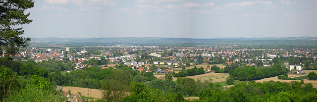
Graz
- city in Styria, Austria
Hiking in Graz
Graz, Austria, is an excellent destination for hiking enthusiasts, offering a mix of urban and natural landscapes. The region around Graz is characterized by rolling hills, wooded areas, and beautiful scenery, making it perfect for a variety of hiking experiences. Here are some key points about hiking in and around Graz:...
- Country:
- Postal Code: 8055; 8054; 8053; 8052; 8051; 8047; 8046; 8045; 8044; 8043; 8042; 8041; 8036; 8020; 8010
- Local Dialing Code: 316
- Licence Plate Code: G
- Coordinates: 47° 4' 0" N, 15° 26' 0" E
- GPS tracks (wikiloc): [Link]
- AboveSeaLevel: 353 м m
- Area: 127.58 sq km
- Population: 289440
- Web site: [Link]

Murtal District
- district of Austria
Hiking in Murtal District
Murtal District, located in Styria, Austria, is a great destination for hiking enthusiasts. The region is characterized by its stunning landscapes, which include rolling hills, deep forests, and majestic mountain ranges, making it an ideal spot for nature lovers. Here are some highlights and recommendations for hiking in Murtal District:...
- Country:
- Capital: Judenburg
- Licence Plate Code: JU
- Coordinates: 47° 10' 21" N, 14° 39' 37" E
- GPS tracks (wikiloc): [Link]
- AboveSeaLevel: 714 м m
- Area: 1675.38 sq km
- Web site: [Link]

Deutschlandsberg District
- district in Austria
Hiking in Deutschlandsberg District
The Deutschlandsberg District, located in Styria, Austria, offers a varied and picturesque landscape ideal for hiking enthusiasts. Known for its rolling hills, vineyards, and charming villages, this region provides multiple trails suited for all skill levels, from leisurely strolls to more challenging hikes....
- Country:
- Capital: Deutschlandsberg
- Licence Plate Code: DL
- Coordinates: 46° 49' 23" N, 15° 15' 0" E
- GPS tracks (wikiloc): [Link]
- AboveSeaLevel: 557 м m
- Area: 863.5 sq km
- Population: 61498
- Web site: [Link]

Leibnitz District
- district of Austria
Hiking in Leibnitz District
Leibnitz District, located in southern Austria's Styria region, is a fantastic destination for hiking enthusiasts. The region is known for its picturesque landscapes, rolling hills, vineyards, and charming villages. Here are some key points about hiking in the Leibnitz District:...
- Country:
- Capital: Leibnitz
- Licence Plate Code: LB
- Coordinates: 46° 46' 55" N, 15° 31' 59" E
- GPS tracks (wikiloc): [Link]
- AboveSeaLevel: 348 м m
- Area: 726.95 sq km
- Population: 75775
- Web site: [Link]

Weiz District
- district of Austria
Hiking in Weiz District
The Weiz District in Austria is a beautiful area for hiking enthusiasts, known for its stunning landscapes, rolling hills, and scenic views. Here are key highlights and insights about hiking in the region:...
- Country:
- Capital: Weiz
- Licence Plate Code: WZ
- Coordinates: 47° 13' 8" N, 15° 41' 24" E
- GPS tracks (wikiloc): [Link]
- AboveSeaLevel: 915 м m
- Area: 1098 sq km
- Population: 86007
- Web site: [Link]


Leoben District
- district of Austria
Hiking in Leoben District
Leoben District, located in Styria, Austria, offers a variety of hiking opportunities for outdoor enthusiasts. The landscape is characterized by rolling hills, rugged mountains, lush forests, and beautiful valleys, making it a picturesque destination for hikers of all skill levels....
- Country:
- Capital: Leoben
- Coordinates: 47° 24' 36" N, 14° 58' 37" E
- GPS tracks (wikiloc): [Link]
- AboveSeaLevel: 849 м m
- Area: 1052 sq km
- Population: 61544
- Web site: [Link]

Voitsberg District
- district of Austria
Hiking in Voitsberg District
Voitsberg District, located in the state of Styria, Austria, offers a variety of hiking opportunities that cater to different skill levels and preferences. The region is characterized by its picturesque landscapes, rolling hills, and natural beauty, making it a fantastic destination for outdoor enthusiasts....
- Country:
- Capital: Voitsberg
- Licence Plate Code: VO
- Coordinates: 47° 3' 0" N, 15° 6' 50" E
- GPS tracks (wikiloc): [Link]
- AboveSeaLevel: 509 м m
- Area: 679 sq km
- Population: 51330
- Web site: [Link]

Bruck-Mürzzuschlag District
- district in Austria
Hiking in Bruck-Mürzzuschlag District
Bruck-Mürzzuschlag District, located in the state of Styria, Austria, offers a wealth of hiking opportunities surrounded by stunning natural beauty. The region is characterized by its picturesque mountains, lush forests, and vibrant valleys, making it an ideal destination for both novice and experienced hikers. Here are some highlights and tips for hiking in this area:...
- Country:
- Capital: Bruck an der Mur
- Licence Plate Code: BM
- Coordinates: 47° 25' 0" N, 15° 16' 0" E
- GPS tracks (wikiloc): [Link]
- Area: 2155 sq km
- Web site: [Link]


Südoststeiermark District
- district of Austria
Hiking in Südoststeiermark District
Südoststeiermark District, located in the southern part of Austria, is known for its scenic landscapes, rolling hills, vineyards, and charming villages. Hiking in this region offers a variety of experiences for outdoor enthusiasts, whether you're looking for leisurely walks or more challenging trails....
- Country:
- Capital: Feldbach
- Licence Plate Code: FB
- Coordinates: 46° 57' 0" N, 15° 53' 0" E
- GPS tracks (wikiloc): [Link]
- AboveSeaLevel: 344 м m
- Area: 1009 sq km
- Web site: [Link]