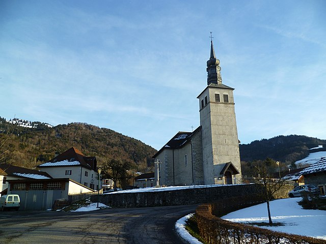
Burdignin (Burdignin)

- commune in Haute-Savoie, France
 Hiking in Burdignin
Burdignin, a picturesque village located in the Haute-Savoie region of France, offers a charming experience for hiking enthusiasts. Nestled in the stunning French Alps, it serves as an excellent base for exploring the surrounding natural beauty.
Hiking Trails
-
Local Trails: The area around Burdignin boasts several well-marked trails suitable for different experience levels. Whether you're looking for a leisurely stroll or a challenging hike, you'll find options that take you through lush forests, quaint Alpine meadows, and offer views of nearby mountain ranges.
-
Les Pléiades: This nearby area offers scenic trails with panoramic views of Lake Geneva and the surrounding Alps. The paths range from moderate to challenging, appealing to various skill levels.
-
Circuit du Mont de Grange: This is a more strenuous hike that offers breathtaking views and a chance to experience the diverse ecosystem of the Alps, including unique flora and fauna.
-
Vallée d’Aulps: Exploring this valley provides both historical context and natural beauty, with trails that lead to ancient monasteries and stunning waterfalls.
Tips for Hiking in Burdignin
- Preparation: Always check the weather conditions before heading out, as the Alpine weather can change rapidly.
- Gear: Invest in good hiking boots, and consider trekking poles for support on steep trails. Don't forget essentials such as water, snacks, and a map or GPS device.
- Safety: Inform someone of your hiking plans, especially if you're tackling less-traveled trails. Cell reception can be spotty in remote areas.
- Respect Nature: Follow the Leave No Trace principles; pack out what you pack in, and stay on marked trails to protect local wildlife and ecosystems.
Best Time to Hike
The best times for hiking in this region are late spring through early fall (May to October), when the weather is milder, and the trails are more accessible. Each season offers a unique perspective of the landscape, with blooming wildflowers in the spring and vibrant fall colors.
Conclusion
Burdignin is a hidden gem for hikers looking to explore the Alps' tranquil beauty away from the busier tourist spots. With trails suitable for various skill levels, it promises a memorable hiking experience amidst stunning natural landscapes. Happy hiking!
- Country:

- Postal Code: 74420
- Coordinates: 46° 13' 16" N, 6° 25' 26" E


- GPS tracks (wikiloc): [Link]
- Area: 9.87 sq km
- Population: 610
- Web site: http://www.burdignin.fr
- Wikipedia en: wiki(en)
- Wikipedia: wiki(fr)
- Wikidata storage: Wikidata: Q740667
- Wikipedia Commons Category: [Link]
- Freebase ID: [/m/03ntyc_]
- GeoNames ID: Alt: [6451028]
- SIREN number: [217400506]
- BnF ID: [15274309j]
- INSEE municipality code: 74050
Shares border with regions:


Boëge
- commune in Haute-Savoie, France
Hiking in Boëge
Boëge is a charming commune located in the Haute-Savoie region of the French Alps, offering beautiful landscapes and a variety of hiking options. The area is characterized by its picturesque mountain views, lush forests, and tranquil lakes, making it a fantastic destination for outdoor enthusiasts....
- Country:
- Postal Code: 74420
- Coordinates: 46° 12' 32" N, 6° 24' 17" E
- GPS tracks (wikiloc): [Link]
- Area: 16 sq km
- Population: 1672

Villard, Haute-Savoie
- commune in Haute-Savoie, France
Hiking in Villard, Haute-Savoie
Villard in Haute-Savoie is a fantastic destination for hiking enthusiasts, set in the stunning French Alps. The region offers a variety of trails that cater to all levels of hikers, from beginners to experienced trekkers. Here are some key points about hiking in Villard:...
- Country:
- Postal Code: 74420
- Coordinates: 46° 13' 1" N, 6° 26' 27" E
- GPS tracks (wikiloc): [Link]
- Area: 7.42 sq km
- Population: 760


Fessy
- commune in Haute-Savoie, France
Hiking in Fessy
Fessy, located in the Haute-Savoie region of France, offers beautiful hiking opportunities with stunning views of the surrounding Alpine landscape. Here are some key points to know before you head out for hiking in this area:...
- Country:
- Postal Code: 74890
- Coordinates: 46° 16' 32" N, 6° 24' 41" E
- GPS tracks (wikiloc): [Link]
- Area: 8.53 sq km
- Population: 890


Habère-Lullin
- commune in Haute-Savoie, France
Hiking in Habère-Lullin
Habère-Lullin is a charming village located in the Haute-Savoie region of France, near the border with Switzerland. It's surrounded by beautiful natural landscapes, making it a great destination for hiking enthusiasts. Here are some highlights about hiking in the area:...
- Country:
- Postal Code: 74420
- Coordinates: 46° 14' 1" N, 6° 27' 9" E
- GPS tracks (wikiloc): [Link]
- Area: 8.86 sq km
- Population: 957
Saxel
- commune in Haute-Savoie, France
Hiking in Saxel
Saxel is a picturesque village located in the Haute-Savoie region of France, near Lake Geneva, and is known for its stunning landscapes and outdoor activities, including hiking. The surrounding area offers numerous trails that cater to various skill levels, making it a great destination for hikers of all abilities....
- Country:
- Postal Code: 74420
- Coordinates: 46° 14' 35" N, 6° 23' 43" E
- GPS tracks (wikiloc): [Link]
- Area: 5.63 sq km
- Population: 460