arrondissement of Thonon-les-Bains (arrondissement de Thonon-les-Bains)
- arrondissement of France
 Hiking in arrondissement of Thonon-les-Bains
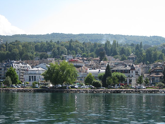
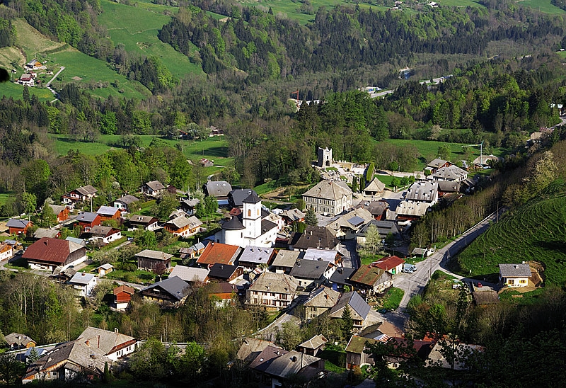
The Arrondissement of Thonon-les-Bains, located in the Haute-Savoie department in the Auvergne-Rhône-Alpes region of France, offers a variety of stunning hiking opportunities. Nestled by the shores of Lake Geneva and surrounded by the majestic Alps, this area provides breathtaking landscapes, diverse trails, and a rich natural environment.
Key Hiking Areas and Trails
-
Les Montagnes du Chablais:
- This mountain range offers numerous trails that cater to all levels of hikers. The area is characterized by its lush forests, alpine meadows, and panoramic views of Lake Geneva and the surrounding mountains.
- Popular trails include the ones leading to Dent d’Oche, which provides spectacular views from the summit.
-
La Dent de Vaulion:
- A rewarding hike with a moderate level of difficulty. The viewpoints along the trail are perfect for photographers looking to capture the stunning scenery of the Alps and the surrounding valleys.
-
Les Gorges du Pont du Diable:
- A shorter hike suitable for families. The trail winds through a beautiful gorge, offering unique rock formations and a chance to see local wildlife.
-
Le Pré de la Chaise:
- A delightful trail that takes hikers through quaint villages and farms with opportunities to sample local cheeses and wines. It’s ideal for those who enjoy combining hiking with cultural experiences.
-
Around Lake Geneva:
- The lakeshore offers flat, accessible paths perfect for leisurely strolls and nature walks. The trail from Thonon-les-Bains to Évian-les-Bains is particularly scenic.
Tips for Hiking in Thonon-les-Bains
- Season: The best time for hiking in the area is during spring through early autumn (March to October), when the weather is generally mild and the trails are more accessible.
- Preparation: Make sure to have a good map or GPS system, as some trails may not be well marked. It's also wise to check local weather conditions before heading out.
- Gear: Wear appropriate hiking gear, including sturdy boots, and bring layers as the weather can change quickly, especially in the mountains.
- Hydration and Snacks: Carry enough water and snacks, as some trails may not have access to facilities.
- Respect Nature: Follow the Leave No Trace principles to preserve the natural beauty of the area.
Overall, the Arrondissement of Thonon-les-Bains offers a diverse range of hiking experiences that appeal to a variety of skill levels and personal preferences, making it a fantastic destination for outdoor enthusiasts. Enjoy your hike!
- Country:

- Capital: Thonon-les-Bains
- Coordinates: 46° 15' 0" N, 6° 30' 0" E


- GPS tracks (wikiloc): [Link]
- Area: 908 sq km
- Population: 143678
- Wikipedia en: wiki(en)
- Wikipedia: wiki(fr)
- Wikidata storage: Wikidata: Q580284
- Freebase ID: [/m/095hsy]
- GeoNames ID: Alt: [2972741]
- INSEE arrondissement code: [744]
- GNS Unique Feature ID: -1472740
Includes regions:

canton of Thonon-les-Bains-Ouest
- canton of France (until March 2015)
 Hiking in canton of Thonon-les-Bains-Ouest
Canton de Thonon-les-Bains-Ouest, located in the Haute-Savoie region of France, offers a variety of stunning hiking opportunities, characterized by its picturesque landscapes, beautiful lakes, and charming alpine villages. Here's an overview of what you can expect when hiking in this area:...
- Country:

- Capital: Thonon-les-Bains
- Coordinates: 46° 19' 33" N, 6° 26' 43" E


- GPS tracks (wikiloc): [Link]

canton of Thonon-les-Bains-Est
- canton of France (until March 2015)
 Hiking in canton of Thonon-les-Bains-Est
Canton de Thonon-les-Bains-Est, located in the Haute-Savoie region of France, is a beautiful area that offers a mix of landscapes, including views of the Alps and nearby Lake Geneva. Here are some highlights for hiking in this region:...
- Country:

- Capital: Thonon-les-Bains
- Coordinates: 46° 19' 28" N, 6° 31' 31" E


- GPS tracks (wikiloc): [Link]

canton of Abondance
- canton of France
Canton d'Abondance, located in the Haute-Savoie region of the French Alps, is a beautiful area that offers stunning landscapes, rich biodiversity, and a variety of hiking opportunities. Here are some key points to consider when planning a hiking trip in this region:...
- Country:

- Capital: Abondance, Haute-Savoie
- Coordinates: 46° 18' 2" N, 6° 43' 23" E


- GPS tracks (wikiloc): [Link]

Canton of Boëge
- canton of France
Canton de Boëge, located in the Haute-Savoie region of the French Alps, offers a stunning backdrop for hikers, featuring lush valleys, rolling hills, and panoramic mountain views. The area is known for its diverse landscapes, including forests, alpine meadows, and nearby peaks, making it a great destination for both casual walkers and experienced trekkers....


canton of Évian-les-Bains
- canton of France
 Hiking in canton of Évian-les-Bains
Hiking in the Canton of Évian-les-Bains, located in the Haute-Savoie region of France near Lake Geneva, offers a blend of stunning natural beauty, scenic trails, and cultural experiences. Here are some highlights and tips for hiking in this area:...
- Country:

- Capital: Évian-les-Bains
- Coordinates: 46° 22' 49" N, 6° 38' 44" E


- GPS tracks (wikiloc): [Link]
- Population: 48491

Canton of Le Biot
- canton of France (until March 2015)
Canton du Biot, located in the picturesque region of the French Alpes-Maritimes, offers some wonderful hiking opportunities. This area is characterized by its stunning natural landscapes, charming villages, and diverse trails suitable for various skill levels....

Canton of Douvaine
- canton of France (until March 2015)
Canton de Douvaine, located in the Haute-Savoie region of France, offers beautiful landscapes and a variety of hiking opportunities for outdoor enthusiasts. Here are some highlights and tips for hiking in this area:...
