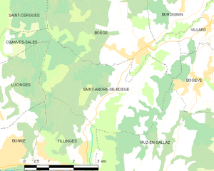
Canton of Boëge (canton de Boëge)
- canton of France
 Hiking in Canton of Boëge
Canton de Boëge, located in the Haute-Savoie region of the French Alps, offers a stunning backdrop for hikers, featuring lush valleys, rolling hills, and panoramic mountain views. The area is known for its diverse landscapes, including forests, alpine meadows, and nearby peaks, making it a great destination for both casual walkers and experienced trekkers.
Key Hiking Areas and Trails:
-
Les Mouilles: This area provides several trails that lead through beautiful forests and meadows. It's an excellent spot for shorter hikes, suitable for families and beginners.
-
Gorges de la Dranse: Located nearby, this natural site offers breathtaking views and scenic routes. You can follow trails that along the gorges, often leading to stunning viewpoints.
-
Le Reposoir: Accessible from Boëge, this traditional mountain village offers various hiking trails, from easy to moderate difficulty. The path to the Col de la Croix is particularly popular, providing expansive views of the surrounding mountains.
-
Mont Billiat: A more challenging hike, this route rewards climbers with spectacular vistas of Lake Geneva and the Alps. The ascent can be steep, but the scenic payoffs make it worthwhile.
-
Alpine Flower Hikes: In spring and summer, the region bursts with wildflowers, and several trails are dedicated to showcasing this natural beauty. These hikes are often easier and very rewarding for those interested in botany and photography.
Tips for Hiking in Canton de Boëge:
-
Prepare for Weather: The weather can change rapidly in the mountains, so it's advisable to check forecasts and dress in layers. Waterproof clothing can be essential.
-
Trail Maps and Guides: Make sure to have a good map of hiking trails or a reliable hiking app. Some trails may not be well marked, and it's good to know where you're going.
-
Safety First: Always notify someone of your hiking plans, especially if you're going on a more isolated trail. Carry a first aid kit, sufficient water, snacks, and a charged mobile phone.
-
Respect Nature: Follow Leave No Trace principles to help preserve the beautiful environment for future visitors.
Hiking in Canton de Boëge can be a truly enriching experience, offering an array of paths to explore, stunning scenery, and a chance to immerse oneself in the natural beauty of the Alps. Enjoy your hike!
- Country:

- Capital: Boëge
- Coordinates: 46° 13' 11" N, 6° 25' 37" E


- GPS tracks (wikiloc): [Link]
- Wikidata storage: Wikidata: Q1724592
Includes regions:
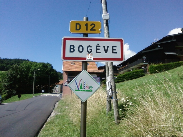

Bogève
- commune in Haute-Savoie, France
Hiking in Bogève
Bogève, a picturesque village located in the Haute-Savoie region of France, offers stunning hiking opportunities amidst the French Alps. The area is known for its rich natural beauty, characterized by rolling hills, lush forests, and breathtaking mountain views....
- Country:
- Postal Code: 74250
- Coordinates: 46° 11' 33" N, 6° 25' 47" E
- GPS tracks (wikiloc): [Link]
- Area: 7 sq km
- Population: 1046


Habère-Poche
- commune in Haute-Savoie, France
Hiking in Habère-Poche
Habère-Poche, located in the Haute-Savoie region of the French Alps, is a great destination for hiking enthusiasts. Nestled near the Swiss border and surrounded by stunning mountain scenery, it offers a variety of trails suitable for all skill levels....
- Country:
- Postal Code: 74420
- Coordinates: 46° 14' 56" N, 6° 28' 21" E
- GPS tracks (wikiloc): [Link]
- Area: 11.96 sq km
- Population: 1382
- Web site: [Link]


Boëge
- commune in Haute-Savoie, France
Hiking in Boëge
Boëge is a charming commune located in the Haute-Savoie region of the French Alps, offering beautiful landscapes and a variety of hiking options. The area is characterized by its picturesque mountain views, lush forests, and tranquil lakes, making it a fantastic destination for outdoor enthusiasts....
- Country:
- Postal Code: 74420
- Coordinates: 46° 12' 32" N, 6° 24' 17" E
- GPS tracks (wikiloc): [Link]
- Area: 16 sq km
- Population: 1672

Villard, Haute-Savoie
- commune in Haute-Savoie, France
Hiking in Villard, Haute-Savoie
Villard in Haute-Savoie is a fantastic destination for hiking enthusiasts, set in the stunning French Alps. The region offers a variety of trails that cater to all levels of hikers, from beginners to experienced trekkers. Here are some key points about hiking in Villard:...
- Country:
- Postal Code: 74420
- Coordinates: 46° 13' 1" N, 6° 26' 27" E
- GPS tracks (wikiloc): [Link]
- Area: 7.42 sq km
- Population: 760

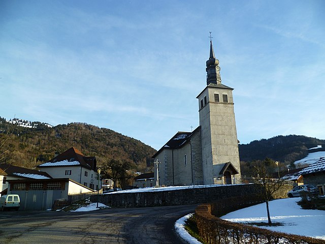
Saint-André-de-Boëge
- commune in Haute-Savoie, France
Hiking in Saint-André-de-Boëge
Saint-André-de-Boëge is a charming commune located in the Haute-Savoie department in the Auvergne-Rhône-Alpes region of southeastern France. It's nestled within the scenic backdrop of the French Alps, making it an appealing destination for outdoor enthusiasts and hikers....
- Country:
- Postal Code: 74420
- Coordinates: 46° 11' 25" N, 6° 23' 37" E
- GPS tracks (wikiloc): [Link]
- Area: 12.6 sq km
- Population: 549


Burdignin
- commune in Haute-Savoie, France
Hiking in Burdignin
Burdignin, a picturesque village located in the Haute-Savoie region of France, offers a charming experience for hiking enthusiasts. Nestled in the stunning French Alps, it serves as an excellent base for exploring the surrounding natural beauty....
- Country:
- Postal Code: 74420
- Coordinates: 46° 13' 16" N, 6° 25' 26" E
- GPS tracks (wikiloc): [Link]
- Area: 9.87 sq km
- Population: 610
- Web site: [Link]


Habère-Lullin
- commune in Haute-Savoie, France
Hiking in Habère-Lullin
Habère-Lullin is a charming village located in the Haute-Savoie region of France, near the border with Switzerland. It's surrounded by beautiful natural landscapes, making it a great destination for hiking enthusiasts. Here are some highlights about hiking in the area:...
- Country:
- Postal Code: 74420
- Coordinates: 46° 14' 1" N, 6° 27' 9" E
- GPS tracks (wikiloc): [Link]
- Area: 8.86 sq km
- Population: 957
Saxel
- commune in Haute-Savoie, France
Hiking in Saxel
Saxel is a picturesque village located in the Haute-Savoie region of France, near Lake Geneva, and is known for its stunning landscapes and outdoor activities, including hiking. The surrounding area offers numerous trails that cater to various skill levels, making it a great destination for hikers of all abilities....
- Country:
- Postal Code: 74420
- Coordinates: 46° 14' 35" N, 6° 23' 43" E
- GPS tracks (wikiloc): [Link]
- Area: 5.63 sq km
- Population: 460