Bure-les-Templiers (Bure-les-Templiers)

- commune in Côte-d'Or, France
- Country:

- Postal Code: 21290
- Coordinates: 47° 44' 19" N, 4° 53' 42" E


- GPS tracks (wikiloc): [Link]
- Area: 35.03 sq km
- Population: 138
- Wikipedia en: wiki(en)
- Wikipedia: wiki(fr)
- Wikidata storage: Wikidata: Q841556
- Wikipedia Commons Category: [Link]
- Freebase ID: [/m/03mfn0k]
- GeoNames ID: Alt: [6428516]
- SIREN number: [212101166]
- BnF ID: [15250403c]
- VIAF ID: Alt: [240525059]
- INSEE municipality code: 21116
Shares border with regions:


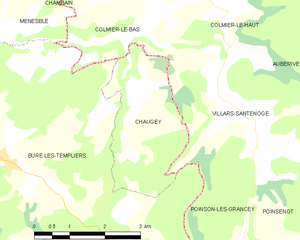
Colmier-le-Bas
- commune in Haute-Marne, France
- Country:
- Postal Code: 52160
- Coordinates: 47° 46' 18" N, 4° 57' 9" E
- GPS tracks (wikiloc): [Link]
- Area: 5.95 sq km
- Population: 23


Villars-Santenoge
- commune in Haute-Marne, France
- Country:
- Postal Code: 52160
- Coordinates: 47° 44' 23" N, 4° 59' 31" E
- GPS tracks (wikiloc): [Link]
- AboveSeaLevel: 374 м m
- Area: 19.95 sq km
- Population: 93


Minot
- commune in Côte-d'Or, France
- Country:
- Postal Code: 21510
- Coordinates: 47° 40' 10" N, 4° 52' 34" E
- GPS tracks (wikiloc): [Link]
- Area: 36.18 sq km
- Population: 189


Beneuvre
- commune in Côte-d'Or, France
- Country:
- Postal Code: 21290
- Coordinates: 47° 41' 31" N, 4° 56' 34" E
- GPS tracks (wikiloc): [Link]
- Area: 15.4 sq km
- Population: 99

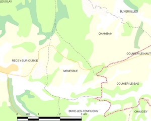
Menesble
- commune in Côte-d'Or, France
- Country:
- Postal Code: 21290
- Coordinates: 47° 46' 24" N, 4° 53' 48" E
- GPS tracks (wikiloc): [Link]
- Area: 5.51 sq km
- Population: 10


Poinson-lès-Grancey
- commune in Haute-Marne, France
- Country:
- Postal Code: 52160
- Coordinates: 47° 42' 27" N, 4° 59' 8" E
- GPS tracks (wikiloc): [Link]
- Area: 11.68 sq km
- Population: 43

Chaugey
- commune in Côte-d'Or, France
- Country:
- Postal Code: 21290
- Coordinates: 47° 45' 8" N, 4° 57' 2" E
- GPS tracks (wikiloc): [Link]
- Area: 6.89 sq km
- Population: 20


Recey-sur-Ource
- commune in Côte-d'Or, France
- Country:
- Postal Code: 21290
- Coordinates: 47° 46' 48" N, 4° 51' 37" E
- GPS tracks (wikiloc): [Link]
- Area: 26.69 sq km
- Population: 370


Terrefondrée
- commune in Côte-d'Or, France
- Country:
- Postal Code: 21290
- Coordinates: 47° 43' 49" N, 4° 51' 52" E
- GPS tracks (wikiloc): [Link]
- Area: 13.89 sq km
- Population: 63

Saint-Broing-les-Moines
- commune in Côte-d'Or, France
- Country:
- Postal Code: 21290
- Coordinates: 47° 41' 50" N, 4° 50' 30" E
- GPS tracks (wikiloc): [Link]
- Area: 20.09 sq km
- Population: 189