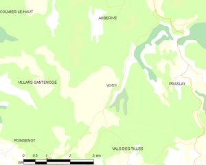
Villars-Santenoge (Villars-Santenoge)

- commune in Haute-Marne, France
- Country:

- Postal Code: 52160
- Coordinates: 47° 44' 23" N, 4° 59' 31" E


- GPS tracks (wikiloc): [Link]
- AboveSeaLevel: 374 м m
- Area: 19.95 sq km
- Population: 93
- Wikipedia en: wiki(en)
- Wikipedia: wiki(fr)
- Wikidata storage: Wikidata: Q1330160
- Wikipedia Commons Category: [Link]
- Freebase ID: [/m/03ntqq0]
- Freebase ID: [/m/03ntqq0]
- GeoNames ID: Alt: [6617015]
- GeoNames ID: Alt: [6617015]
- SIREN number: [215203779]
- SIREN number: [215203779]
- BnF ID: [152637708]
- BnF ID: [152637708]
- INSEE municipality code: 52526
- INSEE municipality code: 52526
Shares border with regions:


Colmier-le-Bas
- commune in Haute-Marne, France
- Country:
- Postal Code: 52160
- Coordinates: 47° 46' 18" N, 4° 57' 9" E
- GPS tracks (wikiloc): [Link]
- Area: 5.95 sq km
- Population: 23

Colmier-le-Haut
- commune in Haute-Marne, France
- Country:
- Postal Code: 52160
- Coordinates: 47° 46' 51" N, 4° 57' 57" E
- GPS tracks (wikiloc): [Link]
- Area: 19.35 sq km
- Population: 52


Poinsenot
- commune in Haute-Marne, France
- Country:
- Postal Code: 52160
- Coordinates: 47° 42' 44" N, 5° 0' 10" E
- GPS tracks (wikiloc): [Link]
- Area: 7.26 sq km
- Population: 46

Vivey
- commune in Haute-Marne, France
- Country:
- Postal Code: 52160
- Coordinates: 47° 44' 1" N, 5° 3' 59" E
- GPS tracks (wikiloc): [Link]
- Area: 13.05 sq km
- Population: 56
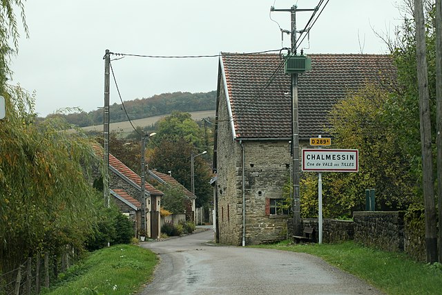

Vals-des-Tilles
- commune in Haute-Marne, France
- Country:
- Postal Code: 52160
- Coordinates: 47° 42' 14" N, 5° 4' 14" E
- GPS tracks (wikiloc): [Link]
- AboveSeaLevel: 380 м m
- Area: 36.89 sq km
- Population: 160


Auberive
- commune in Haute-Marne, France
- Country:
- Postal Code: 52160
- Coordinates: 47° 47' 13" N, 5° 3' 43" E
- GPS tracks (wikiloc): [Link]
- Area: 70.64 sq km
- Population: 193


Poinson-lès-Grancey
- commune in Haute-Marne, France
- Country:
- Postal Code: 52160
- Coordinates: 47° 42' 27" N, 4° 59' 8" E
- GPS tracks (wikiloc): [Link]
- Area: 11.68 sq km
- Population: 43


Bure-les-Templiers
- commune in Côte-d'Or, France
- Country:
- Postal Code: 21290
- Coordinates: 47° 44' 19" N, 4° 53' 42" E
- GPS tracks (wikiloc): [Link]
- Area: 35.03 sq km
- Population: 138

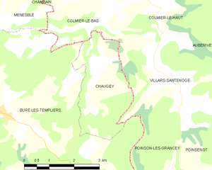
Chaugey
- commune in Côte-d'Or, France
- Country:
- Postal Code: 21290
- Coordinates: 47° 45' 8" N, 4° 57' 2" E
- GPS tracks (wikiloc): [Link]
- Area: 6.89 sq km
- Population: 20