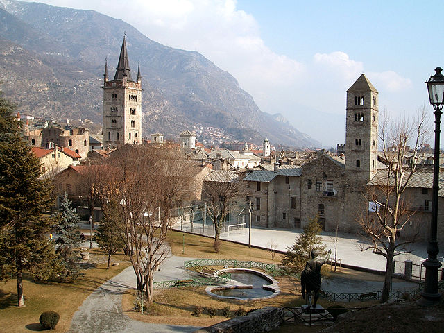
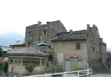
Bussoleno (Bussoleno)

- Italian comune
 Hiking in Bussoleno
Bussoleno is a charming town located in the Susa Valley in the Piedmont region of Italy, nestled in the foothills of the Alps. It offers a variety of hiking opportunities, making it an appealing destination for outdoor enthusiasts. Here are some highlights and tips for hiking in Bussoleno:
Hiking Trails
-
Sentiero dei Franchi: This historical trail follows the ancient route of the Franks, offering spectacular views of the surrounding mountains and valleys. It's a great way to experience the cultural heritage of the area while enjoying nature.
-
Monte Musinè: A popular hike that takes you to the summit of Monte Musinè, which provides panoramic views of the entire Susa Valley. The trail can be steep in parts, so be prepared for a bit of a workout.
-
Parco Naturale Orsiera-Rocciavré: Located nearby, this natural park offers numerous trails that range in difficulty. You can explore lush forests, alpine meadows, and stunning mountain landscapes.
-
The Royal Path: This scenic route offers historical insights and beautiful views. It’s ideal for a leisurely hike and immerses you in the natural beauty and history of the region.
Considerations
-
Season: The best time for hiking in Bussoleno is from late spring to early fall (May to October) when the weather is mild and the trails are generally clear of snow.
-
Equipment: Depending on the trail you choose, sturdy hiking boots, appropriate clothing layers, and sufficient water are essential. Trekking poles can also be helpful, especially on steeper or uneven terrain.
-
Maps and Guides: It’s advisable to have a good map or use a hiking app to help you navigate. Local guides may also offer guided hikes, which can enhance your experience by providing insights into the ecology and history of the area.
-
Safety: Always inform someone of your hiking plans, carry a mobile phone, and be mindful of changing weather conditions. The trails can be less trafficked, so it's important to be prepared.
Conclusion
Hiking in Bussoleno allows you to explore stunning landscapes, rich history, and a variety of trails catering to different experience levels. Whether you're a seasoned hiker or a beginner looking to enjoy nature, Bussoleno is a fantastic destination to consider. Enjoy your hike!
- Country:

- Postal Code: 10053
- Local Dialing Code: 0122
- Licence Plate Code: TO
- Coordinates: 45° 8' 28" N, 7° 8' 51" E


- GPS tracks (wikiloc): [Link]
- AboveSeaLevel: 440 м m
- Area: 37.07 sq km
- Population: 5981
- Web site: http://www.comune.bussoleno.to.it
- Wikipedia en: wiki(en)
- Wikipedia: wiki(it)
- Wikidata storage: Wikidata: Q9116
- Wikipedia Commons Category: [Link]
- Freebase ID: [/m/0g6tbr]
- GeoNames ID: Alt: [6538043]
- VIAF ID: Alt: [239211507]
- OSM relation ID: [44134]
- UN/LOCODE: [ITSXN]
- ISTAT ID: 001044
- Italian cadastre code: B297
Shares border with regions:

Roure
- Italian comune
Hiking in Roure
Roure, located in the Piedmont region of Italy, is a charming town nestled in the Susa Valley. The area offers a multitude of hiking opportunities, characterized by stunning landscapes, rich history, and a diverse range of trails suitable for all skill levels....
- Country:
- Postal Code: 10060
- Local Dialing Code: 0121
- Licence Plate Code: TO
- Coordinates: 45° 0' 0" N, 7° 8' 0" E
- GPS tracks (wikiloc): [Link]
- AboveSeaLevel: 750 м m
- Area: 59.37 sq km
- Population: 832
- Web site: [Link]


San Giorio di Susa
- Italian comune
Hiking in San Giorio di Susa
San Giorio di Susa is a charming village located in the Susa Valley of the Piedmont region in northern Italy. Nestled in the foothills of the Alps, it offers a variety of hiking opportunities that cater to different skill levels and preferences....
- Country:
- Postal Code: 10050
- Local Dialing Code: 0122
- Licence Plate Code: TO
- Coordinates: 45° 8' 0" N, 7° 10' 0" E
- GPS tracks (wikiloc): [Link]
- Area: 19.74 sq km
- Population: 996
- Web site: [Link]

Susa
- Italian comune
Hiking in Susa
Susa, located in the Piedmont region of Italy, is a charming town nestled in the Susa Valley, surrounded by the stunning Alps. The area is known for its spectacular natural landscapes, historical sites, and a variety of hiking opportunities that cater to different skill levels....
- Country:
- Postal Code: 10059
- Local Dialing Code: 0122
- Licence Plate Code: TO
- Coordinates: 45° 8' 0" N, 7° 3' 0" E
- GPS tracks (wikiloc): [Link]
- AboveSeaLevel: 503 м m
- Area: 10.99 sq km
- Population: 6340
- Web site: [Link]


Usseglio
- Italian comune
Hiking in Usseglio
Usseglio, located in the Susa Valley in the Piedmont region of Italy, is a beautiful destination for hikers and outdoor enthusiasts. Known for its stunning alpine scenery, Usseglio offers a variety of trails that cater to different skill levels, making it an ideal spot for both beginners and experienced hikers....
- Country:
- Postal Code: 10070
- Local Dialing Code: 0123
- Licence Plate Code: TO
- Coordinates: 45° 14' 0" N, 7° 13' 0" E
- GPS tracks (wikiloc): [Link]
- AboveSeaLevel: 1260 м m
- Area: 98.54 sq km
- Population: 200
- Web site: [Link]

Chianocco
- Italian comune
Hiking in Chianocco
Chianocco is a charming village located in the Susa Valley of the Piedmont region in Italy, and it serves as a gateway to various hiking adventures, particularly for those exploring the stunning landscapes of the surrounding mountains....
- Country:
- Postal Code: 10050
- Local Dialing Code: 0122
- Licence Plate Code: TO
- Coordinates: 45° 9' 0" N, 7° 10' 0" E
- GPS tracks (wikiloc): [Link]
- AboveSeaLevel: 550 м m
- Area: 18.61 sq km
- Population: 1624
- Web site: [Link]
Mattie
- Italian comune
Hiking in Mattie
Hiking in Mattie, Piedmont, offers a beautiful blend of scenic views and the tranquility of nature. The region is known for its stunning landscapes, including rolling hills, dense forests, and potentially some water bodies like rivers or lakes, depending on the exact area....
- Country:
- Postal Code: 10050
- Local Dialing Code: 0122
- Licence Plate Code: TO
- Coordinates: 45° 7' 0" N, 7° 7' 0" E
- GPS tracks (wikiloc): [Link]
- AboveSeaLevel: 730 м m
- Area: 28.69 sq km
- Population: 662
- Web site: [Link]
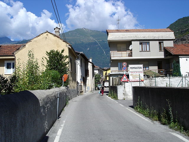
Mompantero
- Italian comune
Hiking in Mompantero
Mompantero, located in the province of Turin in the Piedmont region of Italy, is a charming destination for hikers looking to explore beautiful landscapes and enjoy outdoor activities. Nestled in the Susa Valley, this area is characterized by its stunning mountainous terrain, rich biodiversity, and picturesque views of the surrounding Alps....
- Country:
- Postal Code: 10059
- Local Dialing Code: 0122
- Licence Plate Code: TO
- Coordinates: 45° 9' 0" N, 7° 4' 0" E
- GPS tracks (wikiloc): [Link]
- AboveSeaLevel: 531 м m
- Area: 30.33 sq km
- Population: 646
- Web site: [Link]