Cagnotte (Cagnotte)

- commune in Landes, France
- Country:

- Postal Code: 40300
- Coordinates: 43° 35' 44" N, 1° 4' 4" E


- GPS tracks (wikiloc): [Link]
- Area: 14.68 sq km
- Population: 769
- Wikipedia en: wiki(en)
- Wikipedia: wiki(fr)
- Wikidata storage: Wikidata: Q1070252
- Wikipedia Commons Category: [Link]
- Freebase ID: [/m/03nvwg4]
- GeoNames ID: Alt: [6448861]
- SIREN number: [214000598]
- BnF ID: [15259001r]
- INSEE municipality code: 40059
Shares border with regions:
Heugas
- commune in Landes, France
- Country:
- Postal Code: 40180
- Coordinates: 43° 38' 32" N, 1° 4' 50" E
- GPS tracks (wikiloc): [Link]
- Area: 18.79 sq km
- Population: 1328


Pouillon
- commune in Landes, France
- Country:
- Postal Code: 40350
- Coordinates: 43° 36' 16" N, 0° 59' 47" E
- GPS tracks (wikiloc): [Link]
- Area: 49.74 sq km
- Population: 3042
- Web site: [Link]


Saint-Lon-les-Mines
- commune in Landes, France
- Country:
- Postal Code: 40300
- Coordinates: 43° 36' 51" N, 1° 7' 35" E
- GPS tracks (wikiloc): [Link]
- Area: 21.82 sq km
- Population: 1182
- Web site: [Link]
Bélus
- commune in Landes, France
- Country:
- Postal Code: 40300
- Coordinates: 43° 35' 30" N, 1° 6' 35" E
- GPS tracks (wikiloc): [Link]
- Area: 11.84 sq km
- Population: 611
- Web site: [Link]


Cauneille
- commune in Landes, France
- Country:
- Postal Code: 40300
- Coordinates: 43° 32' 48" N, 1° 3' 50" E
- GPS tracks (wikiloc): [Link]
- Area: 15.42 sq km
- Population: 814

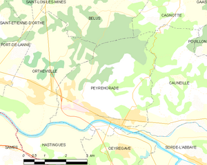
Peyrehorade
- commune in Landes, France
- Country:
- Postal Code: 40300
- Coordinates: 43° 32' 42" N, 1° 6' 0" E
- GPS tracks (wikiloc): [Link]
- Area: 16.11 sq km
- Population: 3616
- Web site: [Link]
Gaas
- commune in Landes, France
- Country:
- Postal Code: 40350
- Coordinates: 43° 36' 48" N, 1° 2' 4" E
- GPS tracks (wikiloc): [Link]
- Area: 9.13 sq km
- Population: 515