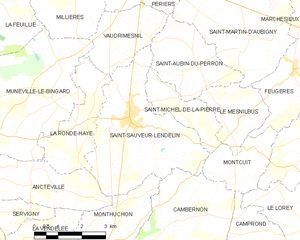
Cambernon (Cambernon)

- commune in Manche, France
- Country:

- Postal Code: 50200
- Coordinates: 49° 4' 49" N, 1° 23' 8" E


- GPS tracks (wikiloc): [Link]
- Area: 17.01 sq km
- Population: 733
- Web site: http://communedecambernon.pagesperso-orange.fr
- Wikipedia en: wiki(en)
- Wikipedia: wiki(fr)
- Wikidata storage: Wikidata: Q579867
- Wikipedia Commons Category: [Link]
- Freebase ID: [/m/03qcqjq]
- Freebase ID: [/m/03qcqjq]
- GeoNames ID: Alt: [3029056]
- GeoNames ID: Alt: [3029056]
- SIREN number: [215000928]
- SIREN number: [215000928]
- BnF ID: [152620703]
- BnF ID: [152620703]
- VIAF ID: Alt: [246962283]
- VIAF ID: Alt: [246962283]
- INSEE municipality code: 50092
- INSEE municipality code: 50092
Shares border with regions:


Belval
- commune in Manche, France
- Country:
- Postal Code: 50210
- Coordinates: 49° 2' 22" N, 1° 21' 49" E
- GPS tracks (wikiloc): [Link]
- Area: 5.72 sq km
- Population: 312


Monthuchon
- commune in Manche, France
- Country:
- Postal Code: 50200
- Coordinates: 49° 4' 56" N, 1° 25' 19" E
- GPS tracks (wikiloc): [Link]
- Area: 7.66 sq km
- Population: 651

Saint-Sauveur-Lendelin
- commune in Manche, France
- Country:
- Postal Code: 50490
- Coordinates: 49° 7' 50" N, 1° 24' 49" E
- GPS tracks (wikiloc): [Link]
- Area: 16.39 sq km
- Population: 1708


Montcuit
- commune in Manche, France
- Country:
- Postal Code: 50490
- Coordinates: 49° 7' 14" N, 1° 20' 29" E
- GPS tracks (wikiloc): [Link]
- Area: 4.79 sq km
- Population: 183
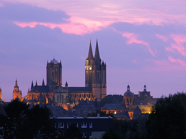
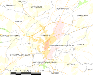
Coutances
- commune in Manche, France
- Country:
- Postal Code: 50200
- Coordinates: 49° 3' 0" N, 1° 26' 0" E
- GPS tracks (wikiloc): [Link]
- AboveSeaLevel: 92 м m
- Area: 12.51 sq km
- Population: 8688
- Web site: [Link]


Camprond
- commune in Manche, France
- Country:
- Postal Code: 50210
- Coordinates: 49° 5' 18" N, 1° 20' 52" E
- GPS tracks (wikiloc): [Link]
- Area: 6.27 sq km
- Population: 425


Courcy
- commune in Manche, France
- Country:
- Postal Code: 50200
- Coordinates: 49° 2' 29" N, 1° 23' 35" E
- GPS tracks (wikiloc): [Link]
- Area: 11.45 sq km
- Population: 618