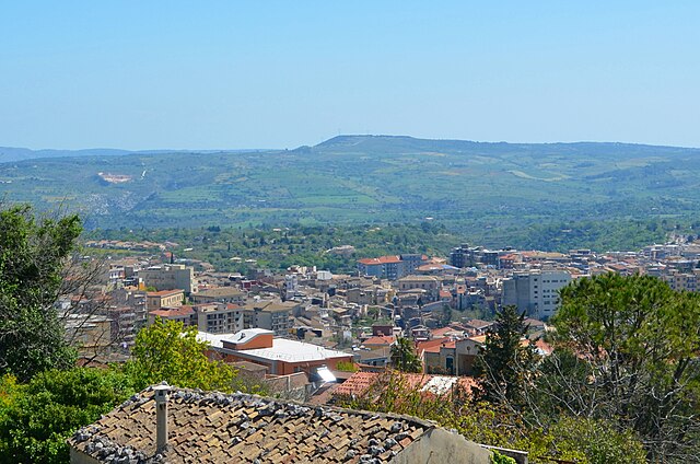
Canicattini Bagni (Canicattini Bagni)
.svg)
- Italian comune
 Hiking in Canicattini Bagni
Canicattini Bagni, a charming town in Sicily, Italy, is a great destination for hiking enthusiasts. Nestled in the Hyblaean Mountains, the area is characterized by stunning natural landscapes, rich flora and fauna, and a range of trails suitable for various skill levels. Here are some key points about hiking in Canicattini Bagni:
Trails and Terrain
- Variety of Trails: The region offers a variety of hiking trails, from easy walks suitable for families to more challenging routes for experienced hikers.
- Scenic Views: Hikers can expect breathtaking views of the surrounding countryside, including olive groves, vineyards, and the beautiful coastline of southeastern Sicily.
- Natural Parks: Nearby natural parks, such as the Riserva Naturale Orientata Cavagrande del Cassibile, provide additional trail options and the chance to explore unique landscapes and ecosystems.
Flora and Fauna
- The area is home to diverse plant species, including Mediterranean scrub and various wildflowers.
- Wildlife enthusiasts may also spot various birds, foxes, and other native species along the trails.
Cultural and Historical Aspects
- Hiking in Canicattini Bagni can also include visits to historical sites and ruins, such as ancient churches and archaeological remains, allowing for a combination of outdoor activity and cultural exploration.
- The trails often intertwine with the local culture, offering glimpses into the traditional Sicilian way of life.
Tips for Hiking in Canicattini Bagni
- Best Time to Visit: The ideal time for hiking is during the spring and fall when temperatures are milder and the landscapes are lush.
- Prepare Properly: Always wear appropriate hiking gear, bring plenty of water, and check the weather forecast before heading out.
- Local Guides: Consider hiring a local guide who can provide insights into the trails and the local ecosystem, enhance safety, and enrich your experience.
Conclusion
Hiking in Canicattini Bagni can be a rewarding experience, combining stunning natural beauty, rich biodiversity, and cultural heritage. Whether you’re a seasoned hiker or a beginner, you'll find plenty to explore in this picturesque Sicilian town.
- Country:

- Postal Code: 96010
- Local Dialing Code: 0931
- Licence Plate Code: SR
- Coordinates: 37° 2' 0" N, 15° 4' 0" E


- GPS tracks (wikiloc): [Link]
- AboveSeaLevel: 362 м m
- Area: 15.06 sq km
- Population: 7032
- Web site: http://www.comune.canicattinibagni.sr.it/
- Wikipedia en: wiki(en)
- Wikipedia: wiki(it)
- Wikidata storage: Wikidata: Q490748
- Wikipedia Commons Gallery: [Link]
- Wikipedia Commons Category: [Link]
- Freebase ID: [/m/0gqh_j]
- GeoNames ID: Alt: [6539207]
- VIAF ID: Alt: [157266032]
- OSM relation ID: [39179]
- GND ID: Alt: [4413618-3]
- ISTAT ID: 089005
- Italian cadastre code: B603
Shares border with regions:


Syracuse
- Italian comune
Hiking in Syracuse
Syracuse, located on the southeastern coast of Sicily, offers a unique blend of history, culture, and natural beauty that can make for a rewarding hiking experience. Here are some popular hiking routes and areas around Syracuse:...
- Country:
- Postal Code: 96100
- Local Dialing Code: 0931
- Licence Plate Code: SR
- Coordinates: 37° 5' 0" N, 15° 17' 0" E
- GPS tracks (wikiloc): [Link]
- AboveSeaLevel: 17 м m
- Area: 207.78 sq km
- Population: 122086
- Web site: [Link]


Noto
- Italian comune
Hiking in Noto
Noto, located in the southeastern region of Sicily, Italy, is renowned for its stunning Baroque architecture, beautiful landscapes, and rich cultural heritage. When it comes to hiking, Noto and its surrounding areas offer a variety of trails that showcase the beauty of the Sicilian countryside, including coastal views, vineyards, and ancient ruins....
- Country:
- Postal Code: 96017
- Local Dialing Code: 0931
- Licence Plate Code: SR
- Coordinates: 36° 53' 0" N, 15° 5' 0" E
- GPS tracks (wikiloc): [Link]
- AboveSeaLevel: 152 м m
- Area: 554.99 sq km
- Population: 24028
- Web site: [Link]

Palazzolo Acreide
- comune of Italy
Hiking in Palazzolo Acreide
Palazzolo Acreide, located in Sicily, Italy, is a wonderful destination for hiking enthusiasts. This charming town is known for its rich history, Baroque architecture, and stunning natural landscapes, set against the backdrop of the Iblei Mountains. Here are some key points to consider when planning a hiking adventure in this area:...
- Country:
- Postal Code: 96010
- Local Dialing Code: 0931
- Licence Plate Code: SR
- Coordinates: 37° 4' 0" N, 14° 54' 0" E
- GPS tracks (wikiloc): [Link]
- AboveSeaLevel: 670 м m
- Area: 87.54 sq km
- Population: 8665
- Web site: [Link]