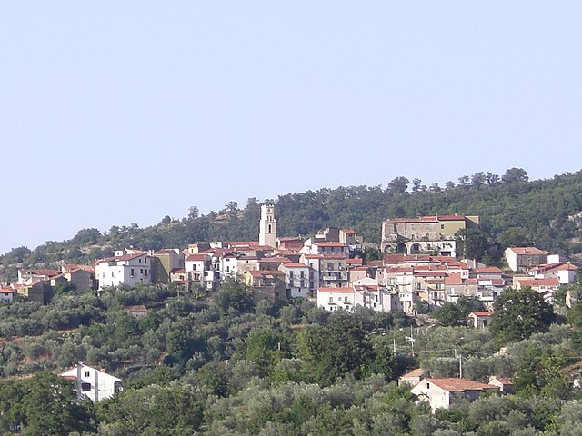
Cannalonga (Cannalonga)

- Italian comune
 Hiking in Cannalonga
Cannalonga is a lesser-known gem in the Campania region of Italy, known for its natural beauty and potential for hiking enthusiasts. Nestled in the Cilento and Vallo di Diano National Park, this area offers a variety of hiking trails that cater to different skill levels.
Hiking in Cannalonga:
-
Scenic Trails: The area is characterized by dense forests, rolling hills, and stunning views of the surrounding mountains and valleys. Trails often take you through beautiful landscapes, offering opportunities to enjoy diverse flora and fauna.
-
Difficulty Levels: There are hikes suitable for beginners as well as more challenging trails for experienced hikers. Always assess your fitness level and choose a trail that matches your capability.
-
Local Flora and Fauna: Keep an eye out for local wildlife, including various bird species, deer, and unique plant life endemic to the region. Springtime brings a burst of colors with wildflowers in bloom.
-
Cultural Significance: Some trails may lead you to historic sites or quaint villages, allowing hikers to immerse themselves in local culture and history. This can enhance your hiking experience as you combine nature with cultural exploration.
-
Best Time to Visit: The best times for hiking in Cannalonga are typically late spring (May-June) and early autumn (September-October) when temperatures are mild and the views are particularly picturesque.
-
Preparation: Ensure you have suitable hiking gear, plenty of water, and snacks. It’s also a good idea to inform someone about your hiking plans and expected return time.
-
Guided Tours: For those unfamiliar with the area, consider joining guided hiking tours. Local guides can offer insights into the terrain and share information about the region's ecosystem and history.
If you're looking for a peaceful and unspoiled hiking experience in Italy, Cannalonga could be an excellent choice! Always remember to leave no trace and respect the natural environment during your hikes.
- Country:

- Postal Code: 84040
- Local Dialing Code: 0974
- Licence Plate Code: SA
- Coordinates: 40° 15' 0" N, 15° 18' 0" E


- GPS tracks (wikiloc): [Link]
- AboveSeaLevel: 570 м m
- Area: 17.75 sq km
- Population: 1040
- Web site: http://cannalonga.asmenet.it/
- Wikipedia en: wiki(en)
- Wikipedia: wiki(it)
- Wikidata storage: Wikidata: Q80743
- Wikipedia Commons Category: [Link]
- Freebase ID: [/m/0d139v]
- GeoNames ID: Alt: [6538809]
- OSM relation ID: [40373]
- TGN ID: [7044506]
- ISTAT ID: 065024
- Italian cadastre code: B608
Shares border with regions:

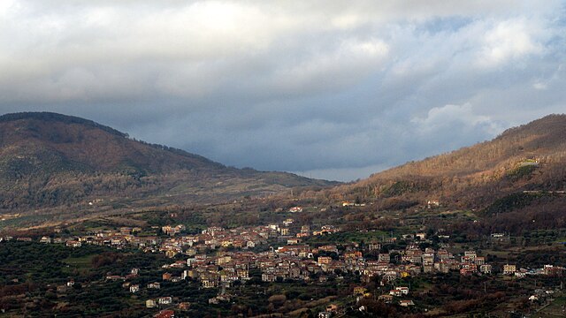
Campora
- Italian comune
Hiking in Campora
Campora is a picturesque destination that offers various hiking opportunities, typically characterized by stunning landscapes, diverse flora and fauna, and sometimes challenging terrains. While specific trails and conditions may vary, here are some general aspects to consider when hiking in an area like Campora:...
- Country:
- Postal Code: 84040
- Local Dialing Code: 0974
- Licence Plate Code: SA
- Coordinates: 40° 18' 19" N, 15° 17' 32" E
- GPS tracks (wikiloc): [Link]
- AboveSeaLevel: 525 м m
- Area: 29.15 sq km
- Population: 391
- Web site: [Link]

Moio della Civitella
- Italian comune
Hiking in Moio della Civitella
Moio della Civitella is a picturesque village located in the province of Salerno in the Campania region of Italy, surrounded by stunning natural landscapes that are perfect for hiking enthusiasts. The area is characterized by its mountainous terrain, lush forests, and a mix of historical sites, offering a variety of hiking opportunities suitable for different skill levels....
- Country:
- Postal Code: 84060
- Local Dialing Code: 0974
- Licence Plate Code: SA
- Coordinates: 40° 14' 50" N, 15° 16' 8" E
- GPS tracks (wikiloc): [Link]
- AboveSeaLevel: 515 м m
- Area: 17.19 sq km
- Population: 1859
- Web site: [Link]


Novi Velia
- Italian comune
Hiking in Novi Velia
Novi Velia is a charming town located in the Cilento region of southern Italy, known for its beautiful landscapes and opportunities for hiking. Nestled in the Parco Nazionale del Cilento, Vallo di Diano e Alburni, it offers stunning views, diverse terrains, and a rich natural environment....
- Country:
- Postal Code: 84060
- Local Dialing Code: 0974
- Licence Plate Code: SA
- Coordinates: 40° 13' 0" N, 15° 17' 0" E
- GPS tracks (wikiloc): [Link]
- AboveSeaLevel: 648 м m
- Area: 34.71 sq km
- Population: 2292
- Web site: [Link]
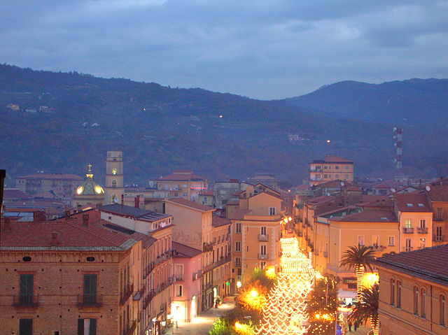

Vallo della Lucania
- Italian comune
Hiking in Vallo della Lucania
Vallo della Lucania is located in the Campania region of southern Italy, nestled within the scenic landscape of the Cilento National Park (Parco Nazionale del Cilento e Vallo di Diano). This area is renowned for its natural beauty, diverse flora and fauna, and well-preserved cultural heritage, making it an excellent destination for hiking enthusiasts. Here are some key points about hiking in Vallo della Lucania:...
- Country:
- Postal Code: 84060; 84050; 84040; 84078
- Local Dialing Code: 0974
- Licence Plate Code: SA
- Coordinates: 40° 14' 0" N, 15° 16' 0" E
- GPS tracks (wikiloc): [Link]
- AboveSeaLevel: 380 м m
- Area: 25.32 sq km
- Population: 8425
- Web site: [Link]