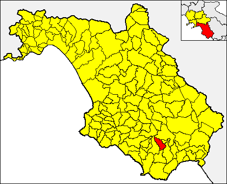
Novi Velia (Novi Velia)

- Italian comune
 Hiking in Novi Velia
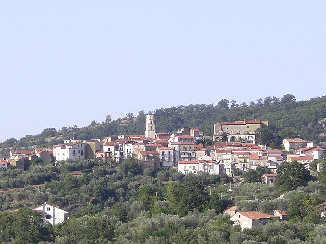
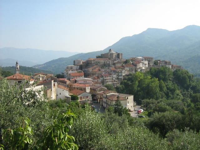
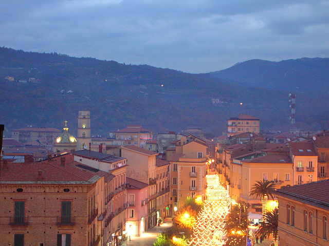
Novi Velia is a charming town located in the Cilento region of southern Italy, known for its beautiful landscapes and opportunities for hiking. Nestled in the Parco Nazionale del Cilento, Vallo di Diano e Alburni, it offers stunning views, diverse terrains, and a rich natural environment.
Hiking Trails in Novi Velia
-
Sentiero degli Dei (Path of the Gods):
- Although this famous trail is closer to the Amalfi Coast, you can access a variety of linked paths leading from Novi Velia to segments of this breathtaking trail.
- Expect panoramic views, ancient pathways, and a taste of local flora and fauna.
-
Monte Gelbison:
- This prominent peak near Novi Velia offers a more challenging hike.
- The trail leads you through lush forests and provides a rewarding view at the summit, with a sanctuary dedicated to the Virgin Mary as a highlight.
-
Valle delle Ferriere:
- A popular trail that features unique waterfalls and lush greenery.
- This hike is moderate and showcases the beauty of Cilento’s hidden landscapes.
Tips for Hiking in Novi Velia
- Best Time to Hike: Spring (April-June) and fall (September-October) offer mild temperatures and vibrant scenery. Summer can be hot, which may make hiking less enjoyable.
- Gear: Good hiking shoes, a backpack with water, snacks, and a map or GPS device are essential.
- Local Knowledge: It’s helpful to check in with local hiking groups or guides for up-to-date trail conditions or to join organized hikes.
- Respect Nature: Follow trail guidelines, stay on marked paths, and take your litter with you to preserve the beauty of the area.
What to Expect
Hiking in Novi Velia allows you to experience tranquil, lesser-known parts of Italy. You can expect a mix of challenging hikes and easier walks for all levels, as well as opportunities to encounter local wildlife, ancient ruins, and maybe even some quaint local eateries where you can taste the authentic Cilento cuisine.
Whether you are an experienced hiker or a beginner, Novi Velia provides a unique hiking experience in a beautiful natural setting. Always remember to prioritize safety and local regulations while enjoying the great outdoors!
- Country:

- Postal Code: 84060
- Local Dialing Code: 0974
- Licence Plate Code: SA
- Coordinates: 40° 13' 0" N, 15° 17' 0" E


- GPS tracks (wikiloc): [Link]
- AboveSeaLevel: 648 м m
- Area: 34.71 sq km
- Population: 2292
- Web site: http://www.comune.noviligure.al.it
- Wikipedia en: wiki(en)
- Wikipedia: wiki(it)
- Wikidata storage: Wikidata: Q81146
- Wikipedia Commons Category: [Link]
- GeoNames ID: Alt: [6541184]
- VIAF ID: Alt: [249395594]
- OSM relation ID: [40348]
- ISTAT ID: 065080
- Italian cadastre code: F967
Shares border with regions:

Laurito
- Italian comune
Hiking in Laurito
Laurito is a charming village located in the Campania region of Italy, nestled in the mountains of the Cilento and Vallo di Diano National Park. This area is known for its stunning landscapes, rich biodiversity, and historical significance....
- Country:
- Postal Code: 84050
- Local Dialing Code: 0974
- Licence Plate Code: SA
- Coordinates: 40° 10' 0" N, 15° 24' 0" E
- GPS tracks (wikiloc): [Link]
- AboveSeaLevel: 475 м m
- Area: 20.22 sq km
- Population: 782
- Web site: [Link]

Campora
- Italian comune
Hiking in Campora
Campora is a picturesque destination that offers various hiking opportunities, typically characterized by stunning landscapes, diverse flora and fauna, and sometimes challenging terrains. While specific trails and conditions may vary, here are some general aspects to consider when hiking in an area like Campora:...
- Country:
- Postal Code: 84040
- Local Dialing Code: 0974
- Licence Plate Code: SA
- Coordinates: 40° 18' 19" N, 15° 17' 32" E
- GPS tracks (wikiloc): [Link]
- AboveSeaLevel: 525 м m
- Area: 29.15 sq km
- Population: 391
- Web site: [Link]


Cannalonga
- Italian comune
Hiking in Cannalonga
Cannalonga is a lesser-known gem in the Campania region of Italy, known for its natural beauty and potential for hiking enthusiasts. Nestled in the Cilento and Vallo di Diano National Park, this area offers a variety of hiking trails that cater to different skill levels....
- Country:
- Postal Code: 84040
- Local Dialing Code: 0974
- Licence Plate Code: SA
- Coordinates: 40° 15' 0" N, 15° 18' 0" E
- GPS tracks (wikiloc): [Link]
- AboveSeaLevel: 570 м m
- Area: 17.75 sq km
- Population: 1040
- Web site: [Link]
Ceraso
- Italian comune
Hiking in Ceraso
Ceraso is a charming town located in the Campania region of southern Italy, nestled in the Cilento area. Known for its picturesque landscapes, Ceraso offers a variety of hiking opportunities that cater to different skill levels. Here are some key points about hiking in Ceraso:...
- Country:
- Postal Code: 84052
- Local Dialing Code: 0974
- Licence Plate Code: SA
- Coordinates: 40° 12' 0" N, 15° 15' 0" E
- GPS tracks (wikiloc): [Link]
- AboveSeaLevel: 340 м m
- Area: 46.46 sq km
- Population: 2310
- Web site: [Link]


Cuccaro Vetere
- Italian comune
Hiking in Cuccaro Vetere
Cuccaro Vetere is a charming village located in the Cilento and Vallo di Diano National Park in the Campania region of southern Italy. The area is known for its beautiful landscapes, rich biodiversity, and numerous hiking trails that cater to a range of skill levels. Here are some key points about hiking in Cuccaro Vetere:...
- Country:
- Postal Code: 84050
- Local Dialing Code: 0974
- Licence Plate Code: SA
- Coordinates: 40° 10' 0" N, 15° 19' 0" E
- GPS tracks (wikiloc): [Link]
- AboveSeaLevel: 629 м m
- Area: 17.66 sq km
- Population: 566
- Web site: [Link]
Futani
- Italian comune
Hiking in Futani
Futani, often known for its beautiful landscapes and serene environments, offers a variety of hiking opportunities for both novice and experienced hikers. Here’s an overview of what you can expect when hiking in this region:...
- Country:
- Postal Code: 84050
- Local Dialing Code: 0974-953012
- Licence Plate Code: SA
- Coordinates: 40° 9' 6" N, 15° 19' 20" E
- GPS tracks (wikiloc): [Link]
- AboveSeaLevel: 431 м m
- Area: 14.85 sq km
- Population: 1170
- Web site: [Link]


Laurino
- Italian comune
Hiking in Laurino
Laurino is a charming village located in the Cilento region of Campania, Italy, known for its stunning natural landscapes and rich cultural heritage. Hiking in and around Laurino offers a variety of beautiful trails that cater to different skill levels, allowing you to explore the diverse terrain, including valleys, hills, and forests....
- Country:
- Postal Code: 84057
- Local Dialing Code: 0974
- Licence Plate Code: SA
- Coordinates: 40° 20' 0" N, 15° 20' 0" E
- GPS tracks (wikiloc): [Link]
- AboveSeaLevel: 531 м m
- Area: 70.46 sq km
- Population: 1475
- Web site: [Link]


Montano Antilia
- Italian comune
Hiking in Montano Antilia
Montano Antilia is a charming town located in the Campania region of Italy, surrounded by the majestic landscapes of the Cilento National Park. This area is known for its rugged terrain, lush greenery, and stunning coastal views, making it an excellent destination for hiking enthusiasts....
- Country:
- Postal Code: 84060
- Local Dialing Code: 0974
- Licence Plate Code: SA
- Coordinates: 40° 9' 43" N, 15° 22' 0" E
- GPS tracks (wikiloc): [Link]
- AboveSeaLevel: 700 м m
- Area: 33.44 sq km
- Population: 2019
- Web site: [Link]

Rofrano
- Italian comune
Hiking in Rofrano
Rofrano, a picturesque village in the Campania region of southern Italy, is surrounded by the stunning landscapes of the Cilento and Vallo di Diano National Park. This area is rich in natural beauty, offering a variety of hiking opportunities suitable for different skill levels....
- Country:
- Postal Code: 84070
- Local Dialing Code: 0974
- Licence Plate Code: SA
- Coordinates: 40° 13' 0" N, 15° 26' 0" E
- GPS tracks (wikiloc): [Link]
- AboveSeaLevel: 450 м m
- Area: 63.59 sq km
- Population: 1509
- Web site: [Link]

Vallo della Lucania
- Italian comune
Hiking in Vallo della Lucania
Vallo della Lucania is located in the Campania region of southern Italy, nestled within the scenic landscape of the Cilento National Park (Parco Nazionale del Cilento e Vallo di Diano). This area is renowned for its natural beauty, diverse flora and fauna, and well-preserved cultural heritage, making it an excellent destination for hiking enthusiasts. Here are some key points about hiking in Vallo della Lucania:...
- Country:
- Postal Code: 84060; 84050; 84040; 84078
- Local Dialing Code: 0974
- Licence Plate Code: SA
- Coordinates: 40° 14' 0" N, 15° 16' 0" E
- GPS tracks (wikiloc): [Link]
- AboveSeaLevel: 380 м m
- Area: 25.32 sq km
- Population: 8425
- Web site: [Link]