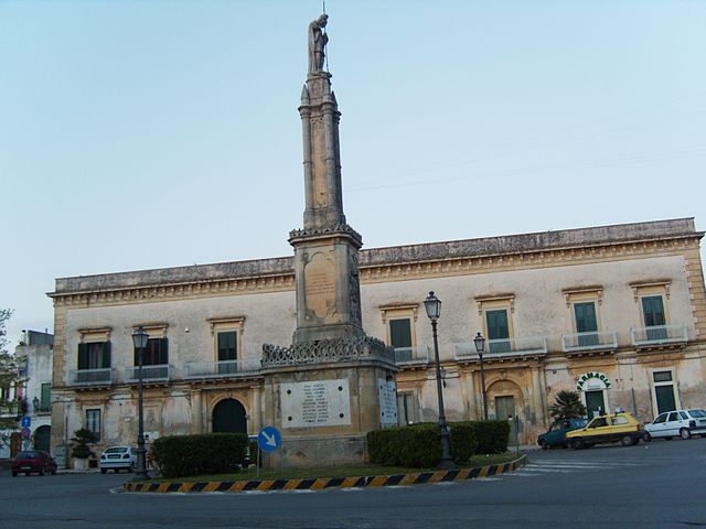
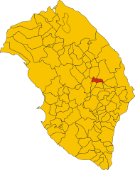
Cannole (Cannole)
.svg)
- Italian comune
 Hiking in Cannole
Cannole is a small, charming town located in the Puglia region of Italy, known for its beautiful landscapes, rolling hills, and proximity to various natural attractions. Hiking in and around Cannole offers a wonderful opportunity to explore the stunning countryside, characterized by olive groves, vineyards, and fragrant Mediterranean vegetation.
Hiking Trails and Areas:
-
Cave of Bauxite: Just a short drive from Cannole, this former bauxite quarry is now a unique natural site with striking red and green colors. There are trails around the area that allow you to explore the paths leading to the stunning lake that has formed in the quarry.
-
Foresta di Celsi: Located nearby, this forest offers several hiking trails. You can walk through beautiful oak and pine woodlands, with opportunities to enjoy observing local flora and fauna.
-
Coastal Trails: A bit of a drive will take you to the Adriatic coast, where you can find scenic coastal trails. The coastline around Puglia is known for its dramatic cliffs and crystal-clear waters, perfect for combining hiking with beautiful views.
-
Altopiano delle Murge: Not far from Cannole, this plateau offers diverse hiking opportunities, with routes that take you through ancient villages, agricultural landscapes, and breathtaking panoramic views.
-
Local Olive Groves: Many local farmers welcome hikers to navigate through their olive groves. This can be a great way to experience the region's agricultural culture and perhaps even participate in olive oil tasting after your hike.
Tips for Hiking in Cannole:
- Footwear: Wear sturdy hiking shoes with good traction, as some trails can be rocky and uneven.
- Hydration: Bring plenty of water, especially during the warmer months, as some trails can be remote.
- Timing: The best times to hike in this region are during the spring (April to June) and fall (September to October) when the weather is mild.
- Maps and Guides: It can be helpful to have a local hiking map or guidebook, as well as a GPS device to help you navigate the trails.
- Respect Nature: Always follow "Leave No Trace" principles to preserve the natural beauty of the area.
Conclusion:
Hiking in Cannole offers a blend of natural beauty, cultural immersion, and the opportunity for outdoor recreation. Whether you're a seasoned hiker or a beginner, there are trails and landscapes to enjoy while taking in the stunning sights of the Puglia countryside.
- Country:

- Postal Code: 73020
- Local Dialing Code: 0836
- Licence Plate Code: LE
- Coordinates: 40° 9' 58" N, 18° 21' 55" E


- GPS tracks (wikiloc): [Link]
- AboveSeaLevel: 105 м m
- Area: 20.35 sq km
- Population: 1680
- Web site: http://www.comune.cannole.le.it/
- Wikipedia en: wiki(en)
- Wikipedia: wiki(it)
- Wikidata storage: Wikidata: Q52121
- Wikipedia Commons Category: [Link]
- Freebase ID: [/m/0fzyw6]
- GeoNames ID: Alt: [6540755]
- OSM relation ID: [40311]
- ISTAT ID: 075012
- Italian cadastre code: B616
Shares border with regions:

Bagnolo del Salento
- Italian comune
Hiking in Bagnolo del Salento
Bagnolo del Salento is a charming village located in the Salento region of southern Italy. It offers a mix of cultural experiences and beautiful landscapes, making it a lovely destination for hiking enthusiasts....
- Country:
- Postal Code: 73020
- Local Dialing Code: 0836
- Licence Plate Code: LE
- Coordinates: 40° 9' 0" N, 18° 21' 0" E
- GPS tracks (wikiloc): [Link]
- AboveSeaLevel: 100 м m
- Area: 6.74 sq km
- Population: 1821
- Web site: [Link]


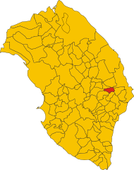
Carpignano Salentino
- Italian comune
Hiking in Carpignano Salentino
Carpignano Salentino is a charming village located in the Apulia region of Italy, known for its scenic beauty and rich cultural heritage. Hiking in this area offers a wonderful opportunity to experience the picturesque landscapes, traditional stone architecture, and the stunning Mediterranean coastline....
- Country:
- Postal Code: 73020
- Local Dialing Code: 0836
- Licence Plate Code: LE
- Coordinates: 40° 11' 49" N, 18° 20' 18" E
- GPS tracks (wikiloc): [Link]
- AboveSeaLevel: 76 м m
- Area: 48.99 sq km
- Population: 3753
- Web site: [Link]

Castrignano de' Greci
- Italian comune
Hiking in Castrignano de' Greci
Castrignano de' Greci is a small town located in the Apulia region of southern Italy, known for its charming historical architecture and beautiful natural surroundings. While it may not be as famous as some other hiking destinations in Italy, it offers some lovely opportunities for hiking enthusiasts....
- Country:
- Postal Code: 73020
- Local Dialing Code: 0836
- Licence Plate Code: LE
- Coordinates: 40° 12' 0" N, 18° 18' 0" E
- GPS tracks (wikiloc): [Link]
- AboveSeaLevel: 90 м m
- Area: 9.62 sq km
- Population: 3919
- Web site: [Link]

Otranto
- Italian comune
Hiking in Otranto
Otranto, a stunning coastal town in the Puglia region of Italy, offers a variety of hiking opportunities that showcase its breathtaking landscapes, rich history, and vibrant Mediterranean culture. Here are some key points to consider when planning a hiking adventure in and around Otranto:...
- Country:
- Postal Code: 73028
- Local Dialing Code: 0836
- Licence Plate Code: LE
- Coordinates: 40° 9' 0" N, 18° 29' 0" E
- GPS tracks (wikiloc): [Link]
- AboveSeaLevel: 15 м m
- Area: 77.2 sq km
- Population: 5799
- Web site: [Link]

Palmariggi
- Italian comune
Hiking in Palmariggi
Palmariggi is a small village located in the province of Lecce in the Apulia region of Italy. While it may not be as well-known as some larger hiking destinations, it offers beautiful landscapes and opportunities for exploration, particularly for those interested in experiencing the natural beauty and local culture of southern Italy....
- Country:
- Postal Code: 73020
- Local Dialing Code: 0836
- Licence Plate Code: LE
- Coordinates: 40° 8' 0" N, 18° 23' 0" E
- GPS tracks (wikiloc): [Link]
- AboveSeaLevel: 99 м m
- Area: 8.97 sq km
- Population: 1495
- Web site: [Link]