canton of Écueillé (canton d'Écueillé)
- canton of France (until March 2015)
- Country:

- Capital: Écueillé
- Coordinates: 47° 5' 6" N, 1° 20' 50" E


- GPS tracks (wikiloc): [Link]
- Wikidata storage: Wikidata: Q972818
- Wikipedia Commons Category: [Link]
- INSEE canton code: [3610]
Includes regions:
Selles-sur-Nahon
- commune in Indre, France
- Country:
- Postal Code: 36180
- Coordinates: 47° 1' 0" N, 1° 26' 52" E
- GPS tracks (wikiloc): [Link]
- Area: 6.77 sq km
- Population: 73


Pellevoisin
- commune in Indre, France
- Country:
- Postal Code: 36180
- Coordinates: 46° 59' 1" N, 1° 24' 51" E
- GPS tracks (wikiloc): [Link]
- Area: 25.62 sq km
- Population: 776

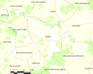
Gehée
- commune in Indre, France
- Country:
- Postal Code: 36240
- Coordinates: 47° 2' 48" N, 1° 30' 7" E
- GPS tracks (wikiloc): [Link]
- Area: 22.75 sq km
- Population: 261


Frédille
- commune in Indre, France
- Country:
- Postal Code: 36180
- Coordinates: 47° 0' 8" N, 1° 28' 49" E
- GPS tracks (wikiloc): [Link]
- Area: 6.31 sq km
- Population: 72


Heugnes
- commune in Indre, France
- Country:
- Postal Code: 36180
- Coordinates: 47° 0' 43" N, 1° 24' 32" E
- GPS tracks (wikiloc): [Link]
- AboveSeaLevel: 167.0 м m
- Area: 42.17 sq km
- Population: 401
- Web site: [Link]

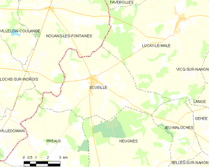
Écueillé
- commune in Indre, France
- Country:
- Postal Code: 36240
- Coordinates: 47° 5' 3" N, 1° 20' 47" E
- GPS tracks (wikiloc): [Link]
- Area: 34.9 sq km
- Population: 1286
- Web site: [Link]


Jeu-Maloches
- commune in Indre, France
- Country:
- Postal Code: 36240
- Coordinates: 47° 2' 14" N, 1° 27' 29" E
- GPS tracks (wikiloc): [Link]
- Area: 12.73 sq km
- Population: 132


Villegouin
- commune in Indre, France
- Country:
- Postal Code: 36500
- Coordinates: 46° 57' 51" N, 1° 22' 23" E
- GPS tracks (wikiloc): [Link]
- Area: 24.03 sq km
- Population: 346


Préaux
- commune in Indre, France
- Country:
- Postal Code: 36240
- Coordinates: 47° 1' 16" N, 1° 17' 33" E
- GPS tracks (wikiloc): [Link]
- Area: 32.54 sq km
- Population: 161
- Web site: [Link]