Heugnes (Heugnes)

- commune in Indre, France
- Country:

- Postal Code: 36180
- Coordinates: 47° 0' 43" N, 1° 24' 32" E


- GPS tracks (wikiloc): [Link]
- AboveSeaLevel: 167.0 м m
- Area: 42.17 sq km
- Population: 401
- Web site: http://www.heugnes.fr
- Wikipedia en: wiki(en)
- Wikipedia: wiki(fr)
- Wikidata storage: Wikidata: Q1141119
- Wikipedia Commons Category: [Link]
- Freebase ID: [/m/03nvb6q]
- GeoNames ID: Alt: [3013528]
- SIREN number: [213600869]
- BnF ID: [15257390j]
- PACTOLS thesaurus ID: [pcrt0gPDnvxbJ9]
- Digital Atlas of the Roman Empire ID: [16314]
- INSEE municipality code: 36086
Shares border with regions:
Selles-sur-Nahon
- commune in Indre, France
- Country:
- Postal Code: 36180
- Coordinates: 47° 1' 0" N, 1° 26' 52" E
- GPS tracks (wikiloc): [Link]
- Area: 6.77 sq km
- Population: 73


Pellevoisin
- commune in Indre, France
- Country:
- Postal Code: 36180
- Coordinates: 46° 59' 1" N, 1° 24' 51" E
- GPS tracks (wikiloc): [Link]
- Area: 25.62 sq km
- Population: 776

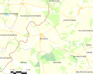
Écueillé
- commune in Indre, France
- Country:
- Postal Code: 36240
- Coordinates: 47° 5' 3" N, 1° 20' 47" E
- GPS tracks (wikiloc): [Link]
- Area: 34.9 sq km
- Population: 1286
- Web site: [Link]


Jeu-Maloches
- commune in Indre, France
- Country:
- Postal Code: 36240
- Coordinates: 47° 2' 14" N, 1° 27' 29" E
- GPS tracks (wikiloc): [Link]
- Area: 12.73 sq km
- Population: 132


Villegouin
- commune in Indre, France
- Country:
- Postal Code: 36500
- Coordinates: 46° 57' 51" N, 1° 22' 23" E
- GPS tracks (wikiloc): [Link]
- Area: 24.03 sq km
- Population: 346


Préaux
- commune in Indre, France
- Country:
- Postal Code: 36240
- Coordinates: 47° 1' 16" N, 1° 17' 33" E
- GPS tracks (wikiloc): [Link]
- Area: 32.54 sq km
- Population: 161
- Web site: [Link]