Écueillé (Écueillé)

- commune in Indre, France
- Country:

- Postal Code: 36240
- Coordinates: 47° 5' 3" N, 1° 20' 47" E


- GPS tracks (wikiloc): [Link]
- Area: 34.9 sq km
- Population: 1286
- Web site: http://ecueille.fr
- Wikipedia en: wiki(en)
- Wikipedia: wiki(fr)
- Wikidata storage: Wikidata: Q273736
- Wikipedia Commons Category: [Link]
- Freebase ID: [/m/03nvbvn]
- GeoNames ID: Alt: [3020405]
- SIREN number: [213600695]
- BnF ID: [15257373z]
- INSEE municipality code: 36069
Shares border with regions:


Luçay-le-Mâle
- commune in Indre, France
- Country:
- Postal Code: 36360
- Coordinates: 47° 7' 48" N, 1° 26' 29" E
- GPS tracks (wikiloc): [Link]
- Area: 68.08 sq km
- Population: 1385
- Web site: [Link]


Heugnes
- commune in Indre, France
- Country:
- Postal Code: 36180
- Coordinates: 47° 0' 43" N, 1° 24' 32" E
- GPS tracks (wikiloc): [Link]
- AboveSeaLevel: 167.0 м m
- Area: 42.17 sq km
- Population: 401
- Web site: [Link]


Nouans-les-Fontaines
- commune in Indre-et-Loire, France
- Country:
- Postal Code: 37460
- Coordinates: 47° 8' 10" N, 1° 17' 54" E
- GPS tracks (wikiloc): [Link]
- Area: 63.31 sq km
- Population: 770


Jeu-Maloches
- commune in Indre, France
- Country:
- Postal Code: 36240
- Coordinates: 47° 2' 14" N, 1° 27' 29" E
- GPS tracks (wikiloc): [Link]
- Area: 12.73 sq km
- Population: 132


Préaux
- commune in Indre, France
- Country:
- Postal Code: 36240
- Coordinates: 47° 1' 16" N, 1° 17' 33" E
- GPS tracks (wikiloc): [Link]
- Area: 32.54 sq km
- Population: 161
- Web site: [Link]

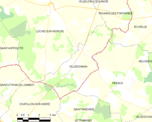
Villedômain
- commune in Indre-et-Loire, France
- Country:
- Postal Code: 37110
- Coordinates: 47° 3' 10" N, 1° 15' 21" E
- GPS tracks (wikiloc): [Link]
- Area: 16.47 sq km
- Population: 118
- Web site: [Link]