canton of Aix-en-Provence-Nord-Est (canton d'Aix-en-Provence-Nord-Est)
- canton of France (until March 2015)
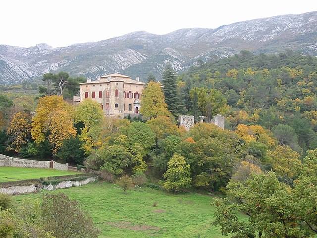
 Hiking in canton of Aix-en-Provence-Nord-Est
Canton d'Aix-en-Provence-Nord-Est, located in the Bouches-du-Rhône department in southern France, offers a fantastic setting for hiking enthusiasts. The region is characterized by its stunning landscapes that encompass rolling hills, vineyards, olive groves, and picturesque villages, along with a diverse range of flora and fauna.
Key Hiking Areas and Trails:
-
Luberon Regional Nature Park: Just north of Aix-en-Provence, this park features a range of trails that traverse dramatic landscapes, including limestone ridges and lush valleys. Popular hikes include the trails around the villages of Gordes and Roussillon, known for their ochre cliffs.
-
Montagne Sainte-Victoire: A prominent landmark near Aix-en-Provence, this mountain offers numerous trails that provide breathtaking views of the surrounding landscape. The main trail to the summit is well-marked and takes you through rocky terrain, with various paths leading to different viewpoints.
-
The Calanques: Although slightly south of the canton, the Calanques National Park is a must-see for hikers visiting the area. The dramatic cliffs and azure waters make for stunning scenery, with trails that allow you to explore the rugged coastline and hidden coves.
-
Vignoble de Sainte-Victoire: For those interested in combining hiking with wine tasting, the trails through the vineyards near the Montagne Sainte-Victoire offer beautiful views and the opportunity to stop at local wineries.
Tips for Hiking in the Region:
-
Weather: The Mediterranean climate means warm summers and mild winters. It's best to hike in the spring or fall when temperatures are more moderate. Always check the weather forecast before heading out.
-
Trail Markers: Many trails in the region are well-marked with signs indicating difficulty levels. Familiarize yourself with the trail colors and symbols (such as GR for Grande Randonnée routes).
-
Safety: Bring plenty of water, sunscreen, and snacks. Some trails can be exposed, so it’s important to stay hydrated and protected from the sun.
-
Local Regulations: Be aware of local wildlife and environmental regulations. Stay on marked trails to protect the natural habitat.
-
Guided Tours: If you're new to hiking or the area, consider joining a guided tour to get insights on the local ecology and history of the region.
Hiking in Canton d'Aix-en-Provence-Nord-Est offers a delightful combination of natural beauty, cultural heritage, and outdoor adventure. Enjoy your hike!
- Country:

- Capital: Aix-en-Provence
- Coordinates: 43° 31' 52" N, 5° 27' 14" E


- GPS tracks (wikiloc): [Link]
- Wikidata storage: Wikidata: Q1533801
- INSEE canton code: [1301]
Includes regions:


Venelles
- commune in Bouches-du-Rhône, France
Hiking in Venelles
Venelles, located in the Provence-Alpes-Côte d'Azur region of France, offers a variety of beautiful landscapes perfect for hiking enthusiasts. Here's a general overview of what you can expect while hiking in and around Venelles:...
- Country:
- Postal Code: 13770
- Coordinates: 43° 35' 54" N, 5° 28' 57" E
- GPS tracks (wikiloc): [Link]
- Area: 20.54 sq km
- Population: 8352
- Web site: [Link]


Le Tholonet
- commune in Bouches-du-Rhône, France
Hiking in Le Tholonet
Le Tholonet is a picturesque village located near Aix-en-Provence in the southeastern part of France. It offers some beautiful hiking opportunities, with trails that showcase stunning views of the surrounding landscape, including the iconic Mont Sainte-Victoire, which has been a muse for many artists, including Cézanne....
- Country:
- Postal Code: 13100
- Coordinates: 43° 31' 18" N, 5° 30' 40" E
- GPS tracks (wikiloc): [Link]
- Area: 10.82 sq km
- Population: 2376


Saint-Marc-Jaumegarde
- commune in Bouches-du-Rhône, France
Hiking in Saint-Marc-Jaumegarde
Saint-Marc-Jaumegarde is a charming commune located near Aix-en-Provence in the Provence-Alpes-Côte d'Azur region of France. It offers beautiful landscapes that are perfect for hiking enthusiasts. Here's what you should know about hiking in this area:...
- Country:
- Postal Code: 13100
- Coordinates: 43° 32' 51" N, 5° 31' 27" E
- GPS tracks (wikiloc): [Link]
- Area: 22.56 sq km
- Population: 1228
- Web site: [Link]

Vauvenargues
- commune in Bouches-du-Rhône, France
Hiking in Vauvenargues
Vauvenargues, located in the Bouches-du-Rhône department in Provence, France, is a picturesque destination for hiking enthusiasts. Nestled at the foot of the iconic Mont Sainte-Victoire, this area offers stunning landscapes, diverse flora and fauna, and a variety of hiking trails suitable for all levels....
- Country:
- Postal Code: 13126
- Coordinates: 43° 33' 19" N, 5° 36' 10" E
- GPS tracks (wikiloc): [Link]
- Area: 54.31 sq km
- Population: 1023