Vauvenargues (Vauvenargues)

- commune in Bouches-du-Rhône, France
 Hiking in Vauvenargues
Vauvenargues, located in the Bouches-du-Rhône department in Provence, France, is a picturesque destination for hiking enthusiasts. Nestled at the foot of the iconic Mont Sainte-Victoire, this area offers stunning landscapes, diverse flora and fauna, and a variety of hiking trails suitable for all levels.
Key Highlights of Hiking in Vauvenargues:
-
Mont Sainte-Victoire: The most famous landmark in the area, Mont Sainte-Victoire towers at 1,011 meters (3,319 feet) and provides several trails that vary in difficulty. The routes tend to be well-marked, offering options for both seasoned hikers and beginners.
-
Scenic Views: Many trails in the region reward hikers with breathtaking panoramic views of the surrounding valleys, vineyards, and the distant Mediterranean Sea. Don't forget your camera, especially near the summit of Mont Sainte-Victoire.
-
Flora and Fauna: The region is rich in biodiversity. As you hike, you'll encounter various Mediterranean plants, including aromatic herbs and native trees. Birdwatchers can also spot various species, adding to the area's natural charm.
-
Historical Sites: The trails around Vauvenargues often take you past interesting historical landmarks. The village itself is known for the Château de Vauvenargues, which was once the home of the artist Pablo Picasso.
-
Trail Conditions: Most trails are well-maintained, but some can be steep or rocky, particularly those leading to the summit of Mont Sainte-Victoire. Make sure to wear appropriate footwear and check trail conditions before you set out.
-
Best Times to Hike: The ideal time for hiking in Vauvenargues is during the spring (April to June) and fall (September to October) when the weather is mild, and the landscapes are vibrant. Summer can be quite hot, so early morning or late afternoon hikes are advisable.
-
Safety Tips: Always carry enough water, wear sun protection, and inform someone about your hiking plans. While many trails are popular, it is wise to be prepared for sudden weather changes in the region.
Suggested Hiking Routes:
-
Circuit des Cretes: A loop around Mont Sainte-Victoire that offers various vantage points and is perfect for a half-day hike.
-
Sentier des Baou: A slightly challenging path that showcases the rugged terrain and unique rock formations of the area, providing spectacular views along the way.
-
From Vauvenargues to Mont Sainte-Victoire: A direct trail leading to the summit of Mont Sainte-Victoire, ideal for those looking for a rewarding ascent.
Overall, hiking in Vauvenargues presents a wonderful opportunity to immerse yourself in the natural beauty of Provence while enjoying the rich cultural heritage of the region. Be sure to plan ahead, stay safe, and enjoy your adventures!
- Country:

- Postal Code: 13126
- Coordinates: 43° 33' 19" N, 5° 36' 10" E


- GPS tracks (wikiloc): [Link]
- Area: 54.31 sq km
- Population: 1023
- Wikipedia en: wiki(en)
- Wikipedia: wiki(fr)
- Wikidata storage: Wikidata: Q816841
- Wikipedia Commons Category: [Link]
- Freebase ID: [/m/02r1p8s]
- GeoNames ID: Alt: [6427094]
- SIREN number: [211301114]
- BnF ID: [15247393c]
- VIAF ID: Alt: [248770787]
- INSEE municipality code: 13111
Shares border with regions:

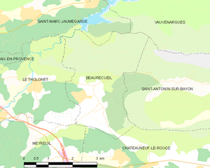
Beaurecueil
- commune in Bouches-du-Rhône, France
Hiking in Beaurecueil
Beaurecueil is a charming village located near Aix-en-Provence in the Provence-Alpes-Côte d'Azur region of southern France. It offers several hiking opportunities, surrounded by beautiful natural landscapes that include rolling hills, forests, and panoramic views of the Sainte-Victoire Mountain, which is renowned for its striking beauty and significance in the works of painter Paul Cézanne....
- Country:
- Postal Code: 13100
- Coordinates: 43° 30' 38" N, 5° 32' 40" E
- GPS tracks (wikiloc): [Link]
- Area: 9.86 sq km
- Population: 578

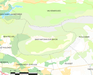
Saint-Antonin-sur-Bayon
- commune in Bouches-du-Rhône, France
Hiking in Saint-Antonin-sur-Bayon
Saint-Antonin-sur-Bayon, located in the Provence-Alpes-Côte d'Azur region of France, is surrounded by stunning natural landscapes, making it an ideal destination for hiking enthusiasts. Here are some highlights and tips for hiking in this beautiful area:...
- Country:
- Postal Code: 13100
- Coordinates: 43° 31' 6" N, 5° 34' 58" E
- GPS tracks (wikiloc): [Link]
- Area: 17.57 sq km
- Population: 124
- Web site: [Link]


Peyrolles-en-Provence
- commune in Bouches-du-Rhône, France
Hiking in Peyrolles-en-Provence
Peyrolles-en-Provence, located in the Bouches-du-Rhône department in southern France, offers a variety of scenic hiking opportunities, characterized by beautiful landscapes, historical sites, and a pleasant Mediterranean climate....
- Country:
- Postal Code: 13860
- Coordinates: 43° 38' 44" N, 5° 35' 6" E
- GPS tracks (wikiloc): [Link]
- Area: 34.9 sq km
- Population: 4976
- Web site: [Link]


Jouques
- commune in Bouches-du-Rhône, France
Hiking in Jouques
Jouques is a delightful commune in the Bouches-du-Rhône department in the Provence-Alpes-Côte d'Azur region of southern France. The area offers a range of hiking opportunities, characterized by its picturesque landscapes, charming villages, and diverse flora and fauna....
- Country:
- Postal Code: 13490
- Coordinates: 43° 38' 13" N, 5° 38' 12" E
- GPS tracks (wikiloc): [Link]
- Area: 80.35 sq km
- Population: 4393

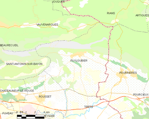
Puyloubier
- commune in Bouches-du-Rhône, France
Hiking in Puyloubier
Puyloubier is a charming commune located in the Provence-Alpes-Côte d'Azur region of southern France, nestled at the foot of the Sainte-Victoire Mountain. Known for its beautiful landscapes and diverse ecosystems, it offers a variety of hiking opportunities for both novice and experienced hikers....
- Country:
- Postal Code: 13114
- Coordinates: 43° 31' 30" N, 5° 40' 37" E
- GPS tracks (wikiloc): [Link]
- Area: 40.85 sq km
- Population: 1799
- Web site: [Link]


Meyrargues
- commune in Bouches-du-Rhône, France
Hiking in Meyrargues
Meyrargues is a picturesque commune located in the Provence-Alpes-Côte d'Azur region of France, surrounded by beautiful natural landscapes perfect for hiking. Here are some highlights and tips for hiking in and around Meyrargues:...
- Country:
- Postal Code: 13650
- Coordinates: 43° 38' 8" N, 5° 31' 42" E
- GPS tracks (wikiloc): [Link]
- Area: 41.67 sq km
- Population: 3745
- Web site: [Link]


Saint-Marc-Jaumegarde
- commune in Bouches-du-Rhône, France
Hiking in Saint-Marc-Jaumegarde
Saint-Marc-Jaumegarde is a charming commune located near Aix-en-Provence in the Provence-Alpes-Côte d'Azur region of France. It offers beautiful landscapes that are perfect for hiking enthusiasts. Here's what you should know about hiking in this area:...
- Country:
- Postal Code: 13100
- Coordinates: 43° 32' 51" N, 5° 31' 27" E
- GPS tracks (wikiloc): [Link]
- Area: 22.56 sq km
- Population: 1228
- Web site: [Link]


Rians
- commune in Var, France
Hiking in Rians
Rians, located in the Var department of the Provence-Alpes-Côte d'Azur region in southeastern France, offers a picturesque setting for hiking enthusiasts. Nestled in the heart of Provence, Rians is surrounded by the beautiful landscapes of rolling hills, vineyards, and lush forests, making it an excellent destination for outdoor activities....
- Country:
- Postal Code: 83560
- Coordinates: 43° 36' 25" N, 5° 45' 26" E
- GPS tracks (wikiloc): [Link]
- AboveSeaLevel: 455 м m
- Area: 96.87 sq km
- Population: 4254
- Web site: [Link]