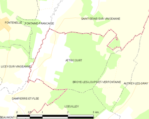
canton of Autrey-lès-Gray (canton d'Autrey-lès-Gray)
- canton of France (until March 2015)
 Hiking in canton of Autrey-lès-Gray
Canton d'Autrey-lès-Gray, located in the Haute-Saône department in the Bourgogne-Franche-Comté region of eastern France, offers a lovely backdrop for hiking enthusiasts. This area is characterized by rolling hills, forests, and charming villages which provide a serene and picturesque environment perfect for outdoor activities.
Hiking Trails
-
Forest Trails: The region is surrounded by several forests that are crisscrossed with walking paths, allowing hikers to explore the rich flora and fauna of the area. Look for trails that lead through the forests, where you might spot wildlife or enjoy the tranquility of nature.
-
Riverside Walks: The Saône River is nearby, and trails along the riverbanks offer beautiful views and a chance to see various bird species. These paths can be ideal for leisurely strolls or more extended hikes.
-
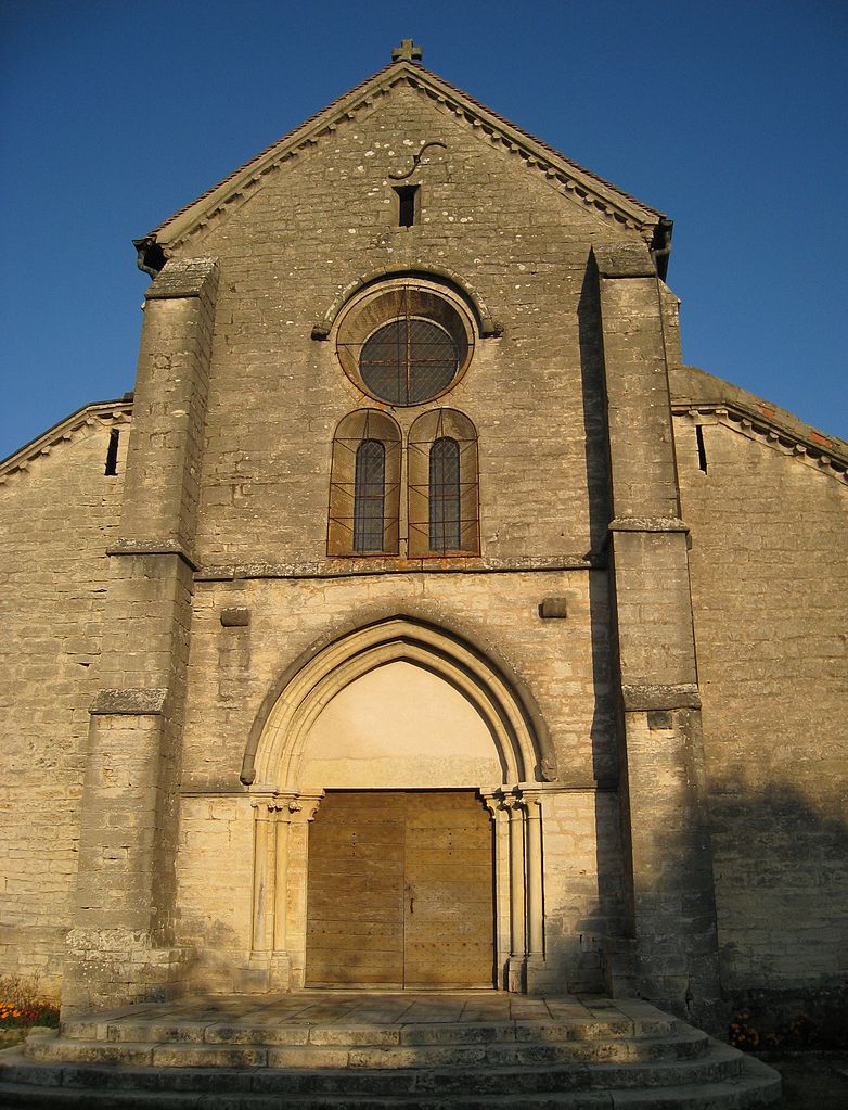
Historic Paths: Some trails may take you through or near small villages with historical significance. Exploring these areas can provide insights into the local culture and history.
Best Time to Hike
- Spring and Fall: These seasons are generally the best times for hiking in this region. The weather is usually mild, and the landscapes are particularly beautiful with blooming flowers in spring and autumn foliage.
Tips for Hiking in Canton d'Autrey-lès-Gray
- Preparation: Always check the weather forecast before heading out, as conditions can change rapidly.
- Equipment: Wear suitable hiking footwear and carry enough water and snacks. A map or a GPS device can be helpful for navigating the trails.
- Respect Nature: Follow the principles of Leave No Trace, ensuring that you leave the environment as you found it.
Local Recommendations
- Guided Tours: If you're unfamiliar with the area or want to enhance your experience, consider joining a guided hiking tour that can provide deeper insights into the local ecology and history.
Whether you're looking for a peaceful walk or a challenging hike, Canton d'Autrey-lès-Gray has options to offer all experience levels. Enjoy the beauty of this lovely corner of France!
- Country:

- Capital: Autrey-lès-Gray
- Coordinates: 47° 29' 14" N, 6° 29' 30" E


- GPS tracks (wikiloc): [Link]
- Wikidata storage: Wikidata: Q1361498
- INSEE canton code: [7002]
Includes regions:


Écuelle
- commune in Haute-Saône, France
- Country:
- Postal Code: 70600
- Coordinates: 47° 32' 59" N, 5° 33' 2" E
- GPS tracks (wikiloc): [Link]
- Area: 5.56 sq km
- Population: 76


Rigny
- commune in Haute-Saône, France
- Country:
- Postal Code: 70100
- Coordinates: 47° 28' 21" N, 5° 37' 59" E
- GPS tracks (wikiloc): [Link]
- Area: 12.72 sq km
- Population: 595
- Web site: [Link]
Nantilly
- commune in Haute-Saône, France
- Country:
- Postal Code: 70100
- Coordinates: 47° 27' 32" N, 5° 31' 37" E
- GPS tracks (wikiloc): [Link]
- Area: 10 sq km
- Population: 487

Attricourt
- commune in Haute-Saône, France
- Country:
- Postal Code: 70100
- Coordinates: 47° 29' 1" N, 5° 23' 26" E
- GPS tracks (wikiloc): [Link]
- Area: 6.08 sq km
- Population: 43

Autrey-lès-Gray
- commune in Haute-Saône, France
- Country:
- Postal Code: 70100
- Coordinates: 47° 29' 11" N, 5° 29' 27" E
- GPS tracks (wikiloc): [Link]
- Area: 32.4 sq km
- Population: 380
Auvet-et-la-Chapelotte
- commune in Haute-Saône, France
- Country:
- Postal Code: 70100
- Coordinates: 47° 30' 33" N, 5° 31' 2" E
- GPS tracks (wikiloc): [Link]
- Area: 14.43 sq km
- Population: 247
Bouhans-et-Feurg
- commune in Haute-Saône, France
- Country:
- Postal Code: 70100
- Coordinates: 47° 28' 42" N, 5° 30' 25" E
- GPS tracks (wikiloc): [Link]
- Area: 9.75 sq km
- Population: 253

Essertenne-et-Cecey
- commune in Haute-Saône, France
- Country:
- Postal Code: 70100
- Coordinates: 47° 23' 58" N, 5° 28' 36" E
- GPS tracks (wikiloc): [Link]
- Area: 11.3 sq km
- Population: 410
Chargey-lès-Gray
- commune in Haute-Saône, France
- Country:
- Postal Code: 70100
- Coordinates: 47° 29' 15" N, 5° 34' 31" E
- GPS tracks (wikiloc): [Link]
- Area: 16.56 sq km
- Population: 726
Broye-les-Loups-et-Verfontaine
- commune in Haute-Saône, France
- Country:
- Postal Code: 70100
- Coordinates: 47° 27' 51" N, 5° 25' 27" E
- GPS tracks (wikiloc): [Link]
- AboveSeaLevel: 223 м m
- Area: 7 sq km
- Population: 119
Fahy-lès-Autrey
- commune in Haute-Saône, France
- Country:
- Postal Code: 70100
- Coordinates: 47° 30' 46" N, 5° 28' 54" E
- GPS tracks (wikiloc): [Link]
- Area: 6.2 sq km
- Population: 116
Lœuilley
- commune in Haute-Saône, France
- Country:
- Postal Code: 70100
- Coordinates: 47° 27' 43" N, 5° 23' 25" E
- GPS tracks (wikiloc): [Link]
- Area: 5.67 sq km
- Population: 109
Poyans
- commune in Haute-Saône, France
- Country:
- Postal Code: 70100
- Coordinates: 47° 26' 48" N, 5° 28' 13" E
- GPS tracks (wikiloc): [Link]
- Area: 12.17 sq km
- Population: 140


Mantoche
- commune in Haute-Saône, France
- Country:
- Postal Code: 70100
- Coordinates: 47° 25' 10" N, 5° 31' 51" E
- GPS tracks (wikiloc): [Link]
- Area: 16.58 sq km
- Population: 457
- Web site: [Link]


Montureux-et-Prantigny
- commune in Haute-Saône, France
- Country:
- Postal Code: 70100
- Coordinates: 47° 30' 12" N, 5° 38' 17" E
- GPS tracks (wikiloc): [Link]
- Area: 12.18 sq km
- Population: 208


Oyrières
- commune in Haute-Saône, France
- Country:
- Postal Code: 70600
- Coordinates: 47° 31' 58" N, 5° 33' 49" E
- GPS tracks (wikiloc): [Link]
- Area: 14.03 sq km
- Population: 390


Vars
- commune in Haute-Saône, France
- Country:
- Postal Code: 70600
- Coordinates: 47° 32' 2" N, 5° 32' 0" E
- GPS tracks (wikiloc): [Link]
- Area: 16.16 sq km
- Population: 199