canton of Cadillac (canton de Cadillac)
- canton of France
- Country:

- Capital: Cadillac
- Coordinates: 44° 39' 33" N, 0° 19' 1" E


- GPS tracks (wikiloc): [Link]
- Wikidata storage: Wikidata: Q1724679
- INSEE canton code: [3317]
Includes regions:


Omet
- commune in Gironde, France
- Country:
- Postal Code: 33410
- Coordinates: 44° 39' 7" N, 0° 16' 51" E
- GPS tracks (wikiloc): [Link]
- Area: 2.62 sq km
- Population: 296

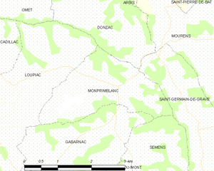
Monprimblanc
- commune in Gironde, France
- Country:
- Postal Code: 33410
- Coordinates: 44° 37' 47" N, 0° 15' 45" E
- GPS tracks (wikiloc): [Link]
- Area: 4.97 sq km
- Population: 290

Béguey
- commune in Gironde, France
- Country:
- Postal Code: 33410
- Coordinates: 44° 38' 34" N, 0° 19' 24" E
- GPS tracks (wikiloc): [Link]
- Area: 3.16 sq km
- Population: 1173
- Web site: [Link]

Cardan
- commune in Gironde, France
- Country:
- Postal Code: 33410
- Coordinates: 44° 40' 46" N, 0° 19' 21" E
- GPS tracks (wikiloc): [Link]
- Area: 4.25 sq km
- Population: 491
- Web site: [Link]


Villenave-de-Rions
- commune in Gironde, France
- Country:
- Postal Code: 33550
- Coordinates: 44° 41' 24" N, 0° 20' 17" E
- GPS tracks (wikiloc): [Link]
- Area: 2.56 sq km
- Population: 313


Laroque
- commune in Gironde, France
- Country:
- Postal Code: 33410
- Coordinates: 44° 39' 35" N, 0° 18' 16" E
- GPS tracks (wikiloc): [Link]
- Area: 2.97 sq km
- Population: 285


Capian
- commune in Gironde, France
- Country:
- Postal Code: 33550
- Coordinates: 44° 42' 39" N, 0° 19' 52" E
- GPS tracks (wikiloc): [Link]
- Area: 18.23 sq km
- Population: 703


Loupiac
- commune in Gironde, France
- Country:
- Postal Code: 33410
- Coordinates: 44° 37' 40" N, 0° 17' 53" E
- GPS tracks (wikiloc): [Link]
- AboveSeaLevel: 85 м m
- Area: 9.57 sq km
- Population: 1132
- Web site: [Link]


Cadillac
- commune in Gironde, France
- Country:
- Postal Code: 33410
- Coordinates: 44° 38' 10" N, 0° 19' 7" E
- GPS tracks (wikiloc): [Link]
- AboveSeaLevel: 92 м m
- Area: 5.44 sq km
- Population: 2761
- Web site: [Link]


Donzac
- commune in Gironde, France
- Country:
- Postal Code: 33410
- Coordinates: 44° 39' 8" N, 0° 16' 7" E
- GPS tracks (wikiloc): [Link]
- Area: 4.41 sq km
- Population: 122
- Web site: [Link]


Gabarnac
- commune in Gironde, France
- Country:
- Postal Code: 33410
- Coordinates: 44° 36' 55" N, 0° 16' 7" E
- GPS tracks (wikiloc): [Link]
- Area: 5.21 sq km
- Population: 356
- Web site: [Link]


Paillet
- commune in Gironde, France
- Country:
- Postal Code: 33550
- Coordinates: 44° 41' 8" N, 0° 21' 54" E
- GPS tracks (wikiloc): [Link]
- Area: 2.48 sq km
- Population: 1221
- Web site: [Link]

Lestiac-sur-Garonne
- commune in Gironde, France
- Country:
- Postal Code: 33550
- Coordinates: 44° 41' 35" N, 0° 22' 27" E
- GPS tracks (wikiloc): [Link]
- Area: 2.98 sq km
- Population: 578


Sainte-Croix-du-Mont
- commune in Gironde, France
- Country:
- Postal Code: 33410
- Coordinates: 44° 35' 36" N, 0° 16' 50" E
- GPS tracks (wikiloc): [Link]
- Area: 8.98 sq km
- Population: 900
- Web site: [Link]


Rions
- commune in Gironde, France
- Country:
- Postal Code: 33410
- Coordinates: 44° 39' 49" N, 0° 21' 8" E
- GPS tracks (wikiloc): [Link]
- Area: 10.65 sq km
- Population: 1570
- Web site: [Link]


Langoiran
- commune in Gironde, France
- Country:
- Postal Code: 33550
- Coordinates: 44° 42' 27" N, 0° 24' 4" E
- GPS tracks (wikiloc): [Link]
- Area: 10.14 sq km
- Population: 2215
- Web site: [Link]