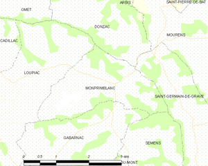
Gabarnac (Gabarnac)
- commune in Gironde, France
- Country:

- Postal Code: 33410
- Coordinates: 44° 36' 55" N, 0° 16' 7" E


- GPS tracks (wikiloc): [Link]
- Area: 5.21 sq km
- Population: 356
- Web site: http://www.gabarnac.fr
- Wikipedia en: wiki(en)
- Wikipedia: wiki(fr)
- Wikidata storage: Wikidata: Q457717
- Wikipedia Commons Category: [Link]
- Freebase ID: [/m/03nrzh_]
- GeoNames ID: Alt: [3016872]
- SIREN number: [213301765]
- BnF ID: [15256228m]
- INSEE municipality code: 33176
Shares border with regions:


Semens
- commune in Gironde, France
- Country:

- Postal Code: 33490
- Coordinates: 44° 36' 48" N, 0° 14' 20" E


- GPS tracks (wikiloc): [Link]
- Area: 3.67 sq km
- Population: 189
- Web site: [Link]


Monprimblanc
- commune in Gironde, France
- Country:

- Postal Code: 33410
- Coordinates: 44° 37' 47" N, 0° 15' 45" E


- GPS tracks (wikiloc): [Link]
- Area: 4.97 sq km
- Population: 290


Loupiac
- commune in Gironde, France
- Country:

- Postal Code: 33410
- Coordinates: 44° 37' 40" N, 0° 17' 53" E


- GPS tracks (wikiloc): [Link]
- AboveSeaLevel: 85 м m
- Area: 9.57 sq km
- Population: 1132
- Web site: [Link]


Sainte-Croix-du-Mont
- commune in Gironde, France
- Country:

- Postal Code: 33410
- Coordinates: 44° 35' 36" N, 0° 16' 50" E


- GPS tracks (wikiloc): [Link]
- Area: 8.98 sq km
- Population: 900
- Web site: [Link]
