canton of Dieulouard (canton de Dieulouard)
- canton of France (until March 2015)
- Country:

- Capital: Dieulouard
- Coordinates: 48° 55' 2" N, 6° 1' 29" E


- GPS tracks (wikiloc): [Link]
- Wikidata storage: Wikidata: Q1605660
- INSEE canton code: [5441]
Includes regions:

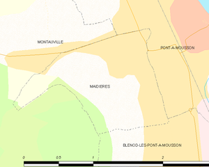
Maidières
- commune in Meurthe-et-Moselle, France
- Country:
- Postal Code: 54700
- Coordinates: 48° 53' 59" N, 6° 2' 17" E
- GPS tracks (wikiloc): [Link]
- Area: 1.81 sq km
- Population: 1526


Fey-en-Haye
- commune in Meurthe-et-Moselle, France
- Country:
- Postal Code: 54470
- Coordinates: 48° 54' 10" N, 5° 57' 42" E
- GPS tracks (wikiloc): [Link]
- Area: 7.05 sq km
- Population: 78


Villers-sous-Prény
- commune in Meurthe-et-Moselle, France
- Country:
- Postal Code: 54700
- Coordinates: 48° 56' 36" N, 5° 59' 56" E
- GPS tracks (wikiloc): [Link]
- Area: 6.17 sq km
- Population: 351

Prény
- commune in Meurthe-et-Moselle, France
- Country:
- Postal Code: 54530
- Coordinates: 48° 58' 41" N, 5° 59' 49" E
- GPS tracks (wikiloc): [Link]
- Area: 15.09 sq km
- Population: 362

Blénod-lès-Pont-à-Mousson
- commune in Meurthe-et-Moselle, France
- Country:
- Postal Code: 54700
- Coordinates: 48° 53' 0" N, 6° 2' 50" E
- GPS tracks (wikiloc): [Link]
- Area: 9.58 sq km
- Population: 4563


Pagny-sur-Moselle
- commune in Meurthe-et-Moselle, France
- Country:
- Postal Code: 54530
- Coordinates: 48° 59' 0" N, 6° 1' 17" E
- GPS tracks (wikiloc): [Link]
- Area: 11.2 sq km
- Population: 4138


Vandières
- commune in Meurthe-et-Moselle, France
- Country:
- Postal Code: 54121
- Coordinates: 48° 57' 15" N, 6° 2' 11" E
- GPS tracks (wikiloc): [Link]
- Area: 12.35 sq km
- Population: 924

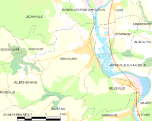
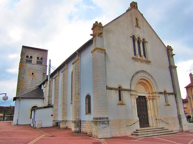
Dieulouard
- commune in Meurthe-et-Moselle, France
- Country:
- Postal Code: 54380
- Coordinates: 48° 50' 23" N, 6° 4' 11" E
- GPS tracks (wikiloc): [Link]
- Area: 17.69 sq km
- Population: 4693
- Web site: [Link]

Jezainville
- commune in Meurthe-et-Moselle, France
- Country:
- Postal Code: 54700
- Coordinates: 48° 52' 15" N, 6° 2' 28" E
- GPS tracks (wikiloc): [Link]
- Area: 18.19 sq km
- Population: 949


Norroy-lès-Pont-à-Mousson
- commune in Meurthe-et-Moselle, France
- Country:
- Postal Code: 54700
- Coordinates: 48° 56' 3" N, 6° 1' 43" E
- GPS tracks (wikiloc): [Link]
- Area: 5.89 sq km
- Population: 1223


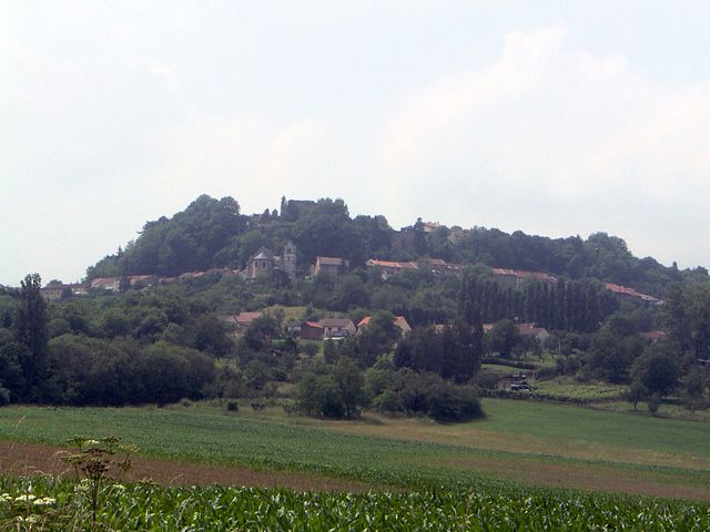
Montauville
- commune in Meurthe-et-Moselle, France
- Country:
- Postal Code: 54700
- Coordinates: 48° 54' 3" N, 6° 1' 15" E
- GPS tracks (wikiloc): [Link]
- Area: 16.19 sq km
- Population: 1086