canton of Kaysersberg (canton de Kaysersberg)
- canton of France (until March 2015)
- Country:

- Capital: Kaysersberg
- Coordinates: 48° 8' 0" N, 7° 15' 0" E


- GPS tracks (wikiloc): [Link]
- Web site: http://infokb.notrecanton.com
- Wikidata storage: Wikidata: Q588693
- INSEE canton code: [6812]
Includes regions:


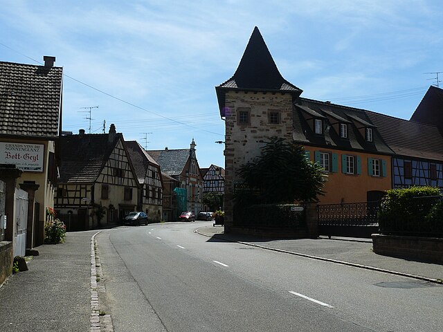
Kientzheim
- former commune in Haut-Rhin, France
- Country:
- Postal Code: 68240
- Coordinates: 48° 8' 10" N, 7° 17' 9" E
- GPS tracks (wikiloc): [Link]
- Area: 4.83 sq km
- Population: 755


Riquewihr
- commune in Haut-Rhin, France
- Country:
- Postal Code: 68340
- Local Dialing Code: 3
- Coordinates: 48° 9' 59" N, 7° 17' 49" E
- GPS tracks (wikiloc): [Link]
- Area: 17.04 sq km
- Population: 1109
- Web site: [Link]

Niedermorschwihr
- commune in Haut-Rhin, France
- Country:
- Postal Code: 68230
- Coordinates: 48° 5' 58" N, 7° 16' 27" E
- GPS tracks (wikiloc): [Link]
- Area: 3.35 sq km
- Population: 534


Mittelwihr
- commune in Haut-Rhin, France
- Country:
- Postal Code: 68630
- Coordinates: 48° 9' 3" N, 7° 19' 10" E
- GPS tracks (wikiloc): [Link]
- Area: 2.42 sq km
- Population: 836


Zellenberg
- commune in Haut-Rhin, France
- Country:
- Postal Code: 68340
- Coordinates: 48° 10' 15" N, 7° 19' 11" E
- GPS tracks (wikiloc): [Link]
- AboveSeaLevel: 374 м m
- Area: 4.96 sq km
- Population: 333

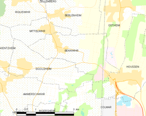
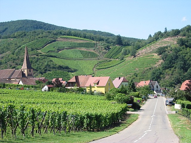
Bennwihr
- commune in Haut-Rhin, France
- Country:
- Postal Code: 68630
- Coordinates: 48° 8' 37" N, 7° 19' 31" E
- GPS tracks (wikiloc): [Link]
- Area: 6.59 sq km
- Population: 1292

Beblenheim
- commune in Haut-Rhin, France
- Country:
- Postal Code: 68980
- Coordinates: 48° 9' 30" N, 7° 19' 38" E
- GPS tracks (wikiloc): [Link]
- AboveSeaLevel: 274 м m
- Area: 5.61 sq km
- Population: 961
- Web site: [Link]


Ammerschwihr
- commune in Haut-Rhin, France
- Country:
- Postal Code: 68770
- Coordinates: 48° 7' 32" N, 7° 16' 55" E
- GPS tracks (wikiloc): [Link]
- Area: 19.66 sq km
- Population: 1791
- Web site: [Link]


Ingersheim
- commune in Haut-Rhin, France
- Country:
- Postal Code: 68040
- Coordinates: 48° 5' 41" N, 7° 18' 23" E
- GPS tracks (wikiloc): [Link]
- AboveSeaLevel: 196.326 м m
- Area: 7.44 sq km
- Population: 4641
- Web site: [Link]


Sigolsheim
- former commune in Haut-Rhin, France
- Country:
- Postal Code: 68240
- Coordinates: 48° 8' 4" N, 7° 18' 3" E
- GPS tracks (wikiloc): [Link]
- Area: 5.8 sq km
- Population: 1219


Katzenthal
- commune in Haut-Rhin, France
- Country:
- Postal Code: 68230
- Coordinates: 48° 6' 28" N, 7° 16' 56" E
- GPS tracks (wikiloc): [Link]
- AboveSeaLevel: 280 м m
- Area: 3.5 sq km
- Population: 533


Kaysersberg
- former commune in Haut-Rhin, France
- Country:
- Postal Code: 68240
- Coordinates: 48° 8' 21" N, 7° 15' 39" E
- GPS tracks (wikiloc): [Link]
- AboveSeaLevel: 240 м m
- Area: 24.82 sq km
- Population: 2703
- Web site: [Link]