
Kaysersberg (Kaysersberg)

- former commune in Haut-Rhin, France
- Country:

- Postal Code: 68240
- Coordinates: 48° 8' 21" N, 7° 15' 39" E


- GPS tracks (wikiloc): [Link]
- AboveSeaLevel: 240 м m
- Area: 24.82 sq km
- Population: 2703
- Web site: http://www.cc-kaysersberg.fr/
- Wikipedia en: wiki(en)
- Wikipedia: wiki(fr)
- Wikidata storage: Wikidata: Q83485
- Wikipedia Commons Gallery: [Link]
- Wikipedia Commons Category: [Link]
- Freebase ID: [/m/07plgy]
- Freebase ID: [/m/07plgy]
- GeoNames ID: Alt: [3011969]
- GeoNames ID: Alt: [3011969]
- BnF ID: [15271864b]
- BnF ID: [15271864b]
- VIAF ID: Alt: [159572494]
- VIAF ID: Alt: [159572494]
- GND ID: Alt: [4235954-5]
- GND ID: Alt: [4235954-5]
- archINFORM location ID: [12880]
- archINFORM location ID: [12880]
- Library of Congress authority ID: Alt: [n89652561]
- Library of Congress authority ID: Alt: [n89652561]
- MusicBrainz area ID: [26909d4d-5fe9-42b2-99d5-709ed006f35a]
- MusicBrainz area ID: [26909d4d-5fe9-42b2-99d5-709ed006f35a]
- INSEE municipality code: 68162
- INSEE municipality code: 68162
Shares border with regions:

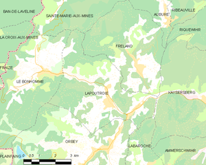
Lapoutroie
- commune in Haut-Rhin, France
- Country:
- Postal Code: 68650
- Coordinates: 48° 9' 9" N, 7° 10' 10" E
- GPS tracks (wikiloc): [Link]
- Area: 21.12 sq km
- Population: 1894
- Web site: [Link]


Labaroche
- commune in Haut-Rhin, France
- Country:
- Postal Code: 68910
- Coordinates: 48° 6' 36" N, 7° 11' 35" E
- GPS tracks (wikiloc): [Link]
- Area: 13.44 sq km
- Population: 2219
- Web site: [Link]


Kientzheim
- former commune in Haut-Rhin, France
- Country:
- Postal Code: 68240
- Coordinates: 48° 8' 10" N, 7° 17' 9" E
- GPS tracks (wikiloc): [Link]
- Area: 4.83 sq km
- Population: 755


Ribeauvillé
- commune in Haut-Rhin, France
- Country:
- Postal Code: 68150
- Coordinates: 48° 11' 43" N, 7° 19' 6" E
- GPS tracks (wikiloc): [Link]
- Area: 32.21 sq km
- Population: 4746
- Web site: [Link]


Riquewihr
- commune in Haut-Rhin, France
- Country:
- Postal Code: 68340
- Local Dialing Code: 3
- Coordinates: 48° 9' 59" N, 7° 17' 49" E
- GPS tracks (wikiloc): [Link]
- Area: 17.04 sq km
- Population: 1109
- Web site: [Link]


Mittelwihr
- commune in Haut-Rhin, France
- Country:
- Postal Code: 68630
- Coordinates: 48° 9' 3" N, 7° 19' 10" E
- GPS tracks (wikiloc): [Link]
- Area: 2.42 sq km
- Population: 836

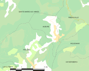
Aubure
- commune in Haut-Rhin, France
- Country:
- Postal Code: 68150
- Coordinates: 48° 11' 50" N, 7° 13' 17" E
- GPS tracks (wikiloc): [Link]
- Area: 4.9 sq km
- Population: 356
- Web site: [Link]


Ammerschwihr
- commune in Haut-Rhin, France
- Country:
- Postal Code: 68770
- Coordinates: 48° 7' 32" N, 7° 16' 55" E
- GPS tracks (wikiloc): [Link]
- Area: 19.66 sq km
- Population: 1791
- Web site: [Link]

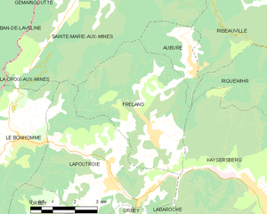
Fréland
- commune in Haut-Rhin, France
- Country:
- Postal Code: 68240
- Coordinates: 48° 10' 16" N, 7° 11' 38" E
- GPS tracks (wikiloc): [Link]
- Area: 19.74 sq km
- Population: 1367

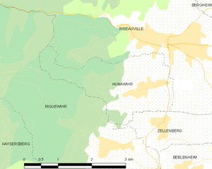
Hunawihr
- commune in Haut-Rhin, France
- Country:
- Postal Code: 68150
- Local Dialing Code: 389
- Coordinates: 48° 10' 49" N, 7° 18' 41" E
- GPS tracks (wikiloc): [Link]
- AboveSeaLevel: 686 м m
- Area: 4.81 sq km
- Population: 598
- Web site: [Link]