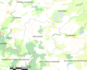
canton of La Tour-d'Auvergne (canton de La Tour-d'Auvergne)
- canton of France (until March 2015)
- Country:

- Capital: La Tour-d'Auvergne
- Coordinates: 45° 28' 56" N, 2° 40' 43" E


- GPS tracks (wikiloc): [Link]
- Wikidata storage: Wikidata: Q276470
- VIAF ID: Alt: [238804715]
- GND ID: Alt: [7550580-0]
- INSEE canton code: [6321]
Includes regions:

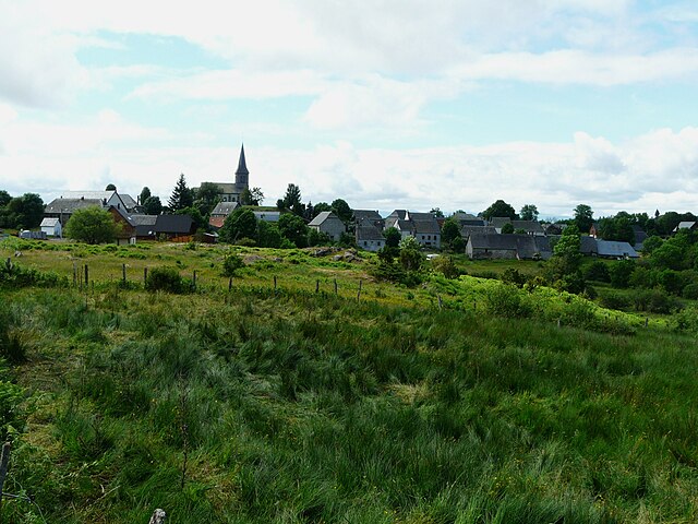
Saint-Donat
- commune in Puy-de-Dôme, France
- Country:
- Postal Code: 63680
- Coordinates: 45° 28' 9" N, 2° 43' 7" E
- GPS tracks (wikiloc): [Link]
- Area: 33.27 sq km
- Population: 224


Chastreix
- commune in Puy-de-Dôme, France
- Country:
- Postal Code: 63680
- Coordinates: 45° 30' 43" N, 2° 44' 5" E
- GPS tracks (wikiloc): [Link]
- Area: 45.12 sq km
- Population: 229
- Web site: [Link]


La Tour-d'Auvergne
- commune in Puy-de-Dôme, France
- Country:
- Postal Code: 63680
- Coordinates: 45° 32' 2" N, 2° 41' 21" E
- GPS tracks (wikiloc): [Link]
- Area: 48.29 sq km
- Population: 648
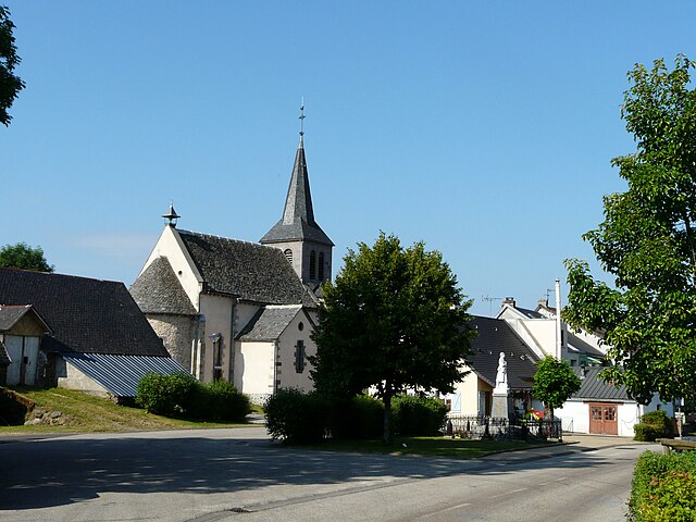
Saint-Genès-Champespe
- commune in Puy-de-Dôme, France
- Country:
- Postal Code: 63850
- Coordinates: 45° 25' 8" N, 2° 43' 24" E
- GPS tracks (wikiloc): [Link]
- Area: 32.33 sq km
- Population: 224

Cros
- commune in Puy-de-Dôme, France
- Country:
- Postal Code: 63810
- Coordinates: 45° 28' 26" N, 2° 36' 6" E
- GPS tracks (wikiloc): [Link]
- AboveSeaLevel: 798 м m
- Area: 19.62 sq km
- Population: 178
- Web site: [Link]

Trémouille-Saint-Loup
- commune in Puy-de-Dôme, France
- Country:
- Postal Code: 63810
- Coordinates: 45° 29' 26" N, 2° 33' 39" E
- GPS tracks (wikiloc): [Link]
- Area: 12.23 sq km
- Population: 139


Picherande
- commune in Puy-de-Dôme, France
- Country:
- Postal Code: 63113
- Coordinates: 45° 27' 51" N, 2° 46' 1" E
- GPS tracks (wikiloc): [Link]
- Area: 44.26 sq km
- Population: 357
- Web site: [Link]


Bagnols
- commune in Puy-de-Dôme, France
- Country:
- Postal Code: 63810
- Coordinates: 45° 30' 1" N, 2° 37' 56" E
- GPS tracks (wikiloc): [Link]
- Area: 42.46 sq km
- Population: 440