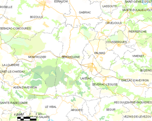
canton of Laissac (canton de Laissac)
- canton of France (until March 2015)
- Country:

- Capital: Laissac
- Coordinates: 44° 22' 54" N, 2° 49' 24" E


- GPS tracks (wikiloc): [Link]
- Wikidata storage: Wikidata: Q768131
- Library of Congress authority ID: Alt: [no2003040391]
- INSEE canton code: [1215]
Includes regions:

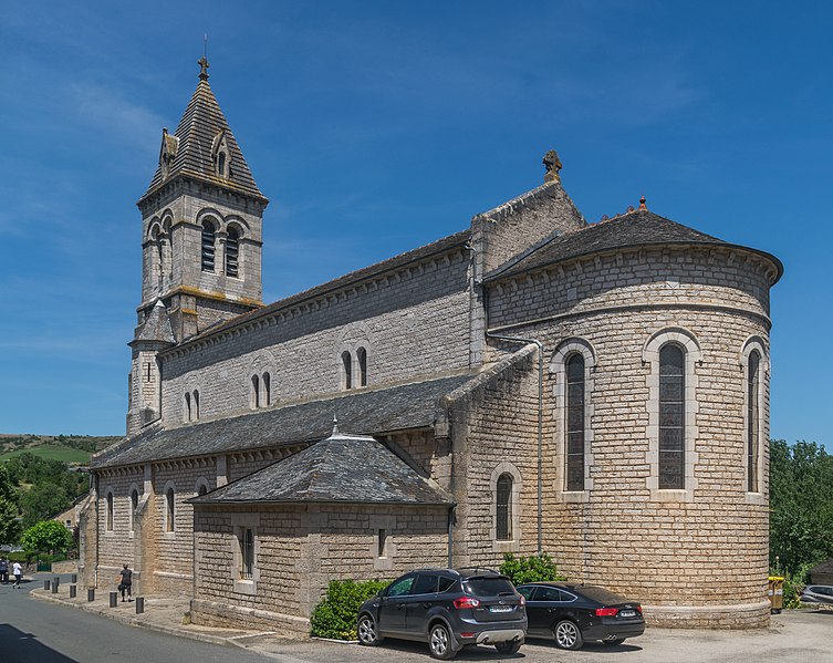
Bertholène
- commune in Aveyron, France
- Country:
- Postal Code: 12310
- Coordinates: 44° 23' 40" N, 2° 46' 43" E
- GPS tracks (wikiloc): [Link]
- Area: 46.96 sq km
- Population: 1029

Coussergues
- former commune in Aveyron, France
- Country:
- Postal Code: 12310
- Coordinates: 44° 24' 41" N, 2° 52' 38" E
- GPS tracks (wikiloc): [Link]
- Area: 10.89 sq km
- Population: 249


Gaillac-d'Aveyron
- commune in Aveyron, France
- Country:
- Postal Code: 12310
- Coordinates: 44° 21' 20" N, 2° 55' 43" E
- GPS tracks (wikiloc): [Link]
- Area: 29.03 sq km
- Population: 301
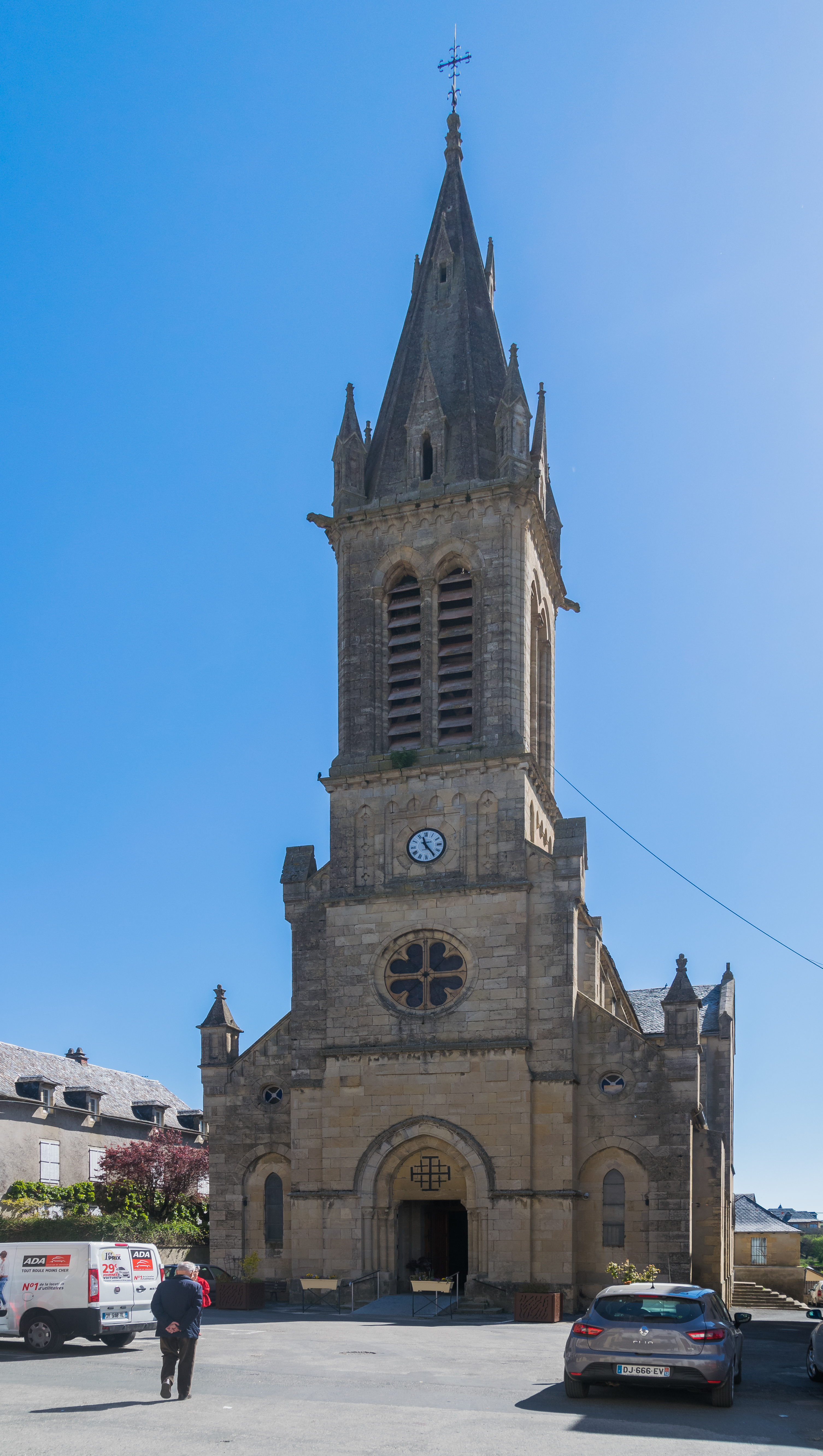

Laissac
- former commune in Aveyron, France
- Country:
- Postal Code: 12310
- Coordinates: 44° 22' 52" N, 2° 49' 21" E
- GPS tracks (wikiloc): [Link]
- Area: 20.21 sq km
- Population: 1676


Sévérac-l'Église
- former commune in Aveyron, France
- Country:
- Postal Code: 12310
- Coordinates: 44° 21' 44" N, 2° 50' 55" E
- GPS tracks (wikiloc): [Link]
- Area: 13.69 sq km
- Population: 407

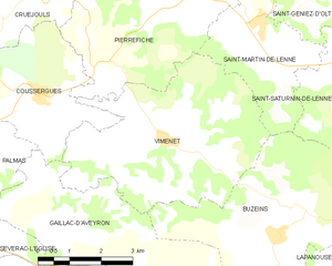
Vimenet
- commune in Aveyron, France
- Country:
- Postal Code: 12310
- Coordinates: 44° 24' 0" N, 2° 55' 35" E
- GPS tracks (wikiloc): [Link]
- Area: 20.95 sq km
- Population: 246
- Web site: [Link]


Palmas
- former commune in Aveyron, France
- Country:
- Postal Code: 12310
- Coordinates: 44° 23' 40" N, 2° 50' 34" E
- GPS tracks (wikiloc): [Link]
- AboveSeaLevel: 630 м m
- Area: 14.34 sq km
- Population: 371


Cruéjouls
- former commune in Aveyron, France
- Country:
- Postal Code: 12340
- Coordinates: 44° 26' 41" N, 2° 51' 19" E
- GPS tracks (wikiloc): [Link]
- Area: 18.35 sq km
- Population: 420