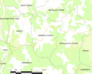
canton of Lauzès (canton de Lauzès)
- canton of France
- Country:

- Capital: Lauzès
- Coordinates: 44° 33' 45" N, 1° 37' 12" E


- GPS tracks (wikiloc): [Link]
- Wikidata storage: Wikidata: Q1725747
- INSEE canton code: [4616]
Includes regions:

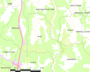
Cras
- commune in Lot, France
- Country:
- Postal Code: 46360
- Coordinates: 44° 34' 3" N, 1° 32' 0" E
- GPS tracks (wikiloc): [Link]
- Area: 10.22 sq km
- Population: 97
Sénaillac-Lauzès
- commune in Lot, France
- Country:
- Postal Code: 46360
- Coordinates: 44° 36' 8" N, 1° 39' 3" E
- GPS tracks (wikiloc): [Link]
- Area: 25.78 sq km
- Population: 124

Saint-Martin-de-Vers
- former commune in Lot, France
- Country:
- Postal Code: 46360
- Coordinates: 44° 34' 51" N, 1° 33' 32" E
- GPS tracks (wikiloc): [Link]
- Area: 9.93 sq km
- Population: 101
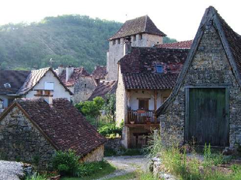
Lauzès
- commune in Lot, France
- Country:
- Postal Code: 46360
- Coordinates: 44° 34' 7" N, 1° 34' 51" E
- GPS tracks (wikiloc): [Link]
- Area: 6.39 sq km
- Population: 169
Lentillac-du-Causse
- commune in Lot, France
- Country:
- Postal Code: 46330
- Coordinates: 44° 33' 44" N, 1° 38' 22" E
- GPS tracks (wikiloc): [Link]
- Area: 13.68 sq km
- Population: 98


Sauliac-sur-Célé
- commune in Lot, France
- Country:
- Postal Code: 46330
- Coordinates: 44° 31' 2" N, 1° 43' 20" E
- GPS tracks (wikiloc): [Link]
- Area: 25.13 sq km
- Population: 123
- Web site: [Link]


Cabrerets
- commune in Lot, France
- Country:
- Postal Code: 46330
- Coordinates: 44° 30' 22" N, 1° 39' 17" E
- GPS tracks (wikiloc): [Link]
- Area: 43.38 sq km
- Population: 230

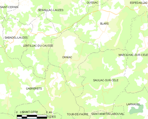
Orniac
- commune in Lot, France
- Country:
- Postal Code: 46330
- Coordinates: 44° 32' 42" N, 1° 40' 3" E
- GPS tracks (wikiloc): [Link]
- Area: 16.79 sq km
- Population: 72

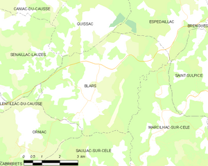
Blars
- commune in Lot, France
- Country:
- Postal Code: 46330
- Coordinates: 44° 33' 58" N, 1° 43' 10" E
- GPS tracks (wikiloc): [Link]
- Area: 25.68 sq km
- Population: 132

Sabadel-Lauzès
- commune in Lot, France
- Country:
- Postal Code: 46360
- Coordinates: 44° 34' 2" N, 1° 36' 11" E
- GPS tracks (wikiloc): [Link]
- Area: 8.79 sq km
- Population: 83
Nadillac
- commune in Lot, France
- Country:
- Postal Code: 46360
- Coordinates: 44° 33' 45" N, 1° 31' 6" E
- GPS tracks (wikiloc): [Link]
- Area: 7.35 sq km
- Population: 62
Saint-Cernin
- former commune in Lot, France
- Country:
- Postal Code: 46360
- Coordinates: 44° 35' 34" N, 1° 34' 56" E
- GPS tracks (wikiloc): [Link]
- Area: 16.28 sq km
- Population: 193