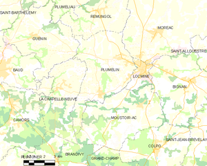
canton of Locminé (canton de Locminé)
- canton of France (until March 2015)
- Country:

- Capital: Locminé
- Coordinates: 47° 54' 51" N, 2° 52' 6" E


- GPS tracks (wikiloc): [Link]
- Wikidata storage: Wikidata: Q1399514
- INSEE canton code: [5616]
Includes regions:


Locminé
- commune in Morbihan, France
- Country:
- Postal Code: 56500
- Coordinates: 47° 53' 12" N, 2° 50' 9" E
- GPS tracks (wikiloc): [Link]
- Area: 4.86 sq km
- Population: 4159
- Web site: [Link]


La Chapelle-Neuve
- commune in Morbihan, France
- Country:
- Postal Code: 56500
- Coordinates: 47° 51' 53" N, 2° 56' 35" E
- GPS tracks (wikiloc): [Link]
- Area: 21.87 sq km
- Population: 965


Moréac
- commune in Morbihan, France
- Country:
- Postal Code: 56500
- Coordinates: 47° 55' 9" N, 2° 49' 16" E
- GPS tracks (wikiloc): [Link]
- Area: 60.3 sq km
- Population: 3759
- Web site: [Link]


Remungol
- former commune in Morbihan, France
- Country:
- Postal Code: 56500
- Coordinates: 47° 56' 2" N, 2° 53' 57" E
- GPS tracks (wikiloc): [Link]
- Area: 26.93 sq km
- Population: 983
- Web site: [Link]

Plumelin
- commune in Morbihan, France
- Country:
- Postal Code: 56500
- Coordinates: 47° 51' 42" N, 2° 53' 17" E
- GPS tracks (wikiloc): [Link]
- Area: 31.33 sq km
- Population: 2737
- Web site: [Link]


Moustoir-Ac
- commune in Morbihan, France
- Country:
- Postal Code: 56500
- Coordinates: 47° 51' 20" N, 2° 50' 7" E
- GPS tracks (wikiloc): [Link]
- Area: 33.92 sq km
- Population: 1819
- Web site: [Link]


Naizin
- former commune in Morbihan, France
- Country:
- Postal Code: 56500
- Coordinates: 47° 59' 22" N, 2° 49' 55" E
- GPS tracks (wikiloc): [Link]
- Area: 40.99 sq km
- Population: 1795
- Web site: [Link]
Moustoir-Remungol
- former commune in Morbihan, France
- Country:
- Postal Code: 56500
- Coordinates: 47° 59' 47" N, 2° 54' 10" E
- GPS tracks (wikiloc): [Link]
- Area: 12.42 sq km
- Population: 684
- Web site: [Link]