Naizin (Naizin)

- former commune in Morbihan, France
- Country:

- Postal Code: 56500
- Coordinates: 47° 59' 22" N, 2° 49' 55" E


- GPS tracks (wikiloc): [Link]
- Area: 40.99 sq km
- Population: 1795
- Web site: http://www.naizin.fr
- Wikipedia en: wiki(en)
- Wikipedia: wiki(fr)
- Wikidata storage: Wikidata: Q70018
- Wikipedia Commons Category: [Link]
- Freebase ID: [/m/03c77xn]
- GeoNames ID: Alt: [2991030]
- BnF ID: [152653939]
- VIAF ID: Alt: [235702912]
- MusicBrainz area ID: [9aced10b-4091-489d-b9d6-d4e0e6605d38]
- INSEE municipality code: 56P01
Shares border with regions:


Moréac
- commune in Morbihan, France
- Country:
- Postal Code: 56500
- Coordinates: 47° 55' 9" N, 2° 49' 16" E
- GPS tracks (wikiloc): [Link]
- Area: 60.3 sq km
- Population: 3759
- Web site: [Link]


Remungol
- former commune in Morbihan, France
- Country:
- Postal Code: 56500
- Coordinates: 47° 56' 2" N, 2° 53' 57" E
- GPS tracks (wikiloc): [Link]
- Area: 26.93 sq km
- Population: 983
- Web site: [Link]


Réguiny
- commune in Morbihan, France
- Country:
- Postal Code: 56500
- Coordinates: 47° 58' 36" N, 2° 44' 46" E
- GPS tracks (wikiloc): [Link]
- Area: 27.92 sq km
- Population: 1963
- Web site: [Link]

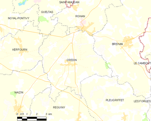
Crédin
- commune in Morbihan, France
- Country:
- Postal Code: 56580
- Coordinates: 48° 2' 5" N, 2° 46' 1" E
- GPS tracks (wikiloc): [Link]
- Area: 33.74 sq km
- Population: 1529
- Web site: [Link]
Moustoir-Remungol
- former commune in Morbihan, France
- Country:
- Postal Code: 56500
- Coordinates: 47° 59' 47" N, 2° 54' 10" E
- GPS tracks (wikiloc): [Link]
- Area: 12.42 sq km
- Population: 684
- Web site: [Link]


Kerfourn
- commune in Morbihan, France
- Country:
- Postal Code: 56920
- Coordinates: 48° 2' 35" N, 2° 50' 0" E
- GPS tracks (wikiloc): [Link]
- Area: 19.46 sq km
- Population: 859
- Web site: [Link]


Noyal-Pontivy
- commune in Morbihan, France
- Country:
- Postal Code: 56920
- Coordinates: 48° 4' 0" N, 2° 53' 0" E
- GPS tracks (wikiloc): [Link]
- Area: 53.45 sq km
- Population: 3677
- Web site: [Link]