canton of Marcillac-Vallon (canton de Marcillac-Vallon)
- canton of France (until March 2015)
- Country:

- Capital: Marcillac-Vallon
- Coordinates: 44° 28' 29" N, 2° 27' 55" E


- GPS tracks (wikiloc): [Link]
- Wikidata storage: Wikidata: Q600576
- Library of Congress authority ID: Alt: [no2004024719]
- INSEE canton code: [1216]
Includes regions:


Balsac
- former commune in Aveyron, France
- Country:
- Postal Code: 12510
- Coordinates: 44° 24' 11" N, 2° 26' 42" E
- GPS tracks (wikiloc): [Link]
- Area: 15.57 sq km
- Population: 618


Clairvaux-d'Aveyron
- commune in Aveyron, France
- Country:
- Postal Code: 12330
- Coordinates: 44° 25' 39" N, 2° 24' 38" E
- GPS tracks (wikiloc): [Link]
- Area: 25.14 sq km
- Population: 1162


Marcillac-Vallon
- commune in Aveyron, France
- Country:
- Postal Code: 12330
- Coordinates: 44° 28' 25" N, 2° 27' 52" E
- GPS tracks (wikiloc): [Link]
- Area: 14.59 sq km
- Population: 1683

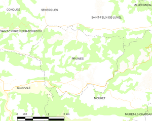
Pruines
- commune in Aveyron, France
- Country:
- Postal Code: 12320
- Coordinates: 44° 31' 50" N, 2° 30' 12" E
- GPS tracks (wikiloc): [Link]
- Area: 18.88 sq km
- Population: 308


Saint-Christophe-Vallon
- commune in Aveyron, France
- Country:
- Postal Code: 12330
- Coordinates: 44° 28' 15" N, 2° 24' 43" E
- GPS tracks (wikiloc): [Link]
- Area: 23.22 sq km
- Population: 1111
- Web site: [Link]


Mouret
- commune in Aveyron, France
- Country:
- Postal Code: 12330
- Coordinates: 44° 31' 2" N, 2° 30' 53" E
- GPS tracks (wikiloc): [Link]
- Area: 31.61 sq km
- Population: 535


Nauviale
- commune in Aveyron, France
- Country:
- Postal Code: 12330
- Coordinates: 44° 31' 12" N, 2° 25' 43" E
- GPS tracks (wikiloc): [Link]
- Area: 26.19 sq km
- Population: 511


Valady
- commune in Aveyron, France
- Country:
- Postal Code: 12330
- Coordinates: 44° 27' 19" N, 2° 25' 35" E
- GPS tracks (wikiloc): [Link]
- Area: 15.51 sq km
- Population: 1509


Muret-le-Château
- commune in Aveyron, France
- Country:
- Postal Code: 12330
- Coordinates: 44° 29' 37" N, 2° 34' 34" E
- GPS tracks (wikiloc): [Link]
- Area: 14.98 sq km
- Population: 344


Salles-la-Source
- commune in Aveyron, France
- Country:
- Postal Code: 12330
- Coordinates: 44° 26' 7" N, 2° 30' 48" E
- GPS tracks (wikiloc): [Link]
- Area: 78.03 sq km
- Population: 2196
- Web site: [Link]