canton of Marolles-les-Braults (canton de Marolles-les-Braults)
- canton of France
- Country:

- Capital: Marolles-les-Braults
- Coordinates: 48° 14' 52" N, 0° 17' 38" E


- GPS tracks (wikiloc): [Link]
- Wikidata storage: Wikidata: Q1726098
- INSEE canton code: [7222]
Includes regions:

Congé-sur-Orne
- commune in Sarthe, France
- Country:
- Postal Code: 72290
- Coordinates: 48° 12' 1" N, 0° 15' 14" E
- GPS tracks (wikiloc): [Link]
- Area: 11.24 sq km
- Population: 345


Courgains
- commune in Sarthe, France
- Country:
- Postal Code: 72260
- Coordinates: 48° 17' 24" N, 0° 16' 44" E
- GPS tracks (wikiloc): [Link]
- Area: 14.66 sq km
- Population: 588


Avesnes-en-Saosnois
- commune in Sarthe, France
- Country:
- Postal Code: 72260
- Coordinates: 48° 15' 48" N, 0° 22' 16" E
- GPS tracks (wikiloc): [Link]
- Area: 5.68 sq km
- Population: 89

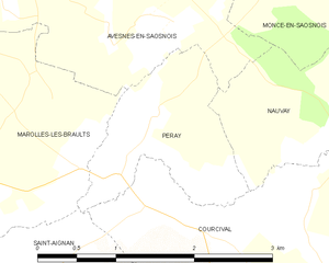
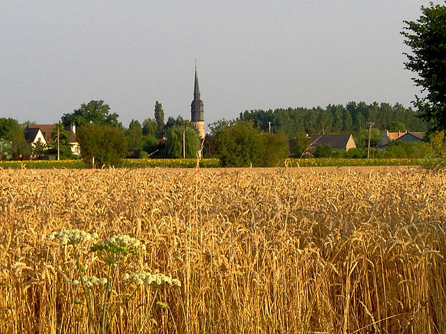
Peray
- commune in Sarthe, France
- Country:
- Postal Code: 72260
- Coordinates: 48° 14' 54" N, 0° 21' 51" E
- GPS tracks (wikiloc): [Link]
- Area: 2.45 sq km
- Population: 65


Mézières-sur-Ponthouin
- commune in Sarthe, France
- Country:
- Postal Code: 72290
- Coordinates: 48° 11' 35" N, 0° 17' 55" E
- GPS tracks (wikiloc): [Link]
- Area: 17.88 sq km
- Population: 692
- Web site: [Link]
Meurcé
- commune in Sarthe, France
- Country:
- Postal Code: 72170
- Coordinates: 48° 14' 4" N, 0° 12' 8" E
- GPS tracks (wikiloc): [Link]
- Area: 6.16 sq km
- Population: 265


Moncé-en-Saosnois
- commune in Sarthe, France
- Country:
- Postal Code: 72260
- Coordinates: 48° 16' 29" N, 0° 23' 20" E
- GPS tracks (wikiloc): [Link]
- Area: 8.81 sq km
- Population: 257
Dissé-sous-Ballon
- commune in Sarthe, France
- Country:
- Postal Code: 72260
- Coordinates: 48° 14' 14" N, 0° 17' 51" E
- GPS tracks (wikiloc): [Link]
- Area: 3.55 sq km
- Population: 140


Nauvay
- commune in Sarthe, France
- Country:
- Postal Code: 72260
- Coordinates: 48° 15' 7" N, 0° 23' 39" E
- GPS tracks (wikiloc): [Link]
- Area: 2.71 sq km
- Population: 11


Dangeul
- commune in Sarthe, France
- Country:
- Postal Code: 72260
- Coordinates: 48° 14' 54" N, 0° 15' 25" E
- GPS tracks (wikiloc): [Link]
- Area: 13.64 sq km
- Population: 483
Lucé-sous-Ballon
- commune in Sarthe, France
- Country:
- Postal Code: 72290
- Coordinates: 48° 12' 30" N, 0° 12' 53" E
- GPS tracks (wikiloc): [Link]
- Area: 6.78 sq km
- Population: 108
Thoigné
- commune in Sarthe, France
- Country:
- Postal Code: 72260
- Coordinates: 48° 17' 21" N, 0° 15' 10" E
- GPS tracks (wikiloc): [Link]
- Area: 7.31 sq km
- Population: 164


Marolles-les-Braults
- commune in Sarthe, France
- Country:
- Postal Code: 72260
- Coordinates: 48° 15' 8" N, 0° 18' 51" E
- GPS tracks (wikiloc): [Link]
- Area: 20.64 sq km
- Population: 2067
- Web site: [Link]


Monhoudou
- commune in Sarthe, France
- Country:
- Postal Code: 72260
- Coordinates: 48° 17' 12" N, 0° 19' 31" E
- GPS tracks (wikiloc): [Link]
- Area: 7.52 sq km
- Population: 218


Nouans
- commune in Sarthe, France
- Country:
- Postal Code: 72260
- Coordinates: 48° 14' 21" N, 0° 13' 18" E
- GPS tracks (wikiloc): [Link]
- Area: 9.96 sq km
- Population: 284


Saint-Aignan, Sarthe
- commune in Sarthe, France
- Country:
- Postal Code: 72110
- Coordinates: 48° 12' 57" N, 0° 20' 34" E
- GPS tracks (wikiloc): [Link]
- Area: 15.13 sq km
- Population: 274