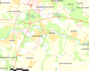
canton of Montbazon (canton de Montbazon)
- canton of France (until March 2015)
- Country:

- Capital: Montbazon
- Coordinates: 47° 15' 39" N, 0° 39' 14" E


- GPS tracks (wikiloc): [Link]
- Wikidata storage: Wikidata: Q1393882
- INSEE canton code: [3714]
Includes regions:


Artannes-sur-Indre
- commune in Indre-et-Loire, France
- Country:
- Postal Code: 37260
- Coordinates: 47° 16' 24" N, 0° 35' 57" E
- GPS tracks (wikiloc): [Link]
- Area: 20.97 sq km
- Population: 2615
- Web site: [Link]


Villeperdue
- commune in Indre-et-Loire, France
- Country:
- Postal Code: 37260
- Coordinates: 47° 12' 3" N, 0° 37' 56" E
- GPS tracks (wikiloc): [Link]
- Area: 11.95 sq km
- Population: 995

Veigné
- commune in Indre-et-Loire, France
- Country:
- Postal Code: 37250
- Coordinates: 47° 17' 15" N, 0° 44' 15" E
- GPS tracks (wikiloc): [Link]
- Area: 26.58 sq km
- Population: 6101
- Web site: [Link]


Monts
- commune in Indre-et-Loire, France
- Country:
- Postal Code: 37260
- Coordinates: 47° 16' 29" N, 0° 38' 34" E
- GPS tracks (wikiloc): [Link]
- Area: 27.28 sq km
- Population: 7704
- Web site: [Link]


Pont-de-Ruan
- commune in Indre-et-Loire, France
- Country:
- Postal Code: 37260
- Coordinates: 47° 15' 38" N, 0° 34' 32" E
- GPS tracks (wikiloc): [Link]
- Area: 5.74 sq km
- Population: 1126


Montbazon
- commune in Indre-et-Loire, France
- Country:
- Postal Code: 37250
- Coordinates: 47° 17' 14" N, 0° 42' 49" E
- GPS tracks (wikiloc): [Link]
- Area: 6.5 sq km
- Population: 4154
- Web site: [Link]

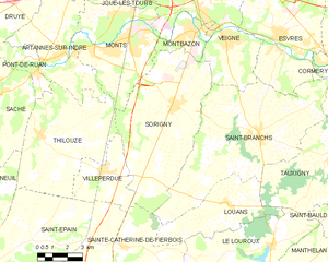
Sorigny
- commune in Indre-et-Loire, France
- Country:
- Postal Code: 37250
- Coordinates: 47° 14' 30" N, 0° 41' 43" E
- GPS tracks (wikiloc): [Link]
- Area: 43.43 sq km
- Population: 2511